Lough Carra facts for kids
Quick facts for kids Lough CarraLoch Ceara |
|
|---|---|
 |
|
| Location | County Mayo |
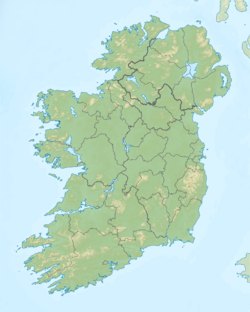
| Coordinates | 53°40′53″N 9°14′27″W / 53.68139°N 9.24083°W |
| Basin countries | Ireland |
| Max. length | 6 mi (9.7 km) |
| Max. width | 1 mi (1.6 km) |
| Surface area | 4,000 acres (16 km2) |
| Average depth | 6 feet (1.8 m) |
| Max. depth | 60 feet (18 m) |
| Islands | 73 |
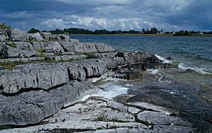
Lough Carra (Irish: Loch Ceara) is a limestone lake (marl) of 4,000 acres (16 km2), in County Mayo, Ireland, about 8 miles (13 km) south of Castlebar. It is approximately 6 miles (9.7 km) long and varies in width from 400 yards (370 m) to one mile (1.6 km). The average depth is 6 feet (1.8 m), with a maximum of 60. It drains into Lough Mask via the Keel River.
Lough Carra was part of the estate of the well-known Moore family of Moore Hall.
It is a well-known brown trout lough, and is situated northeast of Lough Mask.
Historical sites

All content from Kiddle encyclopedia articles (including the article images and facts) can be freely used under Attribution-ShareAlike license, unless stated otherwise. Cite this article:
Lough Carra Facts for Kids. Kiddle Encyclopedia.

