Long Knife Peak facts for kids
Quick facts for kids Long Knife Peak |
|
|---|---|
| Highest point | |
| Elevation | 9,789 ft (2,984 m) |
| Prominence | 2,501 ft (762 m) |
| Parent peak | Kintla Peak |
| Geography | |
| Location | Flathead County, Montana, U.S. |
| Parent range | Clark Range |
| Topo map | USGS Kintla Peak, MT |
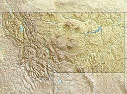
Long Knife Peak (9,789 feet (2,984 m)) is located in the Clark Range, Glacier National Park in the U.S. state of Montana. Though much of the mountain slopes extend into the Canadian Province of British Columbia, the main summit is in the U.S. Long Knife Peak rises more than a vertical 1 mile (1.6 km) above Upper Kintla Lake. It is also the most northerly peak and land area in the contiguous United States above 9,000 feet (2,743 m). Long Knife Peak is on an east west ridgeline identified as the "Boundary Mountains" on the USGS 7.5 minute topo quad and this extended ridge, with peak 8864, also contains the most northerly named (numbered) peak and land area in the contiguous United States above 8,000 feet (2,438 m).

All content from Kiddle encyclopedia articles (including the article images and facts) can be freely used under Attribution-ShareAlike license, unless stated otherwise. Cite this article:
Long Knife Peak Facts for Kids. Kiddle Encyclopedia.


