Loch Awe, Inchnadamph facts for kids
Quick facts for kids Loch Awe, Inchnadamph |
|
|---|---|

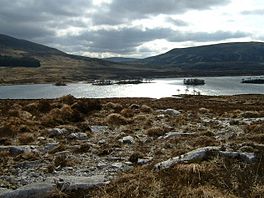
Loch Awe Trees have flourished on the islands, safe from grazing deer.
|
|
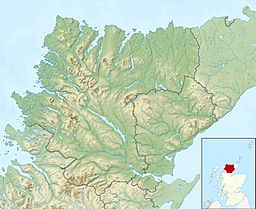
| Coordinates | 58°05′29″N 4°58′40″W / 58.09130096°N 4.97789574°W |
| Type | freshwater loch |
| Primary inflows | Unnamed burn that flows from Loch Na Gruagaich into the northern end of Loch Awe. |
| Primary outflows | River Loanan flows north from Loch Awe and drains into Loch Assynt |
| Max. length | 1.28 km (0.80 mi) |
| Max. width | 0.48 km (0.30 mi) |
| Surface area | 31 ha (77 acres) |
| Average depth | 4.92126 ft (1.50000 m) |
| Max. depth | 6.88976 ft (2.10000 m) |
| Water volume | 16,573,596.9 cu ft (469,312.00 m3) |
| Shore length1 | 4 km (2.5 mi) |
| Surface elevation | 154 m (505 ft) |
| Max. temperature | 53.5 °F (11.9 °C) |
| Min. temperature | 3.5 °F (−15.8 °C) |
| 1 Shore length is not a well-defined measure. | |
Loch Awe is a small loch, located 4 miles south of Loch Assynt and the village of Ledmore within the Assynt area of Sutherland, Scotland. The loch is located in an area along with neighbouring Coigach, as the Assynt-Coigach National Scenic Area, one of 40 such areas in Scotland.
Cairn
Immediately south and west of the loch is a circular cairn at Cnoc Bad Na Cleithe. The first cairn measures 6 to 7 foot high and measures 63 feet on a north-south bearing at the base, by 70 feet. They were surveyed in 11 June 1909 and there is no sign of a cist or chamber.
Images for kids

All content from Kiddle encyclopedia articles (including the article images and facts) can be freely used under Attribution-ShareAlike license, unless stated otherwise. Cite this article:
Loch Awe, Inchnadamph Facts for Kids. Kiddle Encyclopedia.


