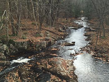
Little Cold River facts for kids
Quick facts for kids Little Cold River |
|
|---|---|

The Little Cold River at Route 113B in Stow, Maine
|
|
| Country | United States |
| States | New Hampshire, Maine |
| Counties | Carroll, NH, Oxford, ME |
| Towns | Chatham, NH, Stow, ME |
| Physical characteristics | |
| Main source | Confluence of Watson Brook & McDonough Brook Chatham, NH 497 ft (151 m) 44°10′24″N 71°0′40″W / 44.17333°N 71.01111°W |
| River mouth | Cold River Stow, ME 380 ft (120 m) 44°9′10″N 70°58′7″W / 44.15278°N 70.96861°W |
| Length | 3.9 mi (6.3 km) |
| Basin features | |
| Tributaries |
|
The Little Cold River is a 3.9-mile-long (6.3 km) stream in western Maine in the United States, flowing through the foothills of the White Mountains. It is a tributary of the Cold River, part of the Saco River watershed.
The river begins in Chatham, New Hampshire, at the junction of McDonough Brook and Watson Brook. Flowing east, the river enters Maine after only one-half mile. Turning more southeast, the river passes the village of Stow, reaching the Cold River one mile upstream from the latter river's end at Charles Pond in Fryeburg.
See also
 In Spanish: Pequeño río frío para niños

All content from Kiddle encyclopedia articles (including the article images and facts) can be freely used under Attribution-ShareAlike license, unless stated otherwise. Cite this article:
Little Cold River Facts for Kids. Kiddle Encyclopedia.


