This list comprises works of public art on permanent display in an outdoor public space in the county of Surrey, England. UK. For brevity this does not include markers and milestones, parts of buildings or ornamental features to main bridges, stained glass and other artistic works attached to places of worship. Art at Brookwood cemetery, the UK's most populous, are not listed here as its land is open to those paying their respects but private.
Indoor artworks are excluded from this list, including in the county's 11 district halls, at its University, schools and colleges, community halls and in the art museums and galleries in Surrey category. Community project millennial tapestries and embroideries are on public display in visitor centres at Dunsfold, Holmbury St Mary and Sunbury-on-Thames. Clock towers (including clock housings on metal posts) are excluded from the list such as in Abinger Hammer (although its colourful blacksmith sculpture striking a bell overhangs a public road), Bisley, Cobham, Epsom, and Sunbury. Wikipedia's list of Grade I listed buildings in Surrey is a government-backed list of the top historical and architectural structures and ruins including the somewhat intact castles: Farnham, Guildford and Reigate. Moved architecture/relics such as part of the Leptis Magna (Roman city) ruins and some fountains have been included, lacking practical purposes.
| Image |
Subject |
Location |
Date |
Sculptor/artist |
Source |
Coordinates |
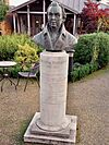 |
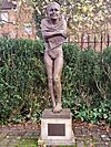
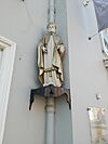
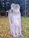
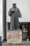
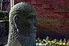
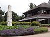
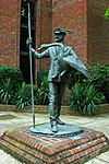
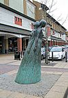
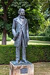
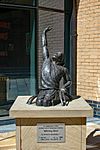
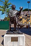
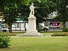
William Cobbett |
Museum of Farnham garden |
1940s |
Willi Soukop |
|
51°12′46″N 0°48′15″W / 51.2128°N 0.8043°W / 51.2128; -0.8043 |
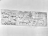 |
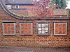
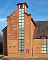
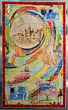
Hawthorn Lodge panels |
Hawthorn Lodge |
1961 |
Rachel Brown and Carole Hodgson |
|
51°12′46″N 0°47′51″W / 51.2127°N 0.7976°W / 51.2127; -0.7976 |
 |
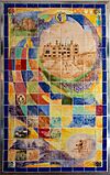
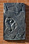
Farnham and the way it sits in hills and valleys |
Farnham Delivery Office, West Street |
1970 |
Michael Fairclough |
|
51°12′51″N 0°48′05″W / 51.2142°N 0.8015°W / 51.2142; -0.8015 |
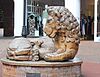 |
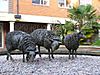
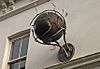
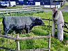
The Lion and Lamb |
Lion and Lamb Yard |
1985-86 |
Edwin Russell |
|
51°12′55″N 0°48′05″W / 51.2152°N 0.8015°W / 51.2152; -0.8015 |
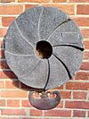 |
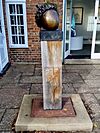
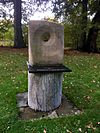
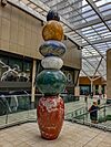
Andernach Millstone |
South Street |
1992 |
|
|
51°12′50″N 0°47′43″W / 51.214°N 0.7954°W / 51.214; -0.7954 |
 |
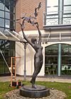
Outdoor Bathing |
Victoria Garden |
1999 |
Jane Jones |
|
51°12′48″N 0°47′42″W / 51.2133°N 0.7951°W / 51.2133; -0.7951 |
 |
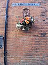
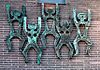
Hands On |
Farnham Library grounds |
2000 |
West Street Potters, Farnham |
|
51°12′48″N 0°48′12″W / 51.2134°N 0.8032°W / 51.2134; -0.8032 |
 |
Millennium Child |
Upper Church Lane |
2000 |
Sue Broadhead |
|
51°12′50″N 0°47′59″W / 51.2139°N 0.7996°W / 51.2139; -0.7996 |
 |
Bookstools or Moments in Time |
Farnham Library grounds |
2003 |
Gillian Trotman |
|
51°12′47″N 0°48′11″W / 51.213°N 0.803°W / 51.213; -0.803 |
 |
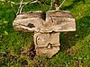
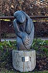
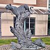
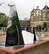
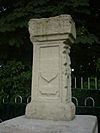
Monument |
Museum of Farnham garden |
2013 |
Sally Woodford |
|
51°12′46″N 0°48′15″W / 51.2128°N 0.8043°W / 51.2128; -0.8043 |
 |
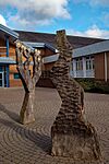
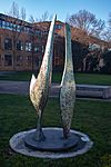
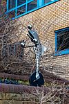
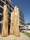
North Downs Way sculpture |
A31 Farnham bypass |
2015 |
FdK Design Consultants |
|
51°12′46″N 0°47′38″W / 51.2128°N 0.7938°W / 51.2128; -0.7938 |
 |
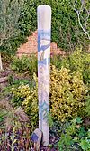
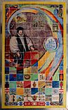
William Cobbett |
Hawthorn Lodge |
2016 |
Sheila Mitchell |
|
51°12′46″N 0°47′52″W / 51.2129°N 0.7977°W / 51.2129; -0.7977 |
 |
The Farnham Sculpture - acorn |
New Ashgate Gallery |
2020 |
David Mayne |
|
51°12′46″N 0°47′58″W / 51.2129°N 0.7994°W / 51.2129; -0.7994 |
 |
The Farnham Sculpture - oak tree |
New Ashgate Gallery |
2020 |
David Mayne |
|
51°12′46″N 0°47′58″W / 51.2129°N 0.7994°W / 51.2129; -0.7994 |
 |
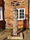
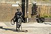
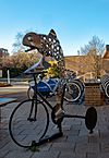
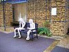
A Hand's Turn |
Riverside Walk |
2023 |
Natalie Bradwell and Livia Spinolo |
|
51°12′44″N 0°47′50″W / 51.2122°N 0.7973°W / 51.2122; -0.7973 |
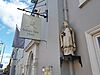 |
Bishop |
Bishop's Table Hotel, West Street |
|
|
|
51°12′50″N 0°48′11″W / 51.2138°N 0.803°W / 51.2138; -0.803 |
 |
Bishop |
Bishop's Table Hotel, West Street |
|
|
|
51°12′50″N 0°48′11″W / 51.2138°N 0.803°W / 51.2138; -0.803 |
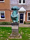 |
Matriarch |
Borelli Yard |
|
Ben Franklin |
|
51°12′53″N 0°47′54″W / 51.2148°N 0.7982°W / 51.2148; -0.7982 |
 |
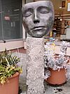
Unidentified sculpture |
Farnham Library grounds |
|
|
|
51°12′47″N 0°48′11″W / 51.213°N 0.803°W / 51.213; -0.803 |
 |
Unidentified sculpture |
Farnham Library grounds |
|
|
|
51°12′47″N 0°48′11″W / 51.213°N 0.803°W / 51.213; -0.803 |
 |
Unidentified sculpture |
Farnham Library grounds |
|
|
|
51°12′47″N 0°48′11″W / 51.213°N 0.803°W / 51.213; -0.803 |
| Image |
Subject |
Location |
Date |
Sculptor/Artist |
Source |
Coordinates |
 |
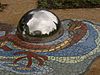
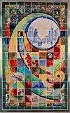
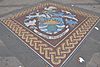
Guildford and Freiburg im Breisgau coats of arms mosaic |
Tunsgate, Guildford |
1994 |
|
|
51°14′09″N 0°34′20″W / 51.2357°N 0.5722°W / 51.2357; -0.5722 |
 |
Alice and the White Rabbit |
Guildford Riverside |
1984 |
Edwin Russell |
|
51°14′4″N 0°34′36″W / 51.23444°N 0.57667°W / 51.23444; -0.57667 |
 |
Alice through the looking glass |
Guildford Castle grounds |
1990 |
Jeanne Argent |
|
51°14′00″N 0°34′19″W / 51.23333°N 0.57194°W / 51.23333; -0.57194 |
 |
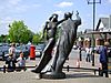
One Man and his Dog |
Eastgate courtyard |
1990 |
Edwin Russell |
|
51°14′15″N 0°34′3″W / 51.23750°N 0.56750°W / 51.23750; -0.56750 |
 |
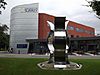
The Surrey Scholar |
bottom of High Street |
2002 |
Allan Sly |
|
51°14′07″N 000°34′29″W / 51.23528°N 0.57472°W / 51.23528; -0.57472 |
|
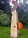
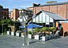
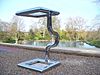
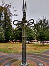
Vane II |
Electric Theatre forecourt |
1997/1998 |
Lucien Simon |
|
|
 |
Masquerade |
Electric Theatre Forecourt |
2005 |
Allan Sly |
|
51°14′10″N 000°34′39″W / 51.23611°N 0.57750°W / 51.23611; -0.57750 |
|
Rhythm Blue |
under Electric Theatre bridge |
|
Peter Freeman |
|
|
 |
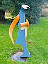
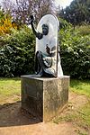
Totem Sculptures |
Onslow Arboretum |
|
Mary Branson |
|
|
|
5 sculptures |
Queen Elizabeth Park |
|
Sue Fenton-Jones |
|
|
|
Lido Tree Sculpture |
Stoke cross-roads |
|
Ruth Wheeler |
|
|
 |
Rising Stars |
outside the Odeon |
|
Steve Geliot |
|
51°14′15″N 000°34′45″W / 51.23750°N 0.57917°W / 51.23750; -0.57917 |
 |
George Abbot Sculpture |
at the top of the High Street |
1993 |
Faith Winter |
|
51°14′11″N 000°34′13″W / 51.23639°N 0.57028°W / 51.23639; -0.57028 |
 |
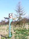
Height Barrier |
access to Woodbridge Meadows car park |
|
Richard Farringdon |
|
51°14′41″N 000°34′49″W / 51.24472°N 0.58028°W / 51.24472; -0.58028 |
|
Mosaic |
outside Debenhams |
|
Martin Cheek |
|
|
|
Reeds |
Millmead Island |
|
Ruth Wheeler |
|
|
|
George Abbot Sculpture Garden |
George Abbot School |
|
Russell Jakubowski |
|
|
|
Abstracts of Guildford |
Guildford Spectrum |
|
Gerry Baptist |
|
|
|
The Dancers |
outside Baker Tilly on the Boxgrove Crossroads roundabout |
|
Jane Jones |
|
51°14′56″N 0°33′12″W / 51.24889°N 0.55333°W / 51.24889; -0.55333 |
 |
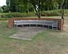
Benches at Millmead Lock |
Millmead Island |
|
Johny Woodford |
|
51°13′59″N 000°34′31″W / 51.23306°N 0.57528°W / 51.23306; -0.57528 |
 |
The Bargeman |
the Wharf |
2003 |
Utopia Forge |
|
51°14′07″N 000°34′37″W / 51.23528°N 0.57694°W / 51.23528; -0.57694 |
|
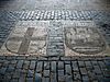
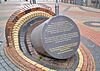
Sculpture and five bronze tablets |
Tunsgate |
1989 |
Martin Jennings with poet Matt Black |
|
|
 |
Unknown (dancing figures) |
Youth & Community Centre at Haydon Place |
|
|
|
51°14′21″N 000°34′25″W / 51.23917°N 0.57361°W / 51.23917; -0.57361 |
 |
Out of the Block/Head |
Quaker's Acre off North Street |
1996 |
Janine Creaye |
|
51°14′12″N 000°34′19″W / 51.23667°N 0.57194°W / 51.23667; -0.57194 |
|
The Way Markers |
Shalford Meadows and Artington Park & Ride |
|
Mary Anstee Parry |
|
|
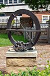 |
Millennium Sundial |
Millmead Gardens |
|
Joanna Migdal |
|
51°14′02″N 000°34′36″W / 51.23389°N 0.57667°W / 51.23389; -0.57667 |
 |
Central Growth |
Building on Market Street |
|
Andrew Kay |
|
51°14′10.53″N 0°34′22.03″W / 51.2362583°N 0.5727861°W / 51.2362583; -0.5727861 |
 |
Opening lines of The Listeners by Walter de la Mare |
Side of Premier Inn at Stoke Crossroads |
|
|
|
51°14′54″N 000°34′15″W / 51.24833°N 0.57083°W / 51.24833; -0.57083 |
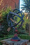 |
Astrolabe |
Guildford House Gallery courtyard |
|
Richard Quinnell |
|
51°14′12″N 000°34′20″W / 51.23667°N 0.57222°W / 51.23667; -0.57222 |
 |
Stained Glass |
Boots on Swan Lane |
|
Catrin Jones |
|
51°14′08.82″N 0°34′27.65″W / 51.2357833°N 0.5743472°W / 51.2357833; -0.5743472 |
 |
Farm Talk |
Artington Park & Ride |
|
Caroline Jackman and Jo Wood |
|
51°13′06.6″N 0°34′49.44″W / 51.218500°N 0.5804000°W / 51.218500; -0.5804000 |
 |
Seeds of Hope |
Seeds of Hope Children's Garden at the Cathedral |
|
Christine Charlesworth |
|
|
 |
White knight on a white horse |
outside former White Horse Hotel, High Street |
|
|
|
51°14′15″N 0°34′0″W / 51.23750°N 0.56667°W / 51.23750; -0.56667 |
 |
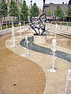
Virtual Fountain |
Printing House Square, Guildford |
2012 |
Charlie Carter |
|
|
 |
Stone Obelisk |
The Priestley Centre, Surrey Research Park |
|
|
|
51°14′19″N 0°36′48″W / 51.23861°N 0.61333°W / 51.23861; -0.61333 |
 |
Jabberwocky |
Allen Pavilion Garden |
2009? |
|
|
51°14′19″N 0°34′7″W / 51.23861°N 0.56861°W / 51.23861; -0.56861 |
 |
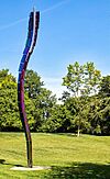
Silver Shoon |
Woodbridge Meadows |
2016 |
Charles Normandale |
|
51°14′48″N 0°34′53″W / 51.24667°N 0.58139°W / 51.24667; -0.58139 |
 |
Golden Pollen |
Woodbridge Meadows |
|
Tom Smith |
|
51°14′48″N 0°34′53″W / 51.24667°N 0.58139°W / 51.24667; -0.58139 |
|
Cedar |
Outside G Live |
|
|
|
51°14′18″N 0°33′58″W / 51.23833°N 0.56611°W / 51.23833; -0.56611 |
 |
Juno the Torch Relay Legacy |
Outside G Live |
2012 |
Ian Campbell-Briggs |
|
51°14′17″N 0°33′59″W / 51.23806°N 0.56639°W / 51.23806; -0.56639 |
 |
The Spine |
Outside Royal Surrey County Hospital |
? |
|
|
51°14′23.22″N 0°36′29.33″W / 51.2397833°N 0.6081472°W / 51.2397833; -0.6081472 |
 |
Phoenix |
Outside Royal Surrey County Hospital |
? |
Martin Cundell |
|
51°14′23.22″N 0°36′29.33″W / 51.2397833°N 0.6081472°W / 51.2397833; -0.6081472 |
 |
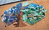
Abbot's Hospital quatercentenary ceramic mural |
Jeffries Passage |
2019 |
Liliana Montoya and Carlos España |
|
51°14′10″N 000°34′16″W / 51.23611°N 0.57111°W / 51.23611; -0.57111 |
 |
Abbot's Hospital quatercentenary ceramic mural |
Jeffries Passage |
2019 |
Liliana Montoya and Carlos España |
|
51°14′10″N 000°34′16″W / 51.23611°N 0.57111°W / 51.23611; -0.57111 |
 |
Abbot's Hospital quatercentenary ceramic mural |
Jeffries Passage |
2019 |
Liliana Montoya and Carlos España |
|
51°14′10″N 000°34′16″W / 51.23611°N 0.57111°W / 51.23611; -0.57111 |
 |
Abbot's Hospital quatercentenary ceramic mural |
Jeffries Passage |
2019 |
Liliana Montoya and Carlos España |
|
51°14′10″N 000°34′16″W / 51.23611°N 0.57111°W / 51.23611; -0.57111 |
| Image |
Subject |
Location |
Date |
Sculptor/Artist |
Source |
Coordinates |
 |
All the Gang Are Here |
University of Surrey campus |
2007 |
Carol Orwin |
|
|
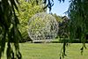 |
Geodesic Dome |
University of Surrey campus |
1982 |
Based on an original by Buckminster Fuller |
|
51°14′36″N 0°35′14″W / 51.24333°N 0.58722°W / 51.24333; -0.58722 |
 |
Spine 3 |
University of Surrey campus |
2004 |
Diane Maclean |
|
51°14′36″N 0°35′13″W / 51.24333°N 0.58694°W / 51.24333; -0.58694 |
 |
Alan Turing |
On the Piazza, University of Surrey campus |
2004 |
John W. Mills |
|
|
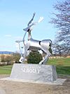 |
The Surrey Stag |
Entrance to the University of Surrey campus |
2009 |
Allan Sly |
|
51°14′29″N 0°35′43″W / 51.24139°N 0.59528°W / 51.24139; -0.59528 |
 |
Knife Birds |
In front of the School of Management Building, University of Surrey campus |
2004 |
Bridget McCrum |
|
|
 |
Narcissus |
University of Surrey campus |
|
William Pye |
|
51°14′34″N 0°35′18″W / 51.24278°N 0.58833°W / 51.24278; -0.58833 |
 |
Thinking Of My Future |
Behind Senate House, in the amphitheatre, University of Surrey campus |
2010 |
Christopher Chipfuya |
|
|
 |
Mural |
Outside of the Lecture Theatre Block, University of Surrey campus |
1980 |
Duncan Newton |
|
|
 |
Ceramic mural |
Outside of the Students’ Union, University of Surrey campus |
|
Students at the Roehampton Institute Art Department |
|
|
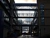 |
Walkways |
above Spine Road, University of Surrey campus |
1996 |
Peter Jeffery |
|
|
 |
Spiral |
in front of Postgraduate Medical School, Manor Park Campus, University of Surrey |
|
Bridget McCrum |
|
51°14′21″N 0°36′45″W / 51.23917°N 0.61250°W / 51.23917; -0.61250 |
 |
Triple Ripple |
Manor Park Campus, University of Surrey |
2008 |
Diane Maclean |
|
51°14′20″N 0°36′25″W / 51.23889°N 0.60694°W / 51.23889; -0.60694 |
|
Acrobat |
Foyer of Austin Pearce Building, University of Surrey |
|
Natalie Staniforth |
|
|
 |
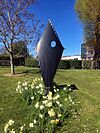
Fish |
Outside Senate House |
|
Daren Greenhow |
|
|
 |
Fish |
Outside Senate House |
|
Daren Greenhow |
|
|
 |
Fish |
Outside the Library |
|
Daren Greenhow |
|
|
 |
Charmer |
Performing Arts technology studios |
2011 |
Jon Edgar |
|
|
| Image |
Subject |
Location |
Date |
Sculptor/Artist |
Source |
Coordinates |
 |
Girl with Doves |
Station Approach, Leatherhead |
1973 cast of 1970 original |
David Wynne |
|
51°17′56″N 0°20′1.68″W / 51.29889°N 0.3338000°W / 51.29889; -0.3338000 |
 |
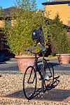
The Leopard |
Station Approach, Leatherhead |
1983 (moved to Leatherhead in 2009) |
Jonathan Kenworth |
|
51°17′57.12″N 0°20′00.24″W / 51.2992000°N 0.3334000°W / 51.2992000; -0.3334000 |
 |
'Bridges' Ironwork |
Leatherhead High Street, Leatherhead |
Unknown |
Peter Parkinson, Lawrence Walker, Richard Quinnell, Lucy Quinnell |
|
51°17′42.8″N 0°19′46.9″W / 51.295222°N 0.329694°W / 51.295222; -0.329694 |
 |
Bindi Dreamer |
Swan Shopping Centre, Leatherhead |
2000 |
Jilly Sutton |
|
51°17′44.6″N 0°19′40.3″W / 51.295722°N 0.327861°W / 51.295722; -0.327861 |
 |
Mole Gap Sculpture |
Leatherhead Park, Leatherhead |
2002 |
Terrence M. Clarke |
|
51°17′49.6″N 0°19′57.2″W / 51.297111°N 0.332556°W / 51.297111; -0.332556 |
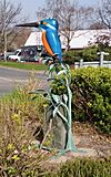 |
The Leatherhead Kingfisher |
Kingston Road, Leatherhead |
2022 |
Peter Parkinson, Lawrence Walker, Richard Quinnell, Lucy Quinnell |
|
51°18′43″N 0°20′02″W / 51.31194°N 0.33389°W / 51.31194; -0.33389 |
| Image |
Subject |
Location |
Date |
Sculptor/Artist |
Source |
Coordinates |
 |
Spelthorne coat of arms mosaic |
High Street, middle of pedestrianised section |
2002 |
Gary Drostle |
|
51°26′03″N 0°30′37″W / 51.4343°N 0.5104°W / 51.4343; -0.5104 |
 |
Gateway mosaic panels |
High Street, middle of pedestrianised section |
2002 |
Gary Drostle |
|
51°26′05″N 0°30′33″W / 51.4348°N 0.5093°W / 51.4348; -0.5093 |
 |
Release Every Pattern (Linoleum Workers) |
High Street, west end |
|
David Annand |
|
51°26′02″N 0°30′44″W / 51.4338°N 0.5121°W / 51.4338; -0.5121 |
 |
The Swanmaster |
Fairfield Avenue, Staines |
|
Diana Thomson |
|
51°26′11″N 0°30′25″W / 51.43639°N 0.50694°W / 51.43639; -0.50694 |
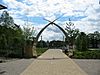 |
The Swan Arches |
Entrances to Memorial Gardens |
|
Anthony and Simon Robinson, and pupils from Kingscroft Junior School (now Riverbridge Primary School) |
|
51°25′58″N 0°30′50″W / 51.4329°N 0.51402°W / 51.4329; -0.51402 |
 |
Water Nymph statues |
Memorial Gardens |
1980 (moved here 2006) |
David Wynne |
|
51°25′58″N 0°30′51″W / 51.4327°N 0.51405°W / 51.4327; -0.51405 |
 |
Origami swans |
Memorial Gardens |
2002 |
Tom Brown |
|
51°25′57″N 0°30′50″W / 51.43251°N 0.5139°W / 51.43251; -0.5139 |
 |
London Stone (riparian) (replica) |
Memorial Gardens |
|
|
|
51°25′57″N 0°30′51″W / 51.43255°N 0.51418°W / 51.43255; -0.51418 |
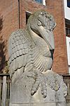 |
The River Guardian (Heron) |
At confluence of River Colne with River Thames, near Staines Bridge |
|
Simon Buchanan |
|
51°25′59″N 0°30′56″W / 51.43295°N 0.51546°W / 51.43295; -0.51546 |
 |
Pound Mill Sculpture |
Wraysbury Road, Staines |
|
John Atkin |
|
51°26′09″N 0°30′55″W / 51.4359°N 0.51515°W / 51.4359; -0.51515 |
 |
Memorial to British European Airways Flight 548 |
Waters Drive Recreation Ground |
2012 |
|
|
51°26′18″N 0°30′44″W / 51.43823°N 0.5123°W / 51.43823; -0.5123 |
 |
Water Sprites (combined hominid forms tapering above, exceeding head-height) |
Two Rivers Shopping and Entertainment Centre |
|
David Backhouse |
|
|
 |
Time Continuum (sundial) |
Two Rivers Shopping and Entertainment Centre |
|
David Backhouse |
|
|
| Image |
Subject |
Location |
Date |
Sculptor/Artist |
Source |
Coordinates |
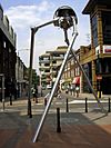 |
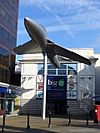
Martian tripod (aloft on slender, angular legs) |
Church Street East, Woking |
1998 |
Michael Condron |
|
51°19′14″N 0°33′25″W / 51.32056°N 0.55694°W / 51.32056; -0.55694 |
 |
Martian cylinder |
Church Street East, Woking |
1998 |
Michael Condron |
|
51°19′14″N 0°33′25″W / 51.32056°N 0.55694°W / 51.32056; -0.55694 |
 |
Hawker Hunter |
Church Street East, outside the Big Apple leisure complex |
1996, Removed July 2018 |
|
|
51°19′13″N 0°33′23″W / 51.32028°N 0.55639°W / 51.32028; -0.55639 |
 |
William Robert Grove |
Woking Park |
2003 |
Ulli Knall |
|
51°18′42″N 0°33′24″W / 51.31167°N 0.55667°W / 51.31167; -0.55667 |
 |
Pegasus |
Brewery Road |
2009 |
Tree Pirates |
|
51°19′19″N 0°33′38″W / 51.32194°N 0.56056°W / 51.32194; -0.56056 |
 |
Exchanging Luminance |
Outside of The Lightbox |
2010 |
Richard Jackson |
|
51°19′17″N 0°33′34″W / 51.32139°N 0.55944°W / 51.32139; -0.55944 |
 |
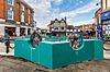
Winning Shot |
Jubilee Square |
2012 |
Christine Charlesworth |
|
51°19′13″N 0°33′32″W / 51.320183°N 0.55877119°W / 51.320183; -0.55877119 |
 |
The Space Between |
Plaza, Orion Gate, Guildford Road |
2012 |
Richard Heys |
|
51°18′58″N 0°33′38″W / 51.31611°N 0.56056°W / 51.31611; -0.56056 |
 |
Lakers Life |
Outside of the Lightbox |
2014 only? |
Jono Retallick, George Otto, Rib Davis, Lakers Youth Centre |
|
51°19′17″N 0°33′34″W / 51.32139°N 0.55944°W / 51.32139; -0.55944 |
 |
Surrey Hills |
Wolsey Place Shopping Centre |
2014 |
Sara Holmes |
|
|
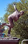 |
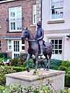
Sir Alec Bedser bowling |
next to Bedser Bridge |
2015 |
Allan Sly |
|
51°19′17″N 0°33′36″W / 51.32139°N 0.56000°W / 51.32139; -0.56000 |
 |
Eric Bedser batting |
next to Bedser Bridge |
2015 |
Allan Sly |
|
51°19′17″N 0°33′36″W / 51.32139°N 0.56000°W / 51.32139; -0.56000 |
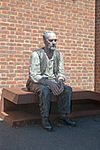 |
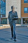
Seated Man |
Woking station |
2017 |
Sean Henry |
|
51°19′09″N 0°33′24″W / 51.319127°N 0.55655837°W / 51.319127; -0.55655837 |
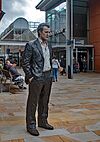 |
Standing Man |
Mercia Walk |
2017 |
Sean Henry |
|
|
 |
Standing Woman |
Peacock Centre |
2017 |
Sean Henry |
|
51°19′11″N 0°33′34″W / 51.319817°N 0.55930763°W / 51.319817; -0.55930763 |
 |
Walking Woman |
Commercial Road |
2017 |
Sean Henry |
|
|
 |
The Wanderer |
Albion Square |
2017 |
Sean Henry |
|
51°19′08″N 0°33′27″W / 51.318842°N 0.55738986°W / 51.318842; -0.55738986 |
 |
Catafalque |
Victoria Square |
2017 |
Sean Henry |
|
|
 |
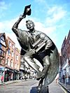
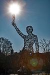
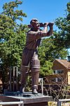
H G Wells |
Victoria Gate |
2017 |
Wesley Harland |
|
|
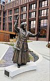 |
Ethel Smyth |
Dukes Court Plaza |
2022 |
Christine Charlesworth |
|
51°19′14″N 0°33′17″W / 51.32056°N 0.55472°W / 51.32056; -0.55472 |
 |
Standing Figure (Man) |
Henry Plaza |
2022 |
Sean Henry |
|
51°19′07″N 0°33′38″W / 51.318589°N 0.56055°W / 51.318589; -0.56055 |
 |
Standing Figure (Woman) |
Henry Plaza |
2022 |
Sean Henry |
|
51°19′07″N 0°33′38″W / 51.318675°N 0.560581°W / 51.318675; -0.560581 |
 |
? |
Henry Plaza |
2022 |
|
|
51°19′07.65″N 0°33′40.66″W / 51.3187917°N 0.5612944°W / 51.3187917; -0.5612944 |
 |
Going Underground |
Mercia Walk |
? |
Reece Ingram |
|
51°19′14″N 0°33′33″W / 51.320676°N 0.55920839°W / 51.320676; -0.55920839 |
| Image |
Subject |
Location |
Date |
Sculptor/Artist |
Source |
Coordinates |
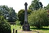 |
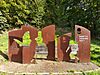
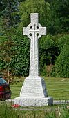
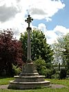
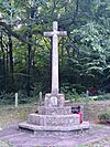
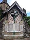
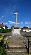
Abinger Common War Memorial |
Church Green Abinger Common |
1920 |
Edwin Lutyens |
|
51°12′05″N 0°24′20″W / 51.20146°N 0.40552°W / 51.20146; -0.40552 |
 |
War Memorial |
Ash Hill Road, Ash, Surrey |
1921 |
Harold Falkner |
|
51°15′16.81″N 0°42′56.84″W / 51.2546694°N 0.7157889°W / 51.2546694; -0.7157889 |
 |
Ashford War Memorial |
Church Road and Fordbridge Road, Ashford |
1920s |
|
|
51°25′58″N 0°27′43″W / 51.4328°N 0.462°W / 51.4328; -0.462 |
 |
Ashtead War Memorial |
St George's Church, Barnett Wood Lane, Ashtead |
1920 |
|
|
51°18′51″N 0°18′32″W / 51.3142°N 0.3089°W / 51.3142; -0.3089 |
 |
Banstead War Memorial |
Banstead High Street, Park Road and Sutton Lane, Banstead |
5 June 1921 |
Local residents |
|
51°19′29″N 0°11′41″W / 51.3246°N 0.1948°W / 51.3246; -0.1948 |
 |
Bisley War Memorial |
Guildford Road and Church Lane, Bisley |
25 September 1921 |
|
|
51°19′38″N 0°38′20″W / 51.3273°N 0.6388°W / 51.3273; -0.6388 |
 |
Buckland War Memorial |
Village Green, Buckland |
1920 |
Ebbutt and Sons, Croydon |
|
51°14′39″N 0°15′04″W / 51.24408°N 0.25123°W / 51.24408; -0.25123 |
 |
Burpham War Memorial |
Churchyard of St Marks, Burpham Lane, Burpham |
22 August 1920 |
|
|
|
 |
Byfleet War Memorial |
High Road, Byfleet |
1928 |
|
|
51°20′N 0°29′W / 51.34°N 0.48°W / 51.34; -0.48 |
 |
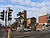
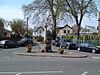
Camberley Memorial Cross |
Haig Road, Camberley |
1922 |
|
|
51°20′21″N 0°44′57″W / 51.33914°N 0.74924°W / 51.33914; -0.74924 |
 |
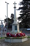
Chertsey War Memorial |
Windsor Street, Chertsey, outside the parish church of St. Peter |
1920s |
Joseph Whitehead and Sons |
|
51°23′32″N 0°30′13″W / 51.3922°N 0.5036°W / 51.3922; -0.5036 |
 |
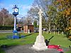
Chipstead War Memorial |
Church Green, Star Lane, Hooley, near Chipstead, opposite St. Margaret's Church |
1920s |
|
|
51°17′32″N 0°09′42″W / 51.2923°N 0.1617°W / 51.2923; -0.1617 |
 |
Chobham War Memorial |
High Street, Chobham and Cannon Crescent |
|
|
|
51°20′52″N 0°36′09″W / 51.3479°N 0.60255°W / 51.3479; -0.60255 |
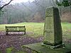 |
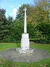
Coldharbour War Memorial |
Coldharbour Common, Abinger Road |
|
|
|
51°10′55″N 0°21′26″W / 51.18205°N 0.35729°W / 51.18205; -0.35729 |
 |
Cranleigh War Memorial |
High Street |
5 December 1920 |
|
|
51°08′31″N 0°29′30″W / 51.1419°N 0.4916°W / 51.1419; -0.4916 |
 |
Dorking War Memorial |
South Street |
17 July 1921 |
Thomas Braddock |
|
51°13′51″N 0°20′03″W / 51.2307°N 0.3342°W / 51.2307; -0.3342 |
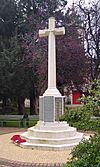 |
Egham War Memorial |
St John's Church |
|
|
|
51°25′57″N 0°32′41″W / 51.4324°N 0.5448°W / 51.4324; -0.5448 |
 |
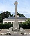
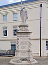
Epsom War Memorial |
Ashley Road and Treadwell Road |
1921 |
Aston Webb |
|
51°19′16″N 0°15′36″W / 51.32111°N 0.26000°W / 51.32111; -0.26000 |
 |
Esher War Memorial |
On Esher Green |
|
|
|
51°22′15″N 0°22′00″W / 51.3709°N 0.3667°W / 51.3709; -0.3667 |
 |
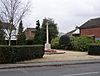
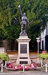
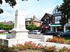
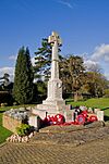
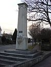
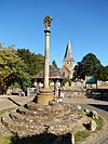
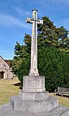
Farnham War Memorial |
Gostrey Meadow, Farnham |
1921 |
W. C. Watson |
|
51°12′05″N 0°24′20″W / 51.20146°N 0.40552°W / 51.20146; -0.40552 |
 |
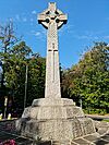
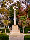
Godalming War Memorial |
Riverside park below St Peter & St Paul's church |
25 September 1921 |
A R Powys |
|
51°11′15″N 0°36′57″W / 51.1874°N 0.6159°W / 51.1874; -0.6159 |
 |
Grayswood War Memorial |
Grayswood Road |
|
|
|
51°06′07″N 0°41′38″W / 51.102°N 0.694°W / 51.102; -0.694 |
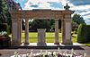 |
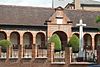
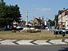
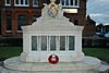
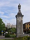
Guildford War Memorial |
Grounds of Guildford Castle |
6 November 1921 |
|
|
51°14′3″N 0°34′18″W / 51.23417°N 0.57167°W / 51.23417; -0.57167 |
 |
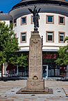
Post WW2 Guildford War Memorial |
Grounds of Guildford Castle |
30 September 2018 |
David Annand |
|
51°14′2″N 0°34′18″W / 51.23389°N 0.57167°W / 51.23389; -0.57167 |
 |
Haslemere War Memorial |
Haslemere town centre |
1920s |
|
|
51°05′16″N 0°42′34″W / 51.0878°N 0.7094°W / 51.0878; -0.7094 |
 |
Horley War Memorial |
Horley Recreation Ground, Brighton Road |
1922 |
Ebbutt and Sons, Croydon |
|
51°10′30″N 0°10′14″W / 51.17499°N 0.17042°W / 51.17499; -0.17042 |
 |
Laleham War Memorial |
Broadway and Shepperton Road, Laleham |
1920s |
|
|
51°24′33″N 0°29′25″W / 51.4093°N 0.4903°W / 51.4093; -0.4903 |
 |
Leatherhead War Memorial |
North Street, Leatherhead |
1920s |
|
|
51°17′45″N 0°19′50″W / 51.29591°N 0.33052°W / 51.29591; -0.33052 |
 |
Molesey War Memorial |
by River Thames towpath and Hurst Road |
|
|
|
51°24′16″N 0°20′45″W / 51.40444°N 0.34583°W / 51.40444; -0.34583 |
|
Oxted War Memorial |
Church Lane, near to Station Road West |
|
|
|
51°15′25″N 0°0′27″W / 51.25694°N 0.00750°W / 51.25694; -0.00750 |
 |
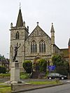
Reigate War Memorial |
Alma Road, near St. Mark's Church, Reigate |
1920s |
Hicks and Charlewood |
|
51°14′36″N 0°12′10″W / 51.24333°N 0.20278°W / 51.24333; -0.20278 |
 |
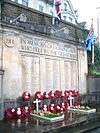
Redhill War Memorial |
Shaw's Corner, Redhill, near St Paul's Reformed Church |
1923 |
Richard Reginald Goulden |
|
51°14′15″N 0°10′55″W / 51.23750°N 0.18194°W / 51.23750; -0.18194 |
 |
Shepperton War Memorial |
Russell Road roundabout, Shepperton |
1921 |
|
|
51°23′28″N 0°27′0″W / 51.39111°N 0.45000°W / 51.39111; -0.45000 |
 |
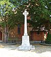
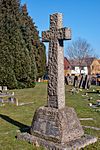
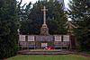
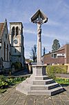
Shere war memorial |
The Square, Shere |
1921 |
|
|
|
 |
Shottermill War Memorial |
St Stephen's Church |
|
|
|
51°05′12″N 0°44′11″W / 51.086743°N 0.736412°W / 51.086743; -0.736412 |
 |
Staines War Memorial |
Square by Old Town Hall |
1920s |
|
|
51°26′00″N 0°30′51″W / 51.43335°N 0.51415°W / 51.43335; -0.51415 |
 |
Sunbury War Memorial |
Green Street |
1920s |
|
|
51°24′41″N 0°25′03″W / 51.4115°N 0.4175°W / 51.4115; -0.4175 |
 |
Walton War Memorial |
High Street, Ashley Road and New Zealand Avenue |
|
|
|
51°23′02″N 0°25′03″W / 51.3840°N 0.4175°W / 51.3840; -0.4175 |
 |
Warlingham War Memorial |
Warlingham Green |
4 December 1921 |
J E Taylorsen |
|
51°18′35″N 0°03′21″W / 51.30965°N 0.05586°W / 51.30965; -0.05586 |
 |
West Byfleet War Memorial |
St John's Church, Parvis Road, West Byfleet |
1920 |
|
|
51°20′17″N 0°30′11″W / 51.338°N 0.503°W / 51.338; -0.503 |
 |
Weybridge War Memorial |
Queens Road and Hanger Hill |
1920s |
J. Hatchard Smith |
|
51°22′15″N 0°27′05″W / 51.3709°N 0.4513°W / 51.3709; -0.4513 |
 |
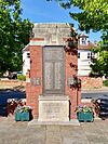
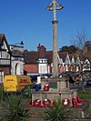
Woking War Memorial |
Jubilee Square. Originally at Sparrow Park. |
1920s |
Francis William Doyle Jones |
|
51°19′12″N 0°33′31″W / 51.32000°N 0.55861°W / 51.32000; -0.55861 |


,_Chertsey.jpg)


.jpg)
_by_James_Tunnard,_Denbies_Wine_Estate,_Dorking,_Surrey_01.jpg)
_Neil_Lawson_Baker,_High_Street,_Egham,_Surrey.jpg)


.jpg)


_by_Willi_Soukoup.jpg)
_by_Rachel_Brown_and_Carole_Hodgson.jpg)
_by_Michael_Fairclough.jpg)


_by_Jane_Jones.jpg)
_by_West_Street_Potters,_Farnham.jpg)

_by_Gillian_Trotman_(2).jpg)
_by_Sally_Woodford.jpg)
.jpg)
_by_Sheila_Mitchell.jpg)
_by_David_Mayne.jpg)
_by_David_Mayne.jpg)

_2.jpg)
.jpg)
.jpg)
.jpg)


_by_Charles_Hewlings.jpg)
_by_Charles_Hewlings_(2).jpg)
_by_Brandon_Davison.jpg)
_by_Marcus_Robinson.jpg)
_by_Michael_Kenny_(2).jpg)
_by_Laurence_Edwards_(2).jpg)
_by_Paul_Cox_(2).jpg)
_by_Vincent_Jack.jpg)
_by_Farnham_residents.jpg)
.jpg)


_Jo_Wood,_Arlington,_Guildford,_Surrey.jpg)


_Andrew_Brighty,_Haslemere.jpg)
_David_Wynne,_Station_Approach,_Leatherhead,_Surrey.jpg)
_Jonathan_Kenworth,_Station_Approach,_Leatherhead,_Surrey_03.jpg)


_Wolfgang_Buttress,_Longcross_Park,_Surrey_02.jpg)


_by_Carole_Vincent,_Cage_Yard,_Reigate,_Surrey.jpg)


.jpg)
.jpg)


.JPG)
.jpg)

_(July_2013).JPG)


.jpg)


.jpg)


.jpg)
.jpg)


.jpg)


.jpg)


.jpg)


