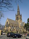
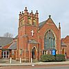
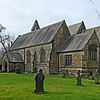
This article lists open, former and demolished places of worship situated within the boundaries of the City of Wakefield.
Open places of worship
Ackworth
| Name |
Image |
Location |
Denomination |
Grade |
Opened |
Notes |
| All Saints' Church |
 |
Ackworth Moor Top |
Church of England |
|
|
|
| St Cuthbert's Church |
 |
Ackworth |
Church of England |
II* |
|
|
Badsworth
| Name |
Image |
Location |
Denomination |
Grade |
Opened |
Notes |
| St Mary's Church |
 |
Badsworth |
Church of England |
I |
|
|
Castleford
| Name |
Image |
Location |
Denomination |
Grade |
Opened |
Notes |
| All Saints' Church (Castleford town centre) |
 |
Albion Street, Castleford town centre |
Church of England |
II |
|
|
| All Saints' Church (Hightown) |
 |
Hightown |
Church of England |
|
|
|
| Cutsyke Christian Church |
|
Leeds Road, Cutsyke, Castleford WF10 5HA |
|
|
|
|
| Gospel Hall |
 |
Pontefract Road |
Gospel |
|
|
Formerly Pontefract Road Primitive Methodist Church |
| Holy Cross Church |
 |
Airedale |
Church of England |
|
|
Serves the Airedale estate |
| St Edmund's Church |
 |
Queens Park Drive, Airedale |
Roman Catholic |
|
|
Serves the Airedale estate |
| St Joseph's Church |
 |
Pontefract Road |
Roman Catholic |
|
|
|
| St Michael's Church |
 |
Smawthorne Lane |
Church of England |
|
|
|
| St Paul the Apostle |
 |
Pontefract Road, Glasshoughton |
Church of England |
|
|
|
| Smawthorne Community Church |
 |
Beancroft Road |
Evangelical |
|
|
|
| Trinity Methodist Church |
 |
Powell Street, Castleford town centre |
Methodist |
|
1964 |
|
| Townville Methodist Church |
 |
Townville |
Methodist |
|
|
|
| Name |
Image |
Location |
Denomination |
Grade |
Opened |
Notes |
| Featherstone Methodist Church |
 |
Featherstone |
Methodist |
|
|
|
| St Gerald Majella |
 |
Featherstone |
Roman Catholic |
|
|
|
| St Thomas |
 |
Featherstone |
Church of England |
|
|
|
| South Featherstone Gospel Hall |
 |
Station Lane, Featherstone |
|
|
|
|
Horbury
For details of current and former places of worship in Horbury, see Horbury#Religion
Knottingley
| Name |
Image |
Location |
Denomination |
Grade |
Opened |
Notes |
| Elim Pentecostal Church |
 |
Tithe Barn Road |
Pentecostal |
|
|
|
| Knottingley United Reformed Church |
 |
Knottingley |
United Reformed Church |
|
|
|
| Salvation Army Church |
 |
Weeland Road |
Salvation Army |
|
|
|
| St Botolph's Church |
 |
Knottingley |
Church of England |
II |
|
|
| Name |
Image |
Location |
Denomination |
Grade |
Opened |
Notes |
| St John the Baptist |
|
Newland Lane
Normanton WF6 1BA |
Roman Catholic |
|
|
The land where the church is built was formerly owned
by the Knights of St John of Jerusalem. |
| Name |
Image |
Location |
Denomination |
Grade |
Opened |
Notes |
| Christ Church |
 |
Ossett |
Church of England |
II |
1851 |
Commissioners' church |
| Holy Trinity Church |
 |
Ossett |
Church of England |
II |
|
|
| The King's Way Church |
 |
Ossett |
Methodist |
|
|
|
| Mount Zion Chapel |
 |
Queen Street |
Methodist |
|
|
|
| St Ignatius |
 |
Storrs Hill Road |
Roman Catholic |
|
|
|
| South Ossett Baptist Church |
 |
Junction Lane |
Baptist |
|
|
|
| Name |
Image |
Location |
Denomination |
Grade |
Opened |
Notes |
| All Saints' Church |
 |
North Bailey Gate, Pontefact |
Church of England |
II* |
|
The outer church was destroyed in the English Civil War, a new church was built within having been completed in 1967 |
| Central Methodist Church |
 |
Jubilee Way, Pontefract |
Methodist |
|
|
|
| Pontefract Congregational Church |
 |
Finkle Street, Pontefract |
Congregational |
|
|
|
| The Evangelical Church |
 |
Finkle Street, Pontefract |
Evangelical |
|
|
|
| Holy Family Church |
 |
Carleton Crest, Chequerfield Estate, Pontefract |
Roman Catholic |
|
|
|
| Kingdom Hall of the Jehovah's Witnesses |
 |
Orchard Head Lane |
Jehovah's Witnesses |
|
|
|
| Chapel of The Church of Jesus Christ of Latter-day Saints |
 |
Park Villas Drive, Pontefract |
Latter-day Saints |
|
|
|
| Micklegate Methodist Church |
 |
Micklegate, Pontefract |
Methodist |
|
1969 |
This replaced the former Tanshelf Methodist Church which burned down in 1965 |
| Salvation Army Hall |
 |
Maud's Yard, Pontefract |
Salvation Army |
|
|
|
| St Giles' Church |
 |
Market Place, Pontefract |
Church of England |
II* |
|
|
| St Joseph's Church |
 |
Back Street, Pontefract |
Roman Catholic |
|
|
|
| Name |
Image |
Location |
Denomination |
Grade |
Opened |
Notes |
| Wakefield Cathedral (Cathedral Church of All Saints') |
 |
Kirkgate, Wakefield City Centre |
Church of England |
I |
|
|
| Destiny Church |
 |
Chaloner Grove |
|
II |
1859 |
A former theatre |
| Evangelical Free Church |
 |
Eastmoor |
Evangelical |
|
|
|
| First Church of Christ Scientist |
 |
Wentworth Street |
First Church of Christ Scientist |
|
|
|
| Church of Jesus Christ and the Latter Day Saints |
 |
Horbury Road |
Mormon |
|
|
| Light ^ Life Church |
 |
Clarion Street, Belle Vue |
Non-denominational |
|
|
| New Life Christian Centre |
 |
George Street |
Pentecostal |
II |
|
|
| Outwood Methodist Church |
 |
Outwood |
Methodist |
|
|
|
| Quaker Meeting House |
 |
Thornhill Street, Wakefield City Centre |
Quaker |
|
|
|
| St Andrew's Church |
 |
Peterson Road, Wakefield |
Church of England |
II |
|
Serves the East end of Wakefield and Eastmoor |
| St Anne's Church |
 |
Wrenthorpe |
Church of England |
|
|
Serves the Wrenthorpe district |
| St Austin's Church |
 |
Wentworth Terrace |
Roman Catholic |
II |
|
Serves North Wakefield |
| St Catherine's Church |
 |
Doncaster Road |
Church of England |
|
|
|
| St George's Church |
 |
St George's Road, Lupset |
Church of England |
|
|
|
| St Helen's Church |
 |
Sandal Magna |
Church of England |
II* |
|
Serves the Sandal district |
| St James Church |
 |
Denby Dale Road, Thornes |
Church of England |
II |
|
|
| St John's Church |
 |
St John's Square, Wakefield City Centre |
Church of England |
II* |
1895 |
Serves the areas to the north of Wakefield City Centre |
| Chantry Chapel of St Mary the Virgin |
 |
Wakefield Bridge, Wakefield City Centre |
Church of England |
I |
c. 1350 |
Forms part of the structure of Wakefield Bridge |
| St Mary Magdalene's Church |
 |
Outwood
WF1 2DT |
Church of England |
|
1858 |
Part of the benefice of North Wakefield |
| St Michael's Church |
 |
Westgate End, Wakefield |
Church of England |
|
|
Serves the west end of Wakefield |
| St Paul's Church |
 |
St Paul's Drive, Alverthorpe, Wakefield |
Church of England |
II |
|
Serves Alverthorpe |
| St Peter and St Paul Church |
 |
Standbridge Lane |
Roman Catholic |
|
|
Serves South Wakefield |
| Sandal Methodist Church |
 |
Sandal Magna |
Methodist |
|
|
|
| Trinity Methodist Church |
 |
Stanley Road |
Methodist |
|
|
Serves North Wakefield |
| Wakefield Baptist Church |
 |
Barnsley Road |
Baptist |
|
|
|
| Wakefield Citadel |
 |
Frederick Street, Wakefield City Centre |
Salvation Army |
|
|
|
| Wakefield Spiritualist Church |
 |
Peterston Road, Wakefield |
Spiritualist |
|
|
|
| Westgate Unitarian Chapel |
 |
Westgate, Wakefield City Centre |
Unitarian |
|
|
|
| West Wakefield Methodist Church |
 |
Thornes Road, Wakefield |
Methodist |
|
|
|
Former places of worship
Featherstone
- North Featherstone Gospel Hall (closed)
West Bretton
See also


