| Name |
Location |
Date Listed |
Grid Ref. |
Geo-coordinates |
Notes |
LB Number |
Image |
| 5 Magdalen Place, Magdalen Hotel |
|
|
|
56°27′15″N 2°59′13″W / 56.454097°N 2.986817°W / 56.454097; -2.986817 (5 Magdalen Place, Magdalen Hotel) |
Category C(S) |
25459 |
|
| 43 Magdalen Yard Road, "The Vine", Including Garden Walls And Gatepiers |
|
|
|
56°27′12″N 2°59′13″W / 56.453314°N 2.98704°W / 56.453314; -2.98704 (43 Magdalen Yard Road, "The Vine", Including Garden Walls And Gatepiers) |
Category A |
25469 |
|
| 8 Salem Street, Salem Cottage |
|
|
|
56°27′51″N 2°58′32″W / 56.464133°N 2.975457°W / 56.464133; -2.975457 (8 Salem Street, Salem Cottage) |
Category C(S) |
25473 |
|
| 55 Magdalen Yard Road And Garden Ornaments |
|
|
|
56°27′13″N 2°59′22″W / 56.453527°N 2.989577°W / 56.453527; -2.989577 (55 Magdalen Yard Road And Garden Ornaments) |
Category B |
25475 |
|
| 1, 2 Somerville Place With Boundary Walls |
|
|
|
56°28′00″N 2°58′50″W / 56.466752°N 2.980556°W / 56.466752; -2.980556 (1, 2 Somerville Place With Boundary Walls) |
Category B |
25476 |
|
| 3 And 4 Somerville Place And Detached Former Billiard Room At 2-6 (Even Nos) Upper Constitution Street And Boundary Walls To Upper Constitution Street And Somerville Place |
|
|
|
56°28′01″N 2°58′47″W / 56.466839°N 2.979811°W / 56.466839; -2.979811 (3 And 4 Somerville Place And Detached Former Billiard Room At 2-6 (Even Nos) Upper Constitution Street And Boundary Walls To Upper Constitution Street And Somerville Place) |
Category B |
25479 |
|
| 67 Magdalen Yard Road, The Shrubbery |
|
|
|
56°27′13″N 2°59′33″W / 56.453557°N 2.992547°W / 56.453557; -2.992547 (67 Magdalen Yard Road, The Shrubbery) |
Category B |
25487 |
|
| 2-6 (Even Nos) Panmure Street, Meadowside, Former Union Bank Of Scotland |
|
|
|
56°27′48″N 2°58′13″W / 56.463285°N 2.970177°W / 56.463285; -2.970177 (2-6 (Even Nos) Panmure Street, Meadowside, Former Union Bank Of Scotland) |
Category B |
25498 |
|
| Rattray Street, Former Baptist Church |
|
|
|
56°27′43″N 2°58′34″W / 56.46208°N 2.97607°W / 56.46208; -2.97607 (Rattray Street, Former Baptist Church) |
Category B |
25516 |
|
| 1 South George Street, 15 And 15A Nelson Street |
|
|
|
56°28′02″N 2°58′04″W / 56.467168°N 2.967679°W / 56.467168; -2.967679 (1 South George Street, 15 And 15A Nelson Street) |
Category B |
25333 |
|
| Harestane Road, Bridge |
|
|
|
56°29′44″N 2°59′12″W / 56.495571°N 2.986595°W / 56.495571; -2.986595 (Harestane Road, Bridge) |
Category C(S) |
25334 |
|
| 93, 95 High Street, Lochee And Return Elevation To Burnside Street, Clydesdale Bank Ltd |
|
|
|
56°28′19″N 3°00′33″W / 56.471913°N 3.009291°W / 56.471913; -3.009291 (93, 95 High Street, Lochee And Return Elevation To Burnside Street, Clydesdale Bank Ltd) |
Category B |
25353 |
|
| 365 Blackness Road With Boundary Walls And Gatepiers |
|
|
|
56°27′36″N 3°00′54″W / 56.460105°N 3.015079°W / 56.460105; -3.015079 (365 Blackness Road With Boundary Walls And Gatepiers) |
Category B |
25380 |
|
| Kingsway West Camperdown Van Leer Factory (Formerly Ncr) |
|
|
|
56°28′54″N 3°01′25″W / 56.481553°N 3.023592°W / 56.481553; -3.023592 (Kingsway West Camperdown Van Leer Factory (Formerly Ncr)) |
Category B |
25381 |
|
| 430 Blackness Road, "Braeknowe" With Boundary Walls |
|
|
|
56°27′32″N 3°01′07″W / 56.458961°N 3.018684°W / 56.458961; -3.018684 (430 Blackness Road, "Braeknowe" With Boundary Walls) |
Category C(S) |
25388 |
|
| 99-103 (Odd Nos) Nethergate, 1 Tay Street Lane |
|
|
|
56°27′29″N 2°58′30″W / 56.458036°N 2.97496°W / 56.458036; -2.97496 (99-103 (Odd Nos) Nethergate, 1 Tay Street Lane) |
Category C(S) |
25394 |
|
| 8 Dudhope Street With Boundary Walls And Gatepiers |
|
|
|
56°27′54″N 2°58′32″W / 56.464967°N 2.975641°W / 56.464967; -2.975641 (8 Dudhope Street With Boundary Walls And Gatepiers) |
Category C(S) |
25214 |
|
| 5 Dudhope Terrace |
|
|
|
56°27′59″N 2°58′58″W / 56.466492°N 2.982838°W / 56.466492; -2.982838 (5 Dudhope Terrace) |
Category B |
25242 |
|
| 113 Hilltown, And 1, 3 Ann Street, Including The Windmill Bar |
|
|
|
56°28′01″N 2°58′20″W / 56.46705°N 2.972335°W / 56.46705; -2.972335 (113 Hilltown, And 1, 3 Ann Street, Including The Windmill Bar) |
Category B |
25256 |
|
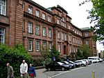
| Park Place, Scrymgeour Building, University Of Dundee, Including Boundary Walls And Railings |
|
|
|
56°27′29″N 2°58′41″W / 56.458182°N 2.978193°W / 56.458182; -2.978193 (Park Place, Scrymgeour Building, University Of Dundee, Including Boundary Walls And Railings) |
Category B |
25269 |
 |
| 11-19 (Odd Nos) North Ellen Street, "The Faces Land" |
|
|
|
56°28′12″N 2°58′07″W / 56.470027°N 2.968564°W / 56.470027; -2.968564 (11-19 (Odd Nos) North Ellen Street, "The Faces Land") |
Category B |
25291 |
|
| 13-19 (Odd Nos) Forfar Road |
|
|
|
56°28′34″N 2°57′13″W / 56.476243°N 2.953673°W / 56.476243; -2.953673 (13-19 (Odd Nos) Forfar Road) |
Category C(S) |
25303 |
|
| 5, 7, 9 Cowgate/75-79 (Odd Nos) Murraygate, Baldragon House |
|
|
|
56°27′48″N 2°58′06″W / 56.463416°N 2.968282°W / 56.463416; -2.968282 (5, 7, 9 Cowgate/75-79 (Odd Nos) Murraygate, Baldragon House) |
Category B |
25117 |
|
| 2 Wallace Street And 2 Broughty Ferry Road, Wallace Craigie Works |
|
|
|
56°27′59″N 2°57′28″W / 56.466363°N 2.957856°W / 56.466363; -2.957856 (2 Wallace Street And 2 Broughty Ferry Road, Wallace Craigie Works) |
Category B |
25132 |
|
| West Henderson's Wynd, Douglas Court, Former Douglas Mill On Milne's East Wynd, Near Douglas Street |
|
|
|
56°27′44″N 2°59′09″W / 56.4622°N 2.98581°W / 56.4622; -2.98581 (West Henderson's Wynd, Douglas Court, Former Douglas Mill On Milne's East Wynd, Near Douglas Street) |
Category B |
25156 |
|
| Constitution Street, Rosebank Church With Boundary Walls And Gatepiers |
|
|
|
56°28′02″N 2°58′37″W / 56.467265°N 2.976982°W / 56.467265; -2.976982 (Constitution Street, Rosebank Church With Boundary Walls And Gatepiers) |
Category B |
25157 |
|
| Arbroath Road, 60 Taybank Works, Tay Spinners Ltd |
|
|
|
56°28′10″N 2°57′18″W / 56.469405°N 2.954865°W / 56.469405; -2.954865 (Arbroath Road, 60 Taybank Works, Tay Spinners Ltd) |
Category B |
25175 |
|
| 24 Euclid Crescent, High School, (Former Girls' School) |
|
|
|
56°27′45″N 2°58′27″W / 56.462409°N 2.974228°W / 56.462409; -2.974228 (24 Euclid Crescent, High School, (Former Girls' School)) |
Category A |
25189 |
|
| 1 Drummond Street With Boundary Walls |
|
|
|
56°28′03″N 2°58′53″W / 56.467635°N 2.981406°W / 56.467635; -2.981406 (1 Drummond Street With Boundary Walls) |
Category C(S) |
25192 |
|
| Dudhope Castle, Well |
|
|
|
56°27′51″N 2°59′03″W / 56.464182°N 2.984028°W / 56.464182; -2.984028 (Dudhope Castle, Well) |
Category B |
25198 |
|
| 1-5 (Odd Nos) Dudhope Street And 63-69 (Odd Nos) Constitution Road, Rustic Place |
|
|
|
56°27′52″N 2°58′34″W / 56.464478°N 2.976164°W / 56.464478; -2.976164 (1-5 (Odd Nos) Dudhope Street And 63-69 (Odd Nos) Constitution Road, Rustic Place) |
Category B |
25202 |
|
| 2 Lochee Road, Tay Works |
|
|
|
56°27′44″N 2°58′45″W / 56.462164°N 2.979042°W / 56.462164; -2.979042 (2 Lochee Road, Tay Works) |
Category A |
25030 |
|
| 12 Bright Street Lochee Baptist Church |
|
|
|
56°28′26″N 3°00′38″W / 56.473862°N 3.010463°W / 56.473862; -3.010463 (12 Bright Street Lochee Baptist Church) |
Category C(S) |
25035 |
|
| 40 Castle Street, Former Stewart's Distillers' Office Entrance |
|
|
|
56°27′38″N 2°58′04″W / 56.460482°N 2.967818°W / 56.460482; -2.967818 (40 Castle Street, Former Stewart's Distillers' Office Entrance) |
Category B |
25036 |
|
| Methven Street, Camperdown Works, Calender Block |
|
|
|
56°28′24″N 3°00′32″W / 56.473281°N 3.008921°W / 56.473281; -3.008921 (Methven Street, Camperdown Works, Calender Block) |
Category B |
25048 |
|
| 240 And 242 Broughty Ferry Road |
|
|
|
56°28′07″N 2°55′56″W / 56.468743°N 2.932092°W / 56.468743; -2.932092 (240 And 242 Broughty Ferry Road) |
Category C(S) |
25051 |
|
| Methven Street, Camperdown Works, Offices, Lodge And Gate |
|
|
|
56°28′23″N 3°00′28″W / 56.472931°N 3.007824°W / 56.472931; -3.007824 (Methven Street, Camperdown Works, Offices, Lodge And Gate) |
Category B |
25053 |
|
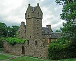
| Caird Park Mains Castle |
|
|
|
56°29′08″N 2°57′29″W / 56.485561°N 2.958145°W / 56.485561; -2.958145 (Caird Park Mains Castle) |
Category A |
25066 |
 |
| Methven Street, Camperdown Works, Jute Warehouses Nos 1-4 (By Former Railway) |
|
|
|
56°28′19″N 3°00′19″W / 56.471944°N 3.005396°W / 56.471944; -3.005396 (Methven Street, Camperdown Works, Jute Warehouses Nos 1-4 (By Former Railway)) |
Category B |
25069 |
|
| Caird Park, Old Mains Churchyard With Graham Of Fintry Vault |
|
|
|
56°29′10″N 2°57′29″W / 56.48602°N 2.957978°W / 56.48602; -2.957978 (Caird Park, Old Mains Churchyard With Graham Of Fintry Vault) |
Category C(S) |
25070 |
|
| 12 Milnbank Road (Aimer's Ltd) |
|
|
|
56°27′43″N 2°59′28″W / 56.461907°N 2.991044°W / 56.461907; -2.991044 (12 Milnbank Road (Aimer's Ltd)) |
Category B |
25077 |
|
| 20 Commercial Street, Iron Warehouse |
|
|
|
56°27′40″N 2°58′03″W / 56.461014°N 2.967571°W / 56.461014; -2.967571 (20 Commercial Street, Iron Warehouse) |
Category B |
25087 |
|
| Camperdown Country Park Sawmill, Workshops, Formerly Stables |
|
|
|
56°29′04″N 3°02′46″W / 56.484392°N 3.046207°W / 56.484392; -3.046207 (Camperdown Country Park Sawmill, Workshops, Formerly Stables) |
Category B |
25090 |
|
| 11-13 Princes Street And Return Elevation To Dens Street With Gate |
|
|
|
56°27′57″N 2°57′44″W / 56.465827°N 2.962192°W / 56.465827; -2.962192 (11-13 Princes Street And Return Elevation To Dens Street With Gate) |
Category C(S) |
25097 |
|
| Camperdown Country Park West Lodge And Gates |
|
|
|
56°29′03″N 3°03′02″W / 56.484032°N 3.050516°W / 56.484032; -3.050516 (Camperdown Country Park West Lodge And Gates) |
Category B |
25098 |
|
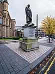
| Albert Square, Statue Of George Kinloch |
|
|
|
56°27′46″N 2°58′19″W / 56.462751°N 2.971851°W / 56.462751; -2.971851 (Albert Square, Statue Of George Kinloch) |
Category B |
24934 |
 |
| 22 Albany Terrace With Boundary Walls And Gatepiers |
|
|
|
56°28′01″N 2°59′15″W / 56.467038°N 2.987591°W / 56.467038; -2.987591 (22 Albany Terrace With Boundary Walls And Gatepiers) |
Category C(S) |
24938 |
|
| 45 Ancrum Road Ancrum Rd Primary School & Janitors House |
|
|
|
56°28′09″N 3°00′31″W / 56.469196°N 3.00857°W / 56.469196; -3.00857 (45 Ancrum Road Ancrum Rd Primary School & Janitors House) |
Category B |
24953 |
|
| 20 Brown Street, And Return Elevations To 8 Guthrie Street, And Session Street, South Mills |
|
|
|
56°27′38″N 2°58′47″W / 56.460568°N 2.97978°W / 56.460568; -2.97978 (20 Brown Street, And Return Elevations To 8 Guthrie Street, And Session Street, South Mills) |
Category A |
24965 |
|
| 3 Bell Street, Abertay University, Former James Church |
|
|
|
56°27′46″N 2°58′27″W / 56.462839°N 2.974288°W / 56.462839; -2.974288 (3 Bell Street, Abertay University, Former James Church) |
Category B |
24968 |
|
| Victoria Dock, South Shed (Consortium Conservation Ltd) |
|
|
|
56°27′46″N 2°57′25″W / 56.462813°N 2.956841°W / 56.462813; -2.956841 (Victoria Dock, South Shed (Consortium Conservation Ltd)) |
Category B |
24976 |
|
| 40 Bell Street, Abertay University, Including Former Boiler House And North Wing |
|
|
|
56°27′49″N 2°58′26″W / 56.463525°N 2.973981°W / 56.463525; -2.973981 (40 Bell Street, Abertay University, Including Former Boiler House And North Wing) |
Category B |
24983 |
|
| Victoria Dock, East Graving Or Dry Dock And Pump House |
|
|
|
56°27′44″N 2°57′24″W / 56.462168°N 2.956598°W / 56.462168; -2.956598 (Victoria Dock, East Graving Or Dry Dock And Pump House) |
Category B |
24986 |
|
| Castle Hill, South West Corner Of Commercial Street And High Street, Castle Hill House, Including Boundary Wall |
|
|
|
56°27′40″N 2°58′04″W / 56.461155°N 2.967916°W / 56.461155; -2.967916 (Castle Hill, South West Corner Of Commercial Street And High Street, Castle Hill House, Including Boundary Wall) |
Category A |
24993 |
|
| Castle Hill, St Paul's Episcopal Cathedral, Including Steps And Boundary Wall |
|
|
|
56°27′39″N 2°58′05″W / 56.460921°N 2.967959°W / 56.460921; -2.967959 (Castle Hill, St Paul's Episcopal Cathedral, Including Steps And Boundary Wall) |
Category A |
24997 |
|
| 23, 25 Castle Street |
|
|
|
56°27′38″N 2°58′07″W / 56.460431°N 2.968628°W / 56.460431; -2.968628 (23, 25 Castle Street) |
Category C(S) |
25005 |
|
| 2, 3 Albany Terrace With Boundary Walls And Gatepiers |
|
|
|
56°28′03″N 2°58′57″W / 56.467508°N 2.982637°W / 56.467508; -2.982637 (2, 3 Albany Terrace With Boundary Walls And Gatepiers) |
Category C(S) |
24929 |
|
| Brook Street, St Aidan's Church Hall, Former East School |
|
|
|
56°27′58″N 2°52′11″W / 56.466195°N 2.869608°W / 56.466195; -2.869608 (Brook Street, St Aidan's Church Hall, Former East School) |
Category C(S) |
50904 |
|
| West Ferry, 87 And 89 Dundee Road, Bryans, Including Boundary Wall And Gatepiers |
|
|
|
56°28′13″N 2°53′45″W / 56.470178°N 2.895816°W / 56.470178; -2.895816 (West Ferry, 87 And 89 Dundee Road, Bryans, Including Boundary Wall And Gatepiers) |
Category B |
25925 |
|
| West Ferry, 17 Fairfield Road, Red Court Including Sundial, Lamp Standard, Gatepiers, Boundary And Garden Walls |
|
|
|
56°28′19″N 2°54′02″W / 56.471912°N 2.900694°W / 56.471912; -2.900694 (West Ferry, 17 Fairfield Road, Red Court Including Sundial, Lamp Standard, Gatepiers, Boundary And Garden Walls) |
Category A |
25938 |
|
| West Ferry, 17 Fairfield Road, Red Court Laundry |
|
|
|
56°28′19″N 2°54′07″W / 56.471966°N 2.901962°W / 56.471966; -2.901962 (West Ferry, 17 Fairfield Road, Red Court Laundry) |
Category C(S) |
25941 |
|
| West Ferry, 26 Victoria Road, Aystree, Including Conservatory, Wall And Gatepiers |
|
|
|
56°28′16″N 2°53′10″W / 56.471163°N 2.886214°W / 56.471163; -2.886214 (West Ferry, 26 Victoria Road, Aystree, Including Conservatory, Wall And Gatepiers) |
Category A |
25950 |
|
| 1 Hazel Drive |
|
|
|
56°27′33″N 3°01′35″W / 56.459248°N 3.026383°W / 56.459248; -3.026383 (1 Hazel Drive) |
Category B |
25958 |
|
| Broughty Ferry, 81 Monifieth Road, Bartley Lodge, Including Boundary Wall, Gatepiers And Entrance Gateway |
|
|
|
56°28′10″N 2°51′37″W / 56.469494°N 2.860351°W / 56.469494; -2.860351 (Broughty Ferry, 81 Monifieth Road, Bartley Lodge, Including Boundary Wall, Gatepiers And Entrance Gateway) |
Category B |
25856 |
|
| Broughty Ferry, 51 Queen Street, (Formerly) Kingsway Bingo, Regal Cinema And Volunteer Hall |
|
|
|
56°28′09″N 2°52′45″W / 56.46911°N 2.879235°W / 56.46911; -2.879235 (Broughty Ferry, 51 Queen Street, (Formerly) Kingsway Bingo, Regal Cinema And Volunteer Hall) |
Category B |
25866 |
|
| Broughty Ferry, 9 West Queen Street, Falcon Lodge, Including Boundary Wall |
|
|
|
56°28′10″N 2°52′55″W / 56.469495°N 2.881971°W / 56.469495; -2.881971 (Broughty Ferry, 9 West Queen Street, Falcon Lodge, Including Boundary Wall) |
Category B |
25886 |
|
| Pitkerro, Pitkerro House, Including Garden Walls And Ruined Dovecot |
|
|
|
56°29′33″N 2°53′22″W / 56.492369°N 2.889567°W / 56.492369; -2.889567 (Pitkerro, Pitkerro House, Including Garden Walls And Ruined Dovecot) |
Category A |
25895 |
|
| Broughty Ferry, 383 Brook Street |
|
|
|
56°28′00″N 2°52′12″W / 56.466678°N 2.870041°W / 56.466678; -2.870041 (Broughty Ferry, 383 Brook Street) |
Category C(S) |
25768 |
|
| Broughty Ferry, 35 Camperdown Street, Including Wall And Gatepiers, Cyandy |
|
|
|
56°28′11″N 2°52′35″W / 56.469841°N 2.876282°W / 56.469841; -2.876282 (Broughty Ferry, 35 Camperdown Street, Including Wall And Gatepiers, Cyandy) |
Category B |
25776 |
|
| Broughty Ferry, 4, 6 Dundas Street, Braehead House |
|
|
|
56°27′56″N 2°52′43″W / 56.465449°N 2.878582°W / 56.465449; -2.878582 (Broughty Ferry, 4, 6 Dundas Street, Braehead House) |
Category B |
25791 |
|
| Broughty Ferry, 10 Fort Street And 4 Bell's Lane Fisherman's Tavern |
|
|
|
56°27′55″N 2°52′37″W / 56.46529°N 2.876923°W / 56.46529; -2.876923 (Broughty Ferry, 10 Fort Street And 4 Bell's Lane Fisherman's Tavern) |
Category C(S) |
25811 |
|
| Broughty Ferry, 4 Forthill Road, Hillside, And 1B Hill Street, Hillfoot, Including Boundary Wall And Gatepiers |
|
|
|
56°28′12″N 2°52′30″W / 56.469869°N 2.87487°W / 56.469869; -2.87487 (Broughty Ferry, 4 Forthill Road, Hillside, And 1B Hill Street, Hillfoot, Including Boundary Wall And Gatepiers) |
Category C(S) |
25818 |
|
| Broughty Ferry, 4 Hill Street, With Wall And Gatepiers |
|
|
|
56°28′10″N 2°52′27″W / 56.469532°N 2.874246°W / 56.469532; -2.874246 (Broughty Ferry, 4 Hill Street, With Wall And Gatepiers) |
Category C(S) |
25840 |
|
| St Peter's Street And Perth Road, St Peter's Churchyard Including Mccheyne Monument |
|
|
|
56°27′22″N 2°59′27″W / 56.456105°N 2.990828°W / 56.456105; -2.990828 (St Peter's Street And Perth Road, St Peter's Churchyard Including Mccheyne Monument) |
Category C(S) |
25676 |
|
| 8 Tait's Lane |
|
|
|
56°27′26″N 2°59′39″W / 56.457193°N 2.994069°W / 56.457193; -2.994069 (8 Tait's Lane) |
Category B |
25680 |
|
| Tay Railway Bridge |
|
|
|
56°26′20″N 2°59′19″W / 56.43889°N 2.98858°W / 56.43889; -2.98858 (Tay Railway Bridge) |
Category A |
25681 |
|
| Balmossie, Road Bridge Over Dichty Water |
|
|
|
56°28′53″N 2°51′04″W / 56.481426°N 2.851187°W / 56.481426; -2.851187 (Balmossie, Road Bridge Over Dichty Water) |
Category B |
25738 |
 |
| Broughty Ferry, 6 Bath Street, Gowan Lea |
|
|
|
56°27′55″N 2°52′28″W / 56.465227°N 2.874455°W / 56.465227; -2.874455 (Broughty Ferry, 6 Bath Street, Gowan Lea) |
Category C(S) |
25756 |
|
| Broughty Ferry, 8 Bath Street |
|
|
|
56°27′55″N 2°52′28″W / 56.46529°N 2.874424°W / 56.46529; -2.874424 (Broughty Ferry, 8 Bath Street) |
Category C(S) |
25757 |
|
| 30, 32, 34 Union Street |
|
|
|
56°27′33″N 2°58′14″W / 56.459077°N 2.970605°W / 56.459077; -2.970605 (30, 32, 34 Union Street) |
Category B |
25592 |
|
| 140 Perth Road |
|
|
|
56°27′22″N 2°58′59″W / 56.456193°N 2.983156°W / 56.456193; -2.983156 (140 Perth Road) |
Category B |
25593 |
|
| 152-4 Perth Road (Formerly Valentine's) |
|
|
|
56°27′22″N 2°59′05″W / 56.456198°N 2.984746°W / 56.456198; -2.984746 (152-4 Perth Road (Formerly Valentine's)) |
Category C(S) |
25597 |
|
| 15, 17, 19 Ward Road, Former Methodist Church And Adjoining Offices, Including Steps And Railings |
|
|
|
56°27′42″N 2°58′33″W / 56.461749°N 2.975785°W / 56.461749; -2.975785 (15, 17, 19 Ward Road, Former Methodist Church And Adjoining Offices, Including Steps And Railings) |
Category C(S) |
25602 |
|
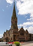
| 328 Perth Road, Mccheyne Memorial Church |
|
|
|
56°27′22″N 2°59′44″W / 56.456138°N 2.995616°W / 56.456138; -2.995616 (328 Perth Road, Mccheyne Memorial Church) |
Category A |
25603 |
 |
| 444, 446 Perth Road, Taygrove And Riversdale, With Boundary Walls And Gatepiers |
|
|
|
56°27′23″N 3°00′12″W / 56.456382°N 3.003265°W / 56.456382; -3.003265 (444, 446 Perth Road, Taygrove And Riversdale, With Boundary Walls And Gatepiers) |
Category B |
25615 |
|
| 17, 19 And 21 Whitehall Crescent |
|
|
|
56°27′32″N 2°58′13″W / 56.458935°N 2.97031°W / 56.458935; -2.97031 (17, 19 And 21 Whitehall Crescent) |
Category B |
25643 |
|
| 11 Rockfield Crescent With Boundary Walls |
|
|
|
56°27′32″N 3°00′15″W / 56.458926°N 3.004257°W / 56.458926; -3.004257 (11 Rockfield Crescent With Boundary Walls) |
Category B |
25648 |
|
| 5 And 7 Whitehall Street, Palace Buildings |
|
|
|
56°27′34″N 2°58′14″W / 56.459427°N 2.970679°W / 56.459427; -2.970679 (5 And 7 Whitehall Street, Palace Buildings) |
Category B |
25659 |
|
| 4, 6 Roseangle With Railings And Boundary Walls |
|
|
|
56°27′22″N 2°58′54″W / 56.456087°N 2.98179°W / 56.456087; -2.98179 (4, 6 Roseangle With Railings And Boundary Walls) |
Category C(S) |
25662 |
|
| 2 And 4 Whitehall Street, 4 And 6 Nethergate |
|
|
|
56°27′35″N 2°58′15″W / 56.459831°N 2.970722°W / 56.459831; -2.970722 (2 And 4 Whitehall Street, 4 And 6 Nethergate) |
Category B |
25663 |
|
| 8 Roseangle With Railings And Boundary Walls |
|
|
|
56°27′21″N 2°58′55″W / 56.455969°N 2.9819°W / 56.455969; -2.9819 (8 Roseangle With Railings And Boundary Walls) |
Category C(S) |
25664 |
|
| 6-12 (Even Nos) Whitehall Street |
|
|
|
56°27′35″N 2°58′14″W / 56.459769°N 2.970493°W / 56.459769; -2.970493 (6-12 (Even Nos) Whitehall Street) |
Category B |
25665 |
|
| 28 Roseangle Including Front Railings And Rear Garden Sea Wall |
|
|
|
56°27′17″N 2°59′03″W / 56.454793°N 2.984077°W / 56.454793; -2.984077 (28 Roseangle Including Front Railings And Rear Garden Sea Wall) |
Category C(S) |
25670 |
|
| 36 Roseangle Including Front Railings And Rear Sea Wall (Excluding Large Addition At Ne) |
|
|
|
56°27′16″N 2°59′05″W / 56.454347°N 2.984795°W / 56.454347; -2.984795 (36 Roseangle Including Front Railings And Rear Sea Wall (Excluding Large Addition At Ne)) |
Category C(S) |
25672 |
|
| 11 Perth Road |
|
|
|
56°27′24″N 2°58′53″W / 56.456565°N 2.98151°W / 56.456565; -2.98151 (11 Perth Road) |
Category C(S) |
25523 |
|
| 276 Clepington Road, Former Dundee, And Newtyle Railway Station, Or Laing's Cottage |
|
|
|
56°28′42″N 2°59′18″W / 56.478325°N 2.988371°W / 56.478325; -2.988371 (276 Clepington Road, Former Dundee, And Newtyle Railway Station, Or Laing's Cottage) |
Category C(S) |
25540 |
|
| 45, 47 South Tay Street |
|
|
|
56°27′32″N 2°58′36″W / 56.458859°N 2.976588°W / 56.458859; -2.976588 (45, 47 South Tay Street) |
Category C(S) |
25556 |
|
| 20, 22 South Tay Street |
|
|
|
56°27′30″N 2°58′35″W / 56.458241°N 2.976393°W / 56.458241; -2.976393 (20, 22 South Tay Street) |
Category B |
25564 |
|
| 329 Perth Road Fernbrae, House And Lodge, Boundary Walls And Gatepiers |
|
|
|
56°27′27″N 3°00′50″W / 56.457464°N 3.013922°W / 56.457464; -3.013922 (329 Perth Road Fernbrae, House And Lodge, Boundary Walls And Gatepiers) |
Category C(S) |
25567 |
|
| 34, 36 South Tay Street Hermon Evangelical Church |
|
|
|
56°27′31″N 2°58′37″W / 56.458685°N 2.977038°W / 56.458685; -2.977038 (34, 36 South Tay Street Hermon Evangelical Church) |
Category C(S) |
25568 |
|
| 385 Perth Road, 4 Hazel Avenue, Inniscarra Including Boundary Walls |
|
|
|
56°27′31″N 3°01′45″W / 56.458498°N 3.029105°W / 56.458498; -3.029105 (385 Perth Road, 4 Hazel Avenue, Inniscarra Including Boundary Walls) |
Category B |
25575 |
|
| 4, 6 Prospect Place, With Gatepiers And Boundary Walls |
|
|
|
56°27′57″N 2°58′38″W / 56.465845°N 2.977108°W / 56.465845; -2.977108 (4, 6 Prospect Place, With Gatepiers And Boundary Walls) |
Category B |
25463 |
|
| 166 Nethergate, Including Boundary Walls And Garden Terracing |
|
|
|
56°27′24″N 2°58′37″W / 56.456799°N 2.97694°W / 56.456799; -2.97694 (166 Nethergate, Including Boundary Walls And Garden Terracing) |
Category B |
25471 |
|
| 61 Magdalen Yard Road |
|
|
|
56°27′12″N 2°59′29″W / 56.453423°N 2.991359°W / 56.453423; -2.991359 (61 Magdalen Yard Road) |
Category B |
25481 |
|
| 38 North Lindsay Street, 8-12 (Even Nos) South Ward Road, Former Halley Brothers' Works |
|
|
|
56°27′37″N 2°58′32″W / 56.460306°N 2.975456°W / 56.460306; -2.975456 (38 North Lindsay Street, 8-12 (Even Nos) South Ward Road, Former Halley Brothers' Works) |
Category B |
25489 |
|
| 69 Magdalen Yard Road |
|
|
|
56°27′13″N 2°59′35″W / 56.453491°N 2.992951°W / 56.453491; -2.992951 (69 Magdalen Yard Road) |
Category C(S) |
25490 |
|
| Magdalen Yard Road, Magdalen Green Bandstand |
|
|
|
56°27′11″N 2°59′41″W / 56.453073°N 2.994724°W / 56.453073; -2.994724 (Magdalen Yard Road, Magdalen Green Bandstand) |
Category A |
25499 |
 |
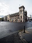
| Panmure Street, Royal Exchange Lane, Royal Exchange |
|
|
|
56°27′48″N 2°58′15″W / 56.463236°N 2.970695°W / 56.463236; -2.970695 (Panmure Street, Royal Exchange Lane, Royal Exchange) |
Category A |
25507 |
 |
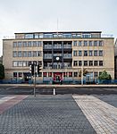
| Panmure Street, Guardian Royal Exchange |
|
|
|
56°27′47″N 2°58′17″W / 56.463149°N 2.971456°W / 56.463149; -2.971456 (Panmure Street, Guardian Royal Exchange) |
Category B |
25510 |
 |
| 21 Meadowside Or Albert Square |
|
|
|
56°27′45″N 2°58′12″W / 56.462522°N 2.970077°W / 56.462522; -2.970077 (21 Meadowside Or Albert Square) |
Category B |
25320 |
|
| Graham Street St Teresa's Formerly St Michael's Rc Church |
|
|
|
56°28′43″N 2°58′06″W / 56.478689°N 2.96846°W / 56.478689; -2.96846 (Graham Street St Teresa's Formerly St Michael's Rc Church) |
Category B |
25322 |
|
| 31 Meadowside Or Albert Square |
|
|
|
56°27′46″N 2°58′12″W / 56.462773°N 2.970132°W / 56.462773; -2.970132 (31 Meadowside Or Albert Square) |
Category B |
25323 |
|
| 138, 140 Seagate And Return Elevation To Queen Street, Magnum House, Former Scws Store |
|
|
|
56°27′51″N 2°57′54″W / 56.464043°N 2.965101°W / 56.464043; -2.965101 (138, 140 Seagate And Return Elevation To Queen Street, Magnum House, Former Scws Store) |
Category B |
25329 |
|
| 49 Meadowside |
|
|
|
56°27′49″N 2°58′13″W / 56.463491°N 2.970182°W / 56.463491; -2.970182 (49 Meadowside) |
Category B |
25331 |
|
| Balgay Park, Footbridge Between Balgay Hill And The Western Necropolis |
|
|
|
56°27′53″N 3°00′52″W / 56.464674°N 3.014455°W / 56.464674; -3.014455 (Balgay Park, Footbridge Between Balgay Hill And The Western Necropolis) |
Category B |
25356 |
|
| Blackness Road, Harris Academy Annexe, Former Logie Central School, And Janitor's House And Gate Piers |
|
|
|
56°27′40″N 2°59′49″W / 56.461213°N 2.996933°W / 56.461213; -2.996933 (Blackness Road, Harris Academy Annexe, Former Logie Central School, And Janitor's House And Gate Piers) |
Category B |
25372 |
|
| Blackness Road, Parkview School, Lodge, Boundary Walls And Railings |
|
|
|
56°27′39″N 3°00′28″W / 56.460784°N 3.007762°W / 56.460784; -3.007762 (Blackness Road, Parkview School, Lodge, Boundary Walls And Railings) |
Category B |
25376 |
|
| 7 Farington Terrace Farington |
|
|
|
56°27′29″N 3°00′59″W / 56.457938°N 3.01632°W / 56.457938; -3.01632 (7 Farington Terrace Farington) |
Category B |
25408 |
|
| 36 Nethergate |
|
|
|
56°27′34″N 2°58′16″W / 56.459512°N 2.971233°W / 56.459512; -2.971233 (36 Nethergate) |
Category B |
25418 |
|
| 80, 82 Nethergate |
|
|
|
56°27′32″N 2°58′20″W / 56.458866°N 2.972271°W / 56.458866; -2.972271 (80, 82 Nethergate) |
Category B |
25421 |
|
| 66, 67 High Street |
|
|
|
56°27′39″N 2°58′12″W / 56.460887°N 2.970019°W / 56.460887; -2.970019 (66, 67 High Street) |
Category B |
25230 |
|
| 26 East Dock Maritime House, Dundee, Perth And London Shipping Co |
|
|
|
56°27′44″N 2°57′49″W / 56.462259°N 2.963514°W / 56.462259; -2.963514 (26 East Dock Maritime House, Dundee, Perth And London Shipping Co) |
Category B |
25232 |
|
| 42 East Dock Street, Retail Park, Unit 7, Former Dundee Foundry Engine Shop |
|
|
|
56°27′50″N 2°57′40″W / 56.46383°N 2.961249°W / 56.46383; -2.961249 (42 East Dock Street, Retail Park, Unit 7, Former Dundee Foundry Engine Shop) |
Category B |
25236 |
|
| 7 Dudhope Terrace And 1 Law Street |
|
|
|
56°27′59″N 2°59′01″W / 56.466432°N 2.983599°W / 56.466432; -2.983599 (7 Dudhope Terrace And 1 Law Street) |
Category C(S) |
25246 |
|
| 1, 3 King Street And Return To Cowgate |
|
|
|
56°27′51″N 2°58′02″W / 56.464188°N 2.967279°W / 56.464188; -2.967279 (1, 3 King Street And Return To Cowgate) |
Category B |
25267 |
|
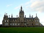
| Forfar Road, Morgan Academy, Main Block And Janitor's House, With Terrace, Boundary Walls And Gatepiers |
|
|
|
56°28′28″N 2°57′15″W / 56.474559°N 2.954085°W / 56.474559; -2.954085 (Forfar Road, Morgan Academy, Main Block And Janitor's House, With Terrace, Boundary Walls And Gatepiers) |
Category A |
25288 |
 |
| Off Perth Road, Geddes Quadrangle, Sundial, University Of Dundee |
|
|
|
56°27′27″N 2°58′49″W / 56.457428°N 2.98038°W / 56.457428; -2.98038 (Off Perth Road, Geddes Quadrangle, Sundial, University Of Dundee) |
Category B |
25293 |
 |
| Claverhouse Road Mains Of Claverhouse With Railings |
|
|
|
56°29′29″N 2°57′49″W / 56.491413°N 2.963506°W / 56.491413; -2.963506 (Claverhouse Road Mains Of Claverhouse With Railings) |
Category C(S) |
25119 |
|
| 15-19 (Odd Nos) Crichton Street |
|
|
|
56°27′35″N 2°58′12″W / 56.459791°N 2.969975°W / 56.459791; -2.969975 (15-19 (Odd Nos) Crichton Street) |
Category C(S) |
25131 |
|
| 92-98 (Even Nos) Clepington Road, Including The Clep Public House |
|
|
|
56°28′38″N 2°58′07″W / 56.477277°N 2.968537°W / 56.477277; -2.968537 (92-98 (Even Nos) Clepington Road, Including The Clep Public House) |
Category B |
25145 |
|
| 14 Dock Street, Lampstandard |
|
|
|
56°27′33″N 2°58′08″W / 56.45909°N 2.968869°W / 56.45909; -2.968869 (14 Dock Street, Lampstandard) |
Category C(S) |
25146 |
|
| 50, 52 Albert Street, 2-6 (Even Nos) Arthurstone Terrace |
|
|
|
56°28′09″N 2°57′29″W / 56.469201°N 2.957992°W / 56.469201; -2.957992 (50, 52 Albert Street, 2-6 (Even Nos) Arthurstone Terrace) |
Category B |
25164 |
|
| Constitution Terrace 6, 8, 10 And 76, 78, 80 Constitution Street Including Boundary Walls And Gatepiers |
|
|
|
56°28′00″N 2°58′42″W / 56.466708°N 2.978201°W / 56.466708; -2.978201 (Constitution Terrace 6, 8, 10 And 76, 78, 80 Constitution Street Including Boundary Walls And Gatepiers) |
Category B |
25165 |
|
| 54, 55 Dock Street/1, 3 Gellatly Street |
|
|
|
56°27′41″N 2°57′54″W / 56.461411°N 2.96505°W / 56.461411; -2.96505 (54, 55 Dock Street/1, 3 Gellatly Street) |
Category B |
25166 |
|
| Albert Street Ogilvie Church (Church Of Scotland) |
|
|
|
56°28′20″N 2°57′25″W / 56.472327°N 2.956983°W / 56.472327; -2.956983 (Albert Street Ogilvie Church (Church Of Scotland)) |
Category B |
25171 |
|
| 56, 58 Arbroath Road, 1 Kemback Street |
|
|
|
56°28′06″N 2°57′19″W / 56.468467°N 2.955409°W / 56.468467; -2.955409 (56, 58 Arbroath Road, 1 Kemback Street) |
Category B |
25179 |
|
| 3 Arthurstone Terrace And 1, 3, 5 Maitland Street, St Patrick's Rc Church, Presbytery And Hall |
|
|
|
56°28′11″N 2°57′31″W / 56.469701°N 2.958492°W / 56.469701; -2.958492 (3 Arthurstone Terrace And 1, 3, 5 Maitland Street, St Patrick's Rc Church, Presbytery And Hall) |
Category B |
25183 |
|
| 80 North Lindsay Street, 29, 31 South Ward Road And Return Elevation To Johnston Street, Lindsay Street Mill |
|
|
|
56°27′39″N 2°58′37″W / 56.460796°N 2.977076°W / 56.460796; -2.977076 (80 North Lindsay Street, 29, 31 South Ward Road And Return Elevation To Johnston Street, Lindsay Street Mill) |
Category B |
25085 |
|
| 29 Paterson Street And Return Elevation To Milton Street, Lawside Works (2-Storey And Attic Former Mill At Corner Of Paterson And Milton Streets Only) |
|
|
|
56°28′26″N 2°58′55″W / 56.474027°N 2.982058°W / 56.474027; -2.982058 (29 Paterson Street And Return Elevation To Milton Street, Lawside Works (2-Storey And Attic Former Mill At Corner Of Paterson And Milton Streets Only)) |
Category B |
25089 |
|
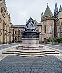
| Albert Square, Statue Of Queen Victoria |
|
|
|
56°27′46″N 2°58′17″W / 56.462836°N 2.971318°W / 56.462836; -2.971318 (Albert Square, Statue Of Queen Victoria) |
Category B |
24944 |
 |
| 17 Ancrum Road St Margarets Episcopal Church |
|
|
|
56°28′09″N 3°00′19″W / 56.469276°N 3.005325°W / 56.469276; -3.005325 (17 Ancrum Road St Margarets Episcopal Church) |
Category B |
24948 |
|
| 56 Barrack Street, Willison House |
|
|
|
56°27′39″N 2°58′25″W / 56.460806°N 2.973554°W / 56.460806; -2.973554 (56 Barrack Street, Willison House) |
Category B |
24963 |
 |
| 27, 29 Castle Street |
|
|
|
56°27′38″N 2°58′06″W / 56.460432°N 2.968449°W / 56.460432; -2.968449 (27, 29 Castle Street) |
Category C(S) |
25009 |
|
| Barnhill, 15 Panmure Terrace, Rowanlee Including Boundary Wall |
|
|
|
56°28′28″N 2°51′02″W / 56.474323°N 2.85059°W / 56.474323; -2.85059 (Barnhill, 15 Panmure Terrace, Rowanlee Including Boundary Wall) |
Category C(S) |
51133 |
|
| 60 Dock Street, Including 1/L, 2/L And Top Floor Flats (Accessed From And Known As 59 Dock Street) |
|
|
|
56°27′42″N 2°57′53″W / 56.461602°N 2.964746°W / 56.461602; -2.964746 (60 Dock Street, Including 1/L, 2/L And Top Floor Flats (Accessed From And Known As 59 Dock Street)) |
Category C(S) |
51353 |
|
| West Ferry, 26 Dundee Road, Harecraig House, Including Wall At Dundee Road |
|
|
|
56°28′10″N 2°53′44″W / 56.469442°N 2.895637°W / 56.469442; -2.895637 (West Ferry, 26 Dundee Road, Harecraig House, Including Wall At Dundee Road) |
Category B |
25927 |
|
| West Ferry, 47 Grove Road, Claremont Lodge, Including Wall And Gatepiers |
|
|
|
56°28′20″N 2°53′29″W / 56.472321°N 2.891322°W / 56.472321; -2.891322 (West Ferry, 47 Grove Road, Claremont Lodge, Including Wall And Gatepiers) |
Category B |
25943 |
|
| West Ferry,1 Ralston Road, Sunningdale, Including Enclosing Walls And Garage |
|
|
|
56°28′07″N 2°54′26″W / 56.468631°N 2.907207°W / 56.468631; -2.907207 (West Ferry,1 Ralston Road, Sunningdale, Including Enclosing Walls And Garage) |
Category B |
25946 |
|
| 5 Annfield Street And 10 Blackness Street, Annfield House With Boundary Wall |
|
|
|
56°27′35″N 2°59′35″W / 56.459842°N 2.993116°W / 56.459842; -2.993116 (5 Annfield Street And 10 Blackness Street, Annfield House With Boundary Wall) |
Category B |
25955 |
|
| Broughty Ferry, 63, 65, 67 And 69 Monifieth Road And 1 And 3 Norrie Street |
|
|
|
56°28′06″N 2°51′52″W / 56.468469°N 2.864434°W / 56.468469; -2.864434 (Broughty Ferry, 63, 65, 67 And 69 Monifieth Road And 1 And 3 Norrie Street) |
Category C(S) |
25854 |
|
In March 2016 there were 47,288 listed buildings in Scotland. Of these, 8% were Category A, and 50% were Category B, with the remaining 42% being Category C.


