List of historic places in the Fraser Valley Regional District facts for kids
The following list includes all of the Canadian Register of Historic Places listings in Fraser Valley Regional District, British Columbia.
| Name | Address | Municipality | PC | Coordinates | IDF | IDP | IDM | Image | |
|---|---|---|---|---|---|---|---|---|---|
| Abbotsford Sikh Temple National Historic Site of Canada | 33089 South Fraser Way | Abbotsford | V2S | 49°03′03″N 122°18′29″W / 49.0508°N 122.308°W | 9358 | 5878 |  More images |
||
| Agassiz Research Station, Building No. 13 | 6947 Highway 7 | Agassiz | 49°14′34″N 121°45′48″W / 49.242712°N 121.763257°W | 4381 | |||||
| Clayburn Church | 4304 Wright Street | Abbotsford | V2S | 49°04′49″N 122°15′40″W / 49.0803°N 122.261°W | 5881 |  More images |
|||
| Clayburn School | 4315 Wright Street | Abbotsford | V2S | 49°04′51″N 122°15′43″W / 49.0807°N 122.262°W | 5882 |  More images |
|||
| Trethewey House | 2313 Ware Street | Abbotsford | V2S | 49°02′37″N 122°18′18″W / 49.0437°N 122.305°W | 5880 |  More images |
|||
| Brigadier Murphy Armoury | 29th & 21st Avenue, Canadian Forces Base Chilliwack | Vernon | 50°15′21″N 119°16′08″W / 50.2559°N 119.269°W | 9504 | |||||
| Building 24 | 45420 Vedder Mountain Road | Chilliwack | V2R | 49°06′09″N 121°58′30″W / 49.1025°N 121.975°W | 11008 | ||||
| Chilliwack City Hall National Historic Site of Canada | 45820 Spadina Avenue | Chilliwack | V2P | 49°10′07″N 121°57′22″W / 49.1687°N 121.956°W | 7408 | 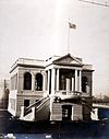 More images |
|||
| Church of the Holy Cross National Historic Site of Canada | Skatin | V2P | 49°56′16″N 122°24′36″W / 49.937710°N 122.410010°W | 7410 | 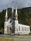 |
||||
| Kilby Store and Farm | 215 Kilby Road | Harrison Mills | V0M | 49°14′16″N 121°57′36″W / 49.2378°N 121.96°W | 1748 |  More images |
|||
| Christ Church National Historic Site of Canada | 681 Fraser Avenue | Hope | V0X | 49°22′52″N 121°26′38″W / 49.381°N 121.444°W | 12564 | 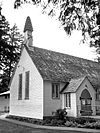 More images |
|||
| Fort Hope National Historic Site of Canada | Corner of Wallace and Water Streets | Hope | V0X | 49°22′43″N 121°26′39″W / 49.3785°N 121.4441°W | 19613 |  |
|||
| Othello Tunnels | Hope | 49°22′14″N 121°21′58″W / 49.3706°N 121.366°W | 18065 | 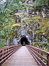 |
|||||
| Royal Engineers' Road | Hope | 49°14′04″N 121°07′23″W / 49.2344°N 121.123°W | 18056 |  |
|||||
| Mission Memorial Centre | 33070 5th Avenue | Mission | 49°08′17″N 122°18′28″W / 49.1380°N 122.3079°W | 19414 | |||||
| Mission Museum | 33201 2nd Avenue | Mission | 49°08′07″N 122°18′17″W / 49.1354°N 122.3047°W | 19413 | |||||
| Silverhill Hall | 31016 Silverhill Avenue | Mission | 49°10′36″N 122°21′53″W / 49.1767°N 122.3648°W | 19426 | |||||
| Stave Falls Hydro-Electric Installation National Historic Site of Canada | Mission | V4S | 49°13′43″N 122°21′22″W / 49.2285°N 122.356°W | 13213 | 19425 |  More images |
|||
| Xá:ytem / Hatzic Rock National Historic Site of Canada | 35087 Lougheed Highway | Mission | V2V | 49°09′04″N 122°15′04″W / 49.1512°N 122.251°W | 2256 |  More images |
|||
| Alexandra Bridge | Old Highway 1 | Spuzzum | 49°42′27″N 121°25′01″W / 49.7075°N 121.417°W | 18067 |  More images |
||||
| Royal Engineers' Road at Alexandra Bridge | Spuzzum | 49°42′26″N 121°24′50″W / 49.7071°N 121.414°W | 18042 |  |
|||||
| Church of St. John the Divine | Douglas Street | Yale | V0K | 49°33′46″N 121°25′55″W / 49.5627°N 121.432°W | 6190 | 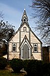 More images |

All content from Kiddle encyclopedia articles (including the article images and facts) can be freely used under Attribution-ShareAlike license, unless stated otherwise. Cite this article:
List of historic places in the Fraser Valley Regional District Facts for Kids. Kiddle Encyclopedia.
