List of historic places in the Central Kootenay Regional District facts for kids
The following list includes all of the Canadian Register of Historic Places listings in Central Kootenay Regional District, British Columbia.
| Name | Address | Municipality | PC | Coordinates | IDF | IDP | IDM | Image | |
|---|---|---|---|---|---|---|---|---|---|
| Doukhobor Suspension Bridge National Historic Site of Canada | Castlegar | V1N | 49°17′27″N 117°38′20″W / 49.2909°N 117.639°W | 7818 |  More images |
||||
| Pilot Bay Lighthouse | Near Crawford Bay | 49°38′16″N 116°52′59″W / 49.6378°N 116.883°W | 18041 | ||||||
| City of Ainsworth Shipwreck Site | Crawford Bay, Kootenay Lake | Gray Creek | 49°36′08″N 116°48′54″W / 49.6023°N 116.8150°W | 19310 | |||||
| 1896 Building | 331 Front Street | Kaslo | V0G | 49°54′42″N 116°54′12″W / 49.9117°N 116.9034°W | 19034 | ||||
| Kaslo Bay | Kaslo waterfront area | Kaslo | V0G | 49°54′54″N 116°54′26″W / 49.9150°N 116.9072°W | 19030 | ||||
| Kaslo Municipal Hall National Historic Site of Canada | 413 Fourth Street | Kaslo | V0G | 49°54′38″N 116°54′18″W / 49.9106°N 116.905°W | 12065 | 19024 |  |
||
| Langham Cultural Centre | 447 A Avenue | Kaslo | V0G | 49°54′42″N 116°54′24″W / 49.9117°N 116.9066°W | 19033 |  |
|||
| S.S. Moyie National Historic Site of Canada | Kaslo | V0G | 49°54′40″N 116°54′04″W / 49.9112°N 116.901°W | 12748 | 19025 |  |
|||
| Sacred Heart Catholic Church | 313 Fifth Street | Kaslo | 49°54′43″N 116°54′24″W / 49.9120°N 116.9067°W | 19028 | |||||
| St. Andrew's United Church | 500 Fourth Street | Kaslo | 49°54′37″N 116°54′17″W / 49.9102°N 116.9048°W | 19029 |  |
||||
| St. Mark's Anglican Church | 500 Fourth Street | Kaslo | 49°54′36″N 116°54′28″W / 49.9101°N 116.9079°W | 19027 | |||||
| Vimy Park | 100 A Avenue | Kaslo | 49°54′31″N 116°53′55″W / 49.9087°N 116.8987°W | 19026 | |||||
| 212 Broadway Street | 212 Broadway Street | Nakusp | 50°14′19″N 117°48′04″W / 50.2385°N 117.801°W | 18710 | |||||
| 302 Broadway Street | 302 Broadway Street | Nakusp | V0G | 50°14′19″N 117°48′07″W / 50.2386°N 117.802°W | 18706 | ||||
| 420 Broadway Street | 420 Broadway Street | Nakusp | V0G | 50°14′20″N 117°48′14″W / 50.2388°N 117.804°W | 18709 | ||||
| 83 Broadway Street | 83 Broadway Street | Nakusp | V0G | 50°14′19″N 117°47′53″W / 50.2387°N 117.798°W | 18721 | ||||
| Bon Marché Store | 416 Broadway Street | Nakusp | 50°14′20″N 117°48′14″W / 50.2388°N 117.804°W | 18592 | |||||
| Cowan House | 608 Broadway Street | Nakusp | V0G | 50°14′21″N 117°48′22″W / 50.2391°N 117.806°W | 18720 | ||||
| Edwards Block | 320 Broadway Street | Nakusp | 50°14′19″N 117°48′11″W / 50.2386°N 117.803°W | 18677 | |||||
| Leland Hotel | 92 4th Avenue SW | Nakusp | 50°14′18″N 117°48′11″W / 50.2383°N 117.803°W | 18590 | |||||
| Masonic Block | 317 Broadway Street | Nakusp | 50°14′20″N 117°48′09″W / 50.2390°N 117.8025°W | 18656 | |||||
| Nakusp Courthouse | 415 Broadway Street | Nakusp | v0g | 50°14′21″N 117°48′14″W / 50.2393°N 117.804°W | 18603 |  |
|||
| Nakusp Hot Springs | 8500 Hot Springs Road | Nakusp | 50°17′50″N 117°41′17″W / 50.2972°N 117.688°W | 18718 | |||||
| Nakusp Legion Hall | 94 4th Avenue | Nakusp | V0G | 50°14′23″N 117°48′11″W / 50.2398°N 117.803°W | 18707 |  |
|||
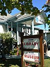
| Nakusp Library and Museum | 92 6th Avenue | Nakusp | V0G | 50°14′24″N 117°48′22″W / 50.2399°N 117.806°W | 18657 |  |
|||
| Nakusp Waterfront Walkway | Waterfront Walkway | Nakusp | 50°14′15″N 117°48′07″W / 50.2376°N 117.802°W | 18741 |  More images |
||||
| Old Presbyterian Church | 93 5th Avenue NW | Nakusp | V0G | 50°14′23″N 117°48′11″W / 50.2398°N 117.803°W | 18591 | ||||
| Our Lady of Lourdes Catholic Church | 96 5th Avenue NW | Nakusp | V0G | 50°14′24″N 117°48′14″W / 50.24°N 117.804°W | 18736 | ||||
| Pine Lodge | 119 Broadway Street | Nakusp | V0G | 50°14′20″N 117°48′00″W / 50.2389°N 117.8°W | 18708 | ||||
| Spicer's Farm | 97 Nelson Ave SW | Nakusp | 50°14′15″N 117°47′35″W / 50.2376°N 117.793°W | 18740 | |||||
| Canadian Pacific Railway Station | 90 Baker Street | Nelson | V1L | 49°29′21″N 117°18′05″W / 49.4893°N 117.3015°W | 4562 |  |
|||
| Nikkei Internment Memorial Centre National Historic Site of Canada | 306 Josephine Street | New Denver | 49°59′12″N 117°22′30″W / 49.9866°N 117.375°W | 15382 |  More images |
||||
| Burlington Northern Railway Station | Railway Avenue (Hwy. #6) | Salmo | V0G | 49°11′38″N 117°16′48″W / 49.194°N 117.28°W | 9330 |  More images |
|||
| Slocan Mercantile General Store | North bank of Carpenter Creek in ghost town of Sandon | Sandon | 49°58′33″N 117°13′38″W / 49.9758°N 117.2273°W | 21056 |  |

All content from Kiddle encyclopedia articles (including the article images and facts) can be freely used under Attribution-ShareAlike license, unless stated otherwise. Cite this article:
List of historic places in the Central Kootenay Regional District Facts for Kids. Kiddle Encyclopedia.
