List of historic places in County of Brant facts for kids
This is a list of historic places in County of Brant, Ontario, containing heritage sites listed on the Canadian Register of Historic Places (CRHP), all of which are designated as historic places either locally, provincially, territorially, nationally, or by more than one level of government.
List of historic places
| Name | Address | Municipality | PC | Coordinates | IDF | IDP | IDM | Image | |
|---|---|---|---|---|---|---|---|---|---|
| Sunnyside | 13 Main Street South | Brant | N0E | 43°14′43″N 80°15′12″W / 43.2452°N 80.2533°W | 9660 | Q111309939 | [[File:{{#property:P18|from=Q111309939 }} |100px]] [[:commons:Category:{{#property:P373|from=Q111309939 }}|More images]] |
||
| Adelaide Hunter Hoodless Homestead National Historic Site of Canada | 359 Blue Lake Road | Brant (St. George) | N0E | 43°14′50″N 80°15′10″W / 43.2473°N 80.2528°W | 4115 | 9723 |  More images |
||
| Arlington Hotel (Paris, Ontario) | 106 Grand River Street | Brant | N3L | 43°11′39″N 80°23′05″W / 43.194097°N 80.384775°W | 9984 |  More images |
|||
| Asa Wolverton House | 52 Grand River Street | Brant | N3L | 43°11′27″N 80°22′42″W / 43.1908°N 80.3784°W | 9985 | Q111309941 | [[File:{{#property:P18|from=Q111309941 }} |100px]] [[:commons:Category:{{#property:P373|from=Q111309941 }}|More images]] |
||
| Brant Bowstring Bridge | Colborne Street | Brant | N3T | 43°08′18″N 80°16′08″W / 43.1384°N 80.2688°W | 9927 | Q111309960 | [[File:{{#property:P18|from=Q111309960 }} |100px]] [[:commons:Category:{{#property:P373|from=Q111309960 }}|More images]] |
||
| Bryning Manse | 676 Mount Pleasant Road | Brant | N3T | 43°04′50″N 80°18′45″W / 43.0806°N 80.3124°W | 9986 | Q111309952 | [[File:{{#property:P18|from=Q111309952 }} |100px]] [[:commons:Category:{{#property:P373|from=Q111309952 }}|More images]] |
||
| Farrington House | 306 Highway 53 | Brant | N0E | 43°06′31″N 80°33′04″W / 43.1085°N 80.551°W | 9987 | Q111309946 | [[File:{{#property:P18|from=Q111309946 }} |100px]] [[:commons:Category:{{#property:P373|from=Q111309946 }}|More images]] |
||
| Gouinlock House | 42 Broadway Street | Brant | N3L | 43°11′50″N 80°23′10″W / 43.1973°N 80.3861°W | 9988 | Q111309936 | [[File:{{#property:P18|from=Q111309936 }} |100px]] [[:commons:Category:{{#property:P373|from=Q111309936 }}|More images]] |
||
| Hamilton Place | 165 Grand River Street | Brant | N3L | 43°11′46″N 80°23′06″W / 43.1962°N 80.3849°W | 10113 |  |
|||
| Hiram Capron House | 8 Homestead Road | Brant | N3L | 43°12′03″N 80°23′03″W / 43.2009°N 80.3843°W | 9888 | Q111309942 | [[File:{{#property:P18|from=Q111309942 }} |100px]] [[:commons:Category:{{#property:P373|from=Q111309942 }}|More images]] |
||
| Kelly Farm | 289 Pinehurst Road | Brant | N3L | 43°14′09″N 80°23′41″W / 43.2358°N 80.3946°W | 10114 | Q111309959 | [[File:{{#property:P18|from=Q111309959 }} |100px]] [[:commons:Category:{{#property:P373|from=Q111309959 }}|More images]] |
||
| King's Ward Park | Broadway Street East | Brant | N3L | 43°11′47″N 80°23′10″W / 43.1964°N 80.3861°W | 10126 | ||||
| Lewis Cope House | 380 Branchton Road | Brant | N0B | 43°16′51″N 80°14′51″W / 43.2808°N 80.2476°W | 10127 | ||||
| Mount Pleasant Cemetery | 703 Mount Pleasant Road | County of Brant (Mount Pleasant) | N0B | 43°04′38″N 80°18′49″W / 43.0773°N 80.3136°W | 10128 | ||||
| O'Neail Residence | 899 Keg Lane | Brant | N3L | 43°12′10″N 80°24′30″W / 43.2028°N 80.4082°W | 10129 | Q111309944 | [[File:{{#property:P18|from=Q111309944 }} |100px]] [[:commons:Category:{{#property:P373|from=Q111309944 }}|More images]] |
||
| Reverend Thomas Henderson House | 22 Church Street | Brant | N3L | 43°11′25″N 80°22′52″W / 43.1903°N 80.3811°W | 10130 | Q111309934 | [[File:{{#property:P18|from=Q111309934 }} |100px]] [[:commons:Category:{{#property:P373|from=Q111309934 }}|More images]] |
||
| The School House | 283 McPherson School Road | Brant | 43°14′45″N 80°19′53″W / 43.2458°N 80.3314°W | 15478 | |||||
| 6 Henrietta Street | 6 Henrietta Street | Brantford | 43°08′45″N 80°16′30″W / 43.1457°N 80.2749°W | 15693 |  |
||||
| 12 Ada Avenue | 12 Ada Avenue | Brantford | 43°08′55″N 80°16′42″W / 43.1487°N 80.2784°W | 15689 |  |
||||
| 48 Albion Street | 48 Albion Street | Brantford | 43°08′35″N 80°16′12″W / 43.143°N 80.2701°W | 15692 |  |
||||
| 87 Sheridan Street | 87 Sheridan Street | Brantford | 43°08′39″N 80°15′36″W / 43.1441°N 80.26°W | 15860 | 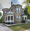 |
||||
| 89 Charlotte Street | 89 Charlotte Street | Brantford | N3T | 43°08′37″N 80°15′40″W / 43.1436°N 80.2612°W | 9068 |  More images |
|||
| 91 North Park Street | 91 North Park Street | Brantford | 43°09′30″N 80°16′09″W / 43.1582°N 80.2691°W | 15696 |  |
||||
| 108-112 George Street | 108 George Street | Brantford | N3T | 43°08′35″N 80°15′46″W / 43.143°N 80.2628°W | 9637 | 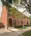 More images |
|||
| 125 Grand River Avenue | 125 Grand River Avenue | Brantford | 43°08′20″N 80°16′17″W / 43.139°N 80.2713°W | 15858 | |||||
| 171 Wellington Street | 171 Wellington Street | Brantford | 43°08′30″N 80°15′25″W / 43.1417°N 80.2569°W | 15848 |  |
||||
| 176 Wellington Street | 176 Wellington Street | Brantford | 43°08′30″N 80°15′23″W / 43.1417°N 80.2565°W | 15683 |  |
||||
| Armoury | 18 Brant Avenue | Brantford | 43°08′20″N 80°16′09″W / 43.1388°N 80.2693°W | 9732 |  More images |
||||
| Bell Homestead National Historic Site of Canada | 94 Tutela Heights Road | Brantford | N3T | 43°06′30″N 80°16′15″W / 43.1082°N 80.2708°W | 12773 |  More images |
|||
| Bell Monument | 41 West Street | Brantford | N3T | 43°08′28″N 80°16′07″W / 43.1412°N 80.2686°W | 10785 |  More images |
|||
| Brant Avenue Heritage Conservation District | Brant Avenue | Brantford | N3T | 43°08′22″N 80°16′11″W / 43.1395°N 80.2698°W | 9746 | 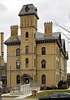 |
|||
| Brant County War Memorial | 6 Dalhousie Street | Brantford | N3S | 43°08′24″N 80°14′38″W / 43.1401°N 80.2438°W | 10020 | 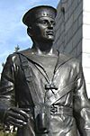 |
|||
| Brantford Waterworks Building | 324 Grand River Avenue | Brantford | N3T | 43°08′25″N 80°17′44″W / 43.1403°N 80.2956°W | 10021 | ||||
| Brethour House | 88 Brant Avenue | Brantford | N3T | 43°08′30″N 80°16′19″W / 43.1418°N 80.272°W | 10022 |  More images |
|||
| Canadian National Railways Station | 5 Wadsworth Street | Brantford | N3T | 43°08′47″N 80°15′57″W / 43.1464°N 80.2657°W | 4515 | 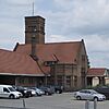 More images |
|||
| Carnegie Library, Brantford | 73 George Street | Brantford | N3T | 43°08′27″N 80°15′45″W / 43.1409°N 80.2625°W | 9885 |  More images |
|||
| Cockshutt Plow Company | 66 Mohawk Street | Brantford | 43°07′47″N 80°14′58″W / 43.1296°N 80.2495°W | 15694 | |||||
| The Crystal Cottage | 35 Chatham Street | Brantford | 43°08′34″N 80°15′54″W / 43.1429°N 80.2649°W | 15812 |  |
||||
| Downs House | 36 William Street | Brantford | 43°08′30″N 80°16′13″W / 43.1418°N 80.2704°W | 15862 |  |
||||
| Federal Building | 60 Dalhousie Street | Brantford | 43°08′21″N 80°15′56″W / 43.1393°N 80.2655°W | 4155 | |||||
| Fred Chalcraft Residence | 48 Palmerston Avenue | Brantford | 43°08′52″N 80°16′44″W / 43.1479°N 80.2789°W | 15864 |  |
||||
| Freeman B. Shaver Residence | 7 Maple Avenue | Brantford | 43°08′49″N 80°16′40″W / 43.147°N 80.2778°W | 15850 |  |
||||
| G. Gordon Caudwell House | 94 Lorne Crescent | Brantford | 43°08′42″N 80°16′30″W / 43.145°N 80.2751°W | 15851 |  |
||||
| Glenhyrst | 20 Ava Road | Brantford | N3T | 43°09′26″N 80°17′14″W / 43.1573°N 80.2872°W | 10024 | ||||
| Greenwood Cemetery | Clarence Street | Brantford | N3T | 43°08′53″N 80°15′38″W / 43.1481°N 80.2605°W | 10025 | ||||
| Her Majesty's / St. Paul's Chapel of the Mohawks National Historic Site of Canada | 301 Mohawk Street | Brantford | N3S | 43°08′00″N 80°15′45″W / 43.1334°N 80.2624°W | 11630 | 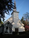 More images |
|||
| Hughes House | 41 Lorne Crescent | Brantford | N3T | 43°08′38″N 80°16′34″W / 43.1438°N 80.2762°W | 15885 | ||||
| J. R. Thompson Residence | 111 Dufferin Avenue | Brantford | 43°08′47″N 80°16′49″W / 43.1465°N 80.2803°W | 15811 | 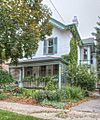 |
||||
| James L. Sutherland Residence | 50 Dufferin Avenue | Brantford | N3T | 43°08′43″N 80°16′36″W / 43.1452°N 80.2768°W | 10026 |  More images |
|||
| Jarvis House | 24 Lorne Crescent | Brantford | N3T | 43°08′37″N 80°16′30″W / 43.1435°N 80.2750°W | 15691 | ||||
| John Maxwell Residence | 81 Albion | Brantford | 43°08′40″N 80°16′17″W / 43.1444°N 80.2713°W | 15698 |  |
||||
| Jubilee Terrace Park | 10 Brant Avenue | Brantford | N3T | 43°06′24″N 80°24′27″W / 43.1068°N 80.4074°W | 10042 |  |
|||
| Lawyer's Hall | 76 Colborne Street | Brantford | N3T | 43°08′18″N 80°16′01″W / 43.1383°N 80.2669°W | 10045 | 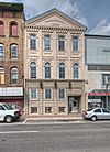 More images |
|||
| Masonic Temple Building | 76 Dalhousie Street | Brantford | N3T | 43°08′22″N 80°15′54″W / 43.1394°N 80.265°W | 10043 |  More images |
|||
| Messiah Church | 35 Wellington Street | Brantford | 43°08′28″N 80°15′57″W / 43.1411°N 80.2659°W | 15852 |  |
||||
| Montessori House of Children | 85 Charlotte | Brantford | 43°08′36″N 80°15′40″W / 43.1434°N 80.2611°W | 15752 |  |
||||
| The Muir House | 30 Lorne Crescent | Brantford | 43°08′38″N 80°16′34″W / 43.1438°N 80.2761°W | 15856 | 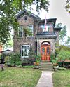 |
||||
| Myrtleville House | 34 Myrtleville Drive | Brantford | N3V | 43°10′26″N 80°17′50″W / 43.1738°N 80.2972°W | 10044 | ||||
| Robert E. Ryerson Residence | 18 Ada Avenue | Brantford | 43°08′56″N 80°16′43″W / 43.1488°N 80.2787°W | 15853 | |||||
| S.R. Drake Memorial Church | 165 Murray Street | Brantford | N3S | 43°08′25″N 80°15′08″W / 43.1403°N 80.2522°W | 10046 | 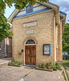 More images |
|||
| St. Jude's Anglican Church National Historic Site of Canada | 81 Peel Street | Brantford | N3S | 43°08′24″N 80°15′12″W / 43.1399°N 80.2534°W | 12563 |  More images |
|||
| Sanderson Centre | 88 Dalhousie Street | Brantford | N3T | 43°08′22″N 80°15′53″W / 43.1395°N 80.2646°W | 10047 | 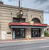 More images |
|||
| Scott House | 7 Egerton Street | Brantford | N3T | 43°08′42″N 80°16′33″W / 43.1451°N 80.2758°W | 10050 | Q112037209 | [[File:{{#property:P18|from=Q112037209 }} |100px]] [[:commons:Category:{{#property:P373|from=Q112037209 }}|More images]] |
||
| Shanahan House | 98 William Street | Brantford | 43°08′41″N 80°16′22″W / 43.1447°N 80.2729°W | 15865 | 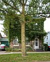 |
||||
| Thorpe Brothers Funeral Home | 96 West Street | Brantford | N3T | 43°08′36″N 80°16′02″W / 43.1433°N 80.2671°W | 10051 |  More images |
|||
| Victoria Park Square | 65 Market Street | Brantford | N3S | 43°08′06″N 80°15′47″W / 43.1349°N 80.263°W | 10052 | 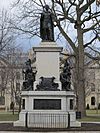 More images |
|||
| Victoria Park Square Heritage Conservation District | Downtown | Brantford | N3S | 43°08′05″N 80°15′47″W / 43.1348°N 80.263°W | 9899 |  |
|||
| Walter R. Turnbull Residence | 38 Dufferin Avenue | Brantford | 43°08′42″N 80°16′34″W / 43.145°N 80.2762°W | 15845 | 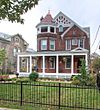 |
||||
| Chiefswood National Historic Site of Canada | 1037 Highway 54 | Six Nations of the Grand River | N0A | 43°06′04″N 80°05′40″W / 43.1011°N 80.0945°W | 7407 | 8297 |  More images |
See also

All content from Kiddle encyclopedia articles (including the article images and facts) can be freely used under Attribution-ShareAlike license, unless stated otherwise. Cite this article:
List of historic places in County of Brant Facts for Kids. Kiddle Encyclopedia.
