List of historic landmarks in Albuquerque, New Mexico facts for kids
This is a list of historic landmarks in Albuquerque, New Mexico, as designated by the City Council. To date 24 individual properties (two of which are no longer standing) have been so designated. Historic landmarks may not be demolished or significantly altered without approval from the Landmarks and Urban Conservation Commission.
There are entire neighborhoods that fall under historic landmark classifications, for a more comprehensive list of their historic landmarks see their respective pages: Barelas, Old Town Albuquerque, Nob Hill, and Los Ranchos de Albuquerque. Also take note of historic parts of the broader Albuquerque metropolitan area, including Belen, Bosque Farms, Corrales, Cuba, Isleta Village Proper, Los Lunas, Peralta, and Rio Rancho.
Historic landmarks
Properties are also listed on the National Register of Historic Places (NR) or New Mexico State Register of Cultural Properties (SR) as noted.
| Name | Image | Location | Notes |
|---|---|---|---|
| AT&SF Locomotive 2926 |  |
1600 12th St. NW 35°6′11″N 106°39′15″W / 35.10306°N 106.65417°W |
SR 1975 NR 2007 |
| AT&SF Memorial Hospital |  |
806 Central Ave. SE 35°4′57″N 106°38′17″W / 35.08250°N 106.63806°W |
Contributing property in Huning Highlands Historic District |
| AT&SF Railway Fire Station |  |
1st and 2nd SW 35°4′36″N 106°39′01″W / 35.07667°N 106.65028°W |
SR 2014 NR 2014 |
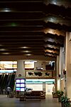
| Albuquerque International Sunport - North Façade and Great Hall |  |
2200 Sunport Blvd. SE 35°2′57″N 106°37′0″W / 35.04917°N 106.61667°W |
|
| Bataan Memorial Park | Upload image | 3401 Lomas Blvd. NE 35°5′18″N 106°36′21″W / 35.08833°N 106.60583°W |
SR 1999 |
| De Anza Motor Lodge |  |
4301 Central Ave. NE 35°4′46″N 106°35′45″W / 35.07944°N 106.59583°W |
SR 2003 NR 2004 |
| El Vado Auto Court | 2500 Central Ave. SW 35°5′39″N 106°40′36″W / 35.09417°N 106.67667°W |
SR 1993 NR 1993 |
|
| Heights Community Center |  |
823 Buena Vista Dr. SE 35°4′24″N 106°37′28″W / 35.07333°N 106.62444°W |
NR 2021 |
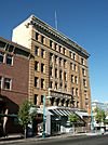
| Highland/Hudson Hotel |  |
202 Central Ave. SE 35°5′1″N 106°38′44″W / 35.08361°N 106.64556°W |
Contributing property in Huning Highlands Historic District |
| Jones Motor Company |  |
3222 Central Ave. SE 35°4′38″N 106°37′9″W / 35.07722°N 106.61917°W |
SR 1993 NR 1993 |
| KiMo Theater |  |
423 Central Ave. NW 35°5′6″N 106°39′7″W / 35.08500°N 106.65194°W |
SR 1976 NR 1977 |
| Las Mañanitas | Upload image | 1800 Rio Grande Blvd. NW 35°6′38″N 106°40′21″W / 35.11056°N 106.67250°W |
|
| Main Library |  |
501 Copper Ave. NW 35°5′9″N 106°39′12″W / 35.08583°N 106.65333°W |
SR 2018 NR 2019 |
| Occidental Life Building |  |
119 3rd St. SW 35°5′1″N 106°39′1″W / 35.08361°N 106.65028°W |
SR 1973 NR 1978 |
| Old Airport Terminal |  |
2920 Yale Blvd. SE 35°2′52″N 106°37′14″W / 35.04778°N 106.62056°W |
SR 1976 NR 1989 |
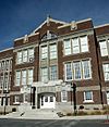
| Old Albuquerque High School |  |
Central and Broadway NE 35°5′3″N 106°38′38″W / 35.08417°N 106.64389°W |
SR 1977 Contributing property in Huning Highlands Historic District |
| Old Hilton Hotel |  |
125 2nd St. NW 35°5′6″N 106°38′56″W / 35.08500°N 106.64889°W |
SR 1983 NR 1984 |
| Old Main Library |  |
423 Central Ave. NE 35°5′2″N 106°38′33″W / 35.08389°N 106.64250°W |
SR 1975 Contributing property in Huning Highlands Historic District |
| Ernie Pyle House |  |
900 Girard Blvd. SE 35°4′13″N 106°36′45″W / 35.07028°N 106.61250°W |
SR 1997 NR 1997 |
| Roosevelt Park |  |
Coal and Spruce SE 35°4′35″N 106°37′49″W / 35.07639°N 106.63028°W |
SR 1996 NR 1996 |
| Rosenwald Building |  |
320 Central Ave. SW 35°5′3″N 106°39′3″W / 35.08417°N 106.65083°W |
SR 1978 NR 1978 |
| Skinner Building |  |
722 Central Ave. SW 35°5′6″N 106°39′20″W / 35.08500°N 106.65556°W |
SR 1980 NR 1980 |
| Sunshine Building |  |
120 Central Ave. SW 35°5′2″N 106°38′57″W / 35.08389°N 106.64917°W |
SR 1985 |
| Whittlesey House |  |
201 Highland Park Cir. SE 35°4′54″N 106°38′21″W / 35.08167°N 106.63917°W |
SR 1975 Contributing property in Huning Highlands Historic District |
Former landmarks
| Name | Image | Location | Notes |
|---|---|---|---|
| Anson Flats | Upload image | 816-894 5th St. NW 35°5′35″N 106°39′4″W / 35.09306°N 106.65111°W |
Burned in 1996 |
| AT&SF Railway Passenger Depot |  |
314 1st St. SW 35°4′56″N 106°38′52″W / 35.08222°N 106.64778°W |
Burned in 1993 |
| Werner–Gilchrist House |  |
314 1st St. SW 35°4′44″N 106°37′9″W / 35.07889°N 106.61917°W |
Demolished in 2011 |
See also

