Lingewaal facts for kids
Quick facts for kids
Lingewaal
|
|||
|---|---|---|---|

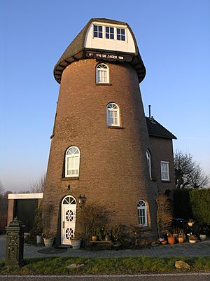
Former windmill in Herwijnen
|
|||
|
|||

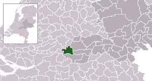
Location in Gelderland
|
|||
| Country | Netherlands | ||
| Province | Gelderland | ||
| Municipality | West Betuwe | ||
| Established | 1 January 1986 | ||
| Merged | 2019 | ||
| Area | |||
| • Total | 54.49 km2 (21.04 sq mi) | ||
| • Land | 50.44 km2 (19.47 sq mi) | ||
| • Water | 4.05 km2 (1.56 sq mi) | ||
| Elevation | 2 m (7 ft) | ||
| Population
(May 2014)
|
|||
| • Total | 11,033 | ||
| • Density | 219/km2 (570/sq mi) | ||
| Time zone | UTC+1 (CET) | ||
| • Summer (DST) | UTC+2 (CEST) | ||
| Postcode |
Parts of 4100 and 4200 ranges
|
||
| Area code | 0183, 0345, 0418 | ||
Lingewaal (Dutch pronunciation: [ˌlɪŋəˈʋaːl]) is a former municipality in the province of Gelderland in the Netherlands.
On 1 January 2019, the municipality merged with Geldermalsen and Neerijnen to form the new municipality of West Betuwe.
History
The municipality was formed in 1986 from the former municipalities of Asperen, Heukelum, Herwijnen, Spijk and Vuren, with the exception of Dalem, which was included in the municipality of Gorinchem. Immediately after the merger, the municipality was briefly called Vuren, after the village of the same name. On January 1, 2019, the municipality of Lingewaal merged with Neerijnen and Geldermalsen into the merged municipality of West Betuwe.
Population centres
- Asperen
- Herwijnen
- Heukelum
- Spijk
- Vuren
Topography
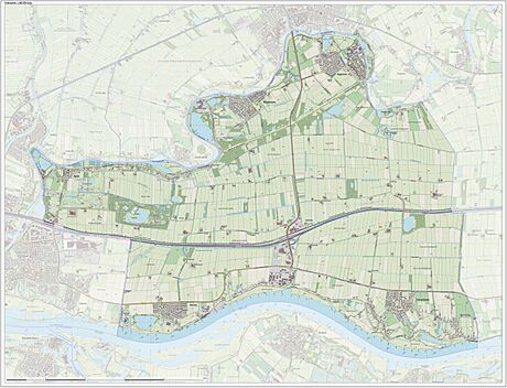
Dutch topographic map of the municipality of Lingewaal, June 2015

All content from Kiddle encyclopedia articles (including the article images and facts) can be freely used under Attribution-ShareAlike license, unless stated otherwise. Cite this article:
Lingewaal Facts for Kids. Kiddle Encyclopedia.


