Limmen National Park facts for kids
Quick facts for kids Limmen National ParkNorthern Territory |
|
|---|---|
|
IUCN Category II (National Park)
|
|

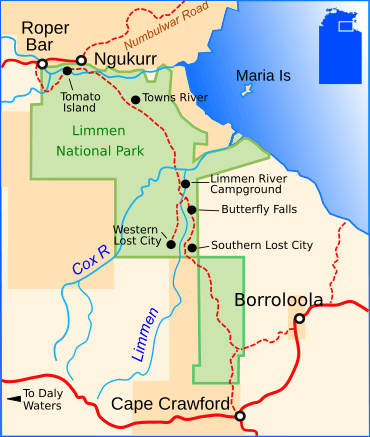
Limmen National Park map
|
|
| Nearest town or city | Katherine |
| Established | 26 June 2012 |
| Area | 9,369.26 km2 (3,617.5 sq mi) |
| Managing authorities | Parks and Wildlife Commission of the Northern Territory |
| Website | Limmen National Park |
| See also | Protected areas of the Northern Territory |
Limmen National Park, announced in 2012, is the third largest national park in the Northern Territory, after Judbarra / Gregory National Park, with an area of approximately 9,369 square kilometres (3,617 sq mi). Located about 600 km south-east of Darwin on the Gulf of Carpentaria, the park incorporates wetlands, sandstone structures and numerous rivers, including the Limmen Bight River from which the park takes its name.
Heritage and attractions
A major attraction in the park are the "Lost Cities"—sandstone rock formations resembling tall apartment blocks.
Rock art
Miniature rock art of the stencilled variety at a rock shelter known as Yilbilinji, in Limmen National Park, is one of only three known examples of such art. Usually stencilled art is life-size, using body parts as the stencil, but the 17 images of designs of human figures, boomerangs, animals such as crabs and long-necked turtles, wavy lines and geometric shapes are very rare. Found in 2017 by archaeologists, the only other recorded examples are at Nielson's Creek in New South Wales and at Kisar Island in Indonesia. It is thought that the designs may have been created by stencils fashioned out of beeswax.

