Lime Peak (Arizona) facts for kids
Quick facts for kids Lime Peak |
|
|---|---|

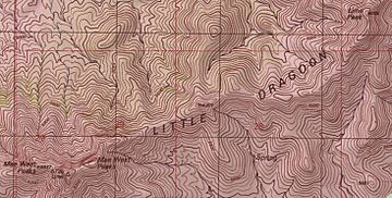
Topographic map of the ridge of the Little Dragoon Mountains with Lime Peak in the upper right corner.
|
|
| Highest point | |
| Elevation | 6,658 ft (2,029 m) NAVD 88 |
| Prominence | 695 ft (212 m) |
| Geography | |
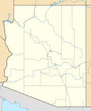
| Location | Cochise County, Arizona, U.S. |
| Parent range | Little Dragoon Mountains |
| Topo map | USGS Dragoon |
Lime Peak is a summit in Cochise County, Arizona, north of Interstate 10 between Benson and Willcox and 6.6 miles (11 km) northwest of Dragoon, Arizona. It is one of three named peak in the Little Dragoon Mountains. Two of the peaks are named the Mae West Peaks since there appearance was thought to be reminiscent of the figure of the actress Mae West.
In 1935 the Coast And Geodetic Survey referred to the tallest of the Mae West peaks as Lime. In 1984 the U.S. Board on Geographic Names officially assigned the name Lime Peak to its current location. It had also been known as Johnson Peak.

All content from Kiddle encyclopedia articles (including the article images and facts) can be freely used under Attribution-ShareAlike license, unless stated otherwise. Cite this article:
Lime Peak (Arizona) Facts for Kids. Kiddle Encyclopedia.

