Levers Water facts for kids
Quick facts for kids Levers Water |
|
|---|---|
 |
|
| Location | Lake District |
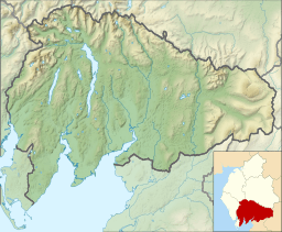
| Coordinates | 54°23′02″N 3°06′40″W / 54.384°N 3.111°W |
| Primary inflows | Swirl Hawse Beck, Cove Beck |
| Primary outflows | Levers Water Beck |
| Basin countries | United Kingdom |
| Surface area | 14 hectares (35 acres) |
| Average depth | 7.9 m (26 ft) |
| Water volume | 1,071,870 m3 (37,853,000 cu ft) |
| Surface elevation | 413 metres (1,355 ft) |
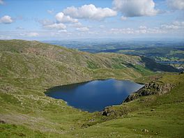
Levers Water is a small lake in the English Lake District. It is located at the head of the Coppermines Valley, above Coniston village. To its south-west is Raven Tor, a spur of Brim Fell, and to its north-west are Little How Crags and Great How Crags, on the eastern side of the north–south ridge leading to Swirl How.
A dam built in 1717 enlarged the existing tarn to provide water for the mines and for the village below.
A public footpath on its north-east side connects the Coppermines Valley to Swirl Hawse, while to its south-west, a path leads up Gill Cove to Levers Hawse on the main ridge of the Coniston Fells.

All content from Kiddle encyclopedia articles (including the article images and facts) can be freely used under Attribution-ShareAlike license, unless stated otherwise. Cite this article:
Levers Water Facts for Kids. Kiddle Encyclopedia.


