Leeuwarderadeel facts for kids
Quick facts for kids
Leeuwarderadeel
Ljouwerteradiel
|
|||
|---|---|---|---|

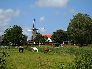
Wind mill in Leeuwarderadeel
|
|||
|
|||

Location in Friesland
|
|||
| Country | Netherlands | ||
| Province | Friesland | ||
| Merged | 2018 | ||
| Area | |||
| • Total | 41.46 km2 (16.01 sq mi) | ||
| • Land | 40.91 km2 (15.80 sq mi) | ||
| • Water | 0.55 km2 (0.21 sq mi) | ||
| Elevation | 1 m (3 ft) | ||
| Highest elevation | 1.7 m (5.6 ft) | ||
| Lowest elevation | 0.6 m (2.0 ft) | ||
| Population
(May 2014)
|
|||
| • Total | 10,264 | ||
| • Density | 251/km2 (650/sq mi) | ||
| Time zone | UTC+1 (CET) | ||
| • Summer (DST) | UTC+2 (CEST) | ||
| Postcode |
9050–9057 9071–9072
|
||
| Area code | 0518, 058 | ||
Leeuwarderadeel (Dutch: [leːuˈɑrdəraːˌdeːl]; West Frisian: Ljouwerteradiel [ˈljɔu(ə)təraˌdiəl]) is a former municipality in the northern Netherlands. Its capital was Stiens.
History
On 1 January 2018 it merged with the municipality of Leeuwarden.
Population centres
- Bartlehiem
- Britsum
- Cornjum
- Finkum
- Hijum
- Jelsum
- Oude Leije
- Stiens
Topography
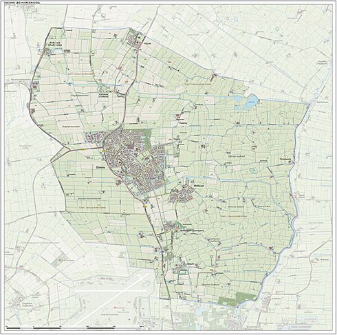
Dutch Topographic map of the municipality of Leeuwarderadeel, June 2015.
Bartlehiem
The hamlet of Bartlehiem is partially in Leeuwarderadeel partially in Ferwerderadiel and partially in Tytsjerksteradiel.
See also
 In Spanish: Leeuwarderadeel para niños

All content from Kiddle encyclopedia articles (including the article images and facts) can be freely used under Attribution-ShareAlike license, unless stated otherwise. Cite this article:
Leeuwarderadeel Facts for Kids. Kiddle Encyclopedia.


