Layton, Blackpool facts for kids
Quick facts for kids Layton |
|
|---|---|
 Westcliffe Drive, Layton |
|
| Population | 6,845 (2011 census) |
| Unitary authority |
|
| Ceremonial county | |
| Region | |
| Country | England |
| Sovereign state | United Kingdom |
| Post town | BLACKPOOL |
| Postcode district | FY3 |
| Dialling code | 01253 |
| Police | Lancashire |
| Fire | Lancashire |
| Ambulance | North West |
| EU Parliament | North West England |
| UK Parliament |
|
Layton is a suburb of Blackpool in the Borough of Blackpool in Lancashire, England. The ward population at the 2011 census was 6,845.
Contents
Geography
Located roughly in Blackpool's geographical centre (although some distance from the coastal business district), Layton accounts for a relatively large part of the town's total area. Layton is bounded by the districts of Bispham (to the north), Whitegate (to the west), Grange Park (to the east) and Marton (to the south). Most of the land in this area is flat, apart from a single hill in the northeast corner.
History
Layton with Warbreck was historically one of two townships in the parish of Bispham. The township included the nascent town of Blackpool within its boundaries, and in 1851 the township was made a Local Board of Health District. From 1866 the township also became a civil parish. The local board was renamed Blackpool in 1868 and the district was made a municipal borough in 1876. The name of the civil parish remained Layton with Warbreck until 1894 when it was renamed Blackpool.
Facilities
The north of Layton has one of Blackpool's main concentrations of shops and other businesses outside the town centre. In this area, there is also a library and several churches and public houses. Layton also has several small parks and a number of bowling greens. The main fire station for Blackpool is at the south of the district. Layton also has a large park, Kingscote Park which is the second largest park in Blackpool, and the largest park within Layton itself. Layton Cemetery is the largest in the area. Established during the town's Victorian expansion, it has a small Judaic burial area.
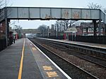
Layton railway station (formerly Bispham railway station) in Bispham Road is on the line to Blackpool North.
Education
Five schools are located within the district:
- St Mary's Catholic Academy
- Blackpool Aspire Academy
- Layton Primary School
- Devonshire Primary Academy, which has been rebuilt after the original building was destroyed by a fire.
- Christ the King RC primary school


