Lares, Puerto Rico facts for kids
Quick facts for kids
Lares
Municipio Autónomo de Lares
|
|||
|---|---|---|---|
|
Town and Municipality
|
|||
|
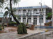
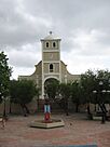
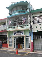
From top, left to right: Lares city hall in downtown Lares; Parroquia del Glorioso Patriarca San José (Parish of the Glorious Patriarch Saint Joseph); Plaza de la Revolución (Revolution Square); Hacienda Lealtad (Loyalty Plantation); and Panoramic mountainous views from barrios Mirasol and Piletas
|
|||
|
|||
| Nicknames:
Ciudad del Grito (The Town of The Cry), Altar de la Patria (High of the Fatherland), La Capital de la Montaña (Capital of the Mountains)
|
|||
| Anthem: "En las verdes montañas de Lares" (In the green mountains of Lares) | |||

Map of Puerto Rico highlighting Lares Municipality
|
|||
| Sovereign state | |||
| Commonwealth | |||
| Settled | 1824 | ||
| Founded | April 26, 1831 | ||
| Founded by | Juan Francisco de Soto | ||
| Barrios | |||
| Area | |||
| • Total | 61.64 sq mi (159.6 km2) | ||
| • Land | 61.45 sq mi (159.2 km2) | ||
| • Water | .09 sq mi (0.2 km2) | ||
| Population
(2020)
|
|||
| • Total | 28,105 | ||
| • Rank | 45th in Puerto Rico | ||
| • Density | 455.95/sq mi (176.045/km2) | ||
| Demonym(s) | Lareños | ||
| Time zone | UTC−4 (AST) | ||
| ZIP Codes |
00669, 00631
|
||
| Area code(s) | 787/939 | ||
| Major routes | |||
Lares (Spanish pronunciation: [ˈlaɾes], locally [ˈlaɾeʔ]) is a mountain town and municipality of Puerto Rico's central-western area. Lares is located north of Maricao and Yauco; south of Camuy, east of San Sebastián and Las Marias; and west of Hatillo, Utuado and Adjuntas. Lares is spread over 10 barrios and Lares Pueblo (Downtown Lares). It is part of the Aguadilla-Isabela-San Sebastián Metropolitan Statistical Area.
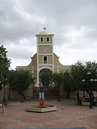
A city adorned with Spanish-era colonial-style churches and small downtown stores, Lares is located on a mountainous, breezy area that is about 1.5 hours from the capital San Juan by car.
In 1868, Lares was the site of the Grito de Lares (literally, The Cry of Lares, or Lares Revolt), an uprising brought on by pro-independence rebels members of the Revolutionary Committee of Puerto Rico striving for Puerto Rican independence from Spain. Even though it was short-lived, it remains an iconic historical event in the history of the island. The flag of the revolt, known as the Bandera del Grito de Lares (Grito de Lares flag), is the official flag of Lares.
Contents
History
Lares was founded on April 26, 1827 by Francisco de Sotomayor and Pedro Vélez Borrero. The city was named after one of its settlers, Don Amador de Lariz, a Spanish nobleman.
Lares was one of the last municipalities to be established in Puerto Rico, receiving its charter from the then governor and captain-general of the Province of Puerto Rico, Don Miguel de la Torre, on October 6, 1831. The lengthy process was begun in 1824 and was led by Don Juan Francisco de Soto Mayor. However late its official foundation, Lares had its beginnings as el Hato de Lariz in the early 16th century. The Spanish word hato means pasture or cattle ranch. This particular hato owes its name to Don Amador de Lariz a Spanish nobleman and colonizer. In 1525, the Spanish Crown granted him an encomienda (a tract of land) that more or less occupies present day Lares, along with one hundred and fifty Tainos to work the property. The name Lariz is of ancient Basque origin and as far as is known, Don Amador de Lariz left no descendents and his name has disappeared from Puerto Rican genealogy. Over the centuries the Basque name was transformed into a Spanish one but interestingly enough, the Jibaros, or mountain-folk of the region, pronounce it LAH-reh to this day.
Prior to becoming a municipality in its own right, Lares was a barrio or ward of the town of San Sebastian del Pepino. The principal reason for Lares' foundation was the long and arduous travel that families residing there encountered in going to San Sebastian to attend mass and to conduct their secular business affairs. According to Spanish law, any barrio that was at least three leagues distant (a league is roughly equivalent to three miles) from the nearest church and, had a least 10 vecinos (citizens who were the head of their household) could petition the central government to allow it to become a municipality, provided, there were no objections from their present municipal government and, other adjacent ones. In any event, over the course of seven years the founders of Lares overcame various difficulties and the municipality of Lares came into being.
Geography
Lares is a mountainous municipality located in the central western part of the island of Puerto Rico. According to the 2010 U.S. Census Bureau, the municipality has a total area of 61.64 square miles (159.6 km2), of which 61.45 square miles (159.2 km2) is land and .09 square miles (0.23 km2) is water.
Caves
There are 10 caves in Lares. Cueva Machos and Cueva Pajita are located in Callejones barrio.
Barrios
Like all municipalities of Puerto Rico, Lares is divided into barrios. The municipal buildings, central square and large Catholic church are located near the center of the municipality, in a barrio referred to as "el pueblo".
Sectors
Barrios (which are, in contemporary times, roughly comparable to minor civil divisions) are further subdivided into smaller areas called sectores ( sectors in English). The types of sectores may vary, from normally sector to urbanización to reparto to barriada to residencial, among others.
Special Communities
Comunidades Especiales de Puerto Rico (Special Communities of Puerto Rico) are marginalized communities whose citizens are experiencing a certain amount of social exclusion. A map shows these communities occur in nearly every municipality of the commonwealth. Of the 742 places that were on the list in 2014, the following barrios, communities, sectors, or neighborhoods were in Lares: Castañer, Cerro Avispa, Comunidad Anón, Comunidad Arizona, Comunidad El Bajadero, Comunidad Peligro, Comunidad San Felipe, and Seburuquillo.
Tourism
Landmarks and places of interest
- Callejones Site — NRHP listed
- Downtown Castañer and its former city hall
- Hacienda Collazo
- Hacienda El Porvenir
- Hacienda Lealtad
- Hacienda Los Torres — NRHP listed
- Heladería de Lares — ice cream parlor
- Mirador Mariana Bracetti
- Parque El Jíbaro
Festivals and events
Lares celebrates its patron saint festival in December. The Fiestas Patronales de San Jose is a religious and cultural celebration that generally features parades, games, artisans, amusement rides, regional food, and live entertainment. The festival has featured live performances by well-known artists such as Sie7e, and Ednita Nazario.
Other festivals and events celebrated in Lares include:
- Banana Festival – June
- Lares Festival – September
- Rábano Estate Festival – October
- Almojábana Festival – October
Sports
Lares has a professional volleyball team called Patriotas de Lares (Lares Patriots) that have international players including: Brock Ullrich, Gregory Berrios, Ramon "Monchito" Hernandez, and Ariel Rodriguez. The Patriotas won 3 championships, in 1981, 1983 and 2002. In 1981 and 1983 they beat Corozal in the finals and in 2002 they beat Naranjito. Some of the local players were David Vera 1979, Rigoberto Guiyoti 1979, Modesto 1980, Luis Vera 1980, Carlos Vera 1980.
Economy
Lares' economy is primarily agricultural. Harvested products include bananas, coffee, oranges, and tomatoes.
Tourism also plays a significant role in the municipality's economy. The Heladeria de Lares (Lares Ice Cream Shop) is well known around Puerto Rico for its unorthodox selection of ice cream including; rice and beans-flavored ice cream.
There was a large population exodus, out of Lares, after September 20, 2017, when Hurricane Maria struck the island.
In 2016, Rural Opportunities Puerto Rico Inc. (ROPRI) in conjunction with the United States Department of Agriculture (USDA) completed the building of 24 (one-bedroom, two-bedroom and three-bedroom) units in Lares, specifically for farmers (in Spanish: agricultores), and their families, to live and work. It is called Alturas de Castañer (Castañer Heights) and there the families work to grow coffee, bananas and other crops which are sold to markets, and restaurants nearby.
Demographics
| Historical population | |||
|---|---|---|---|
| Census | Pop. | %± | |
| 1900 | 20,883 | — | |
| 1910 | 22,650 | 8.5% | |
| 1920 | 25,197 | 11.2% | |
| 1930 | 27,351 | 8.5% | |
| 1940 | 29,914 | 9.4% | |
| 1950 | 29,951 | 0.1% | |
| 1960 | 26,922 | −10.1% | |
| 1970 | 25,263 | −6.2% | |
| 1980 | 26,743 | 5.9% | |
| 1990 | 29,015 | 8.5% | |
| 2000 | 34,415 | 18.6% | |
| 2010 | 30,753 | −10.6% | |
| 2020 | 28,105 | −8.6% | |
| U.S. Decennial Census 1899 (shown as 1900) 1910-1930 1930-1950 1960-2000 2010 2020 |
|||
Like most of Puerto Rico, Lares population originated with the Taino Indians and then many immigrants from Spain settled the central highland, most prominently the Andalusian, Canarian and Extremaduran Spanish migration who formed the bulk of the Jibaro or white peasant stock of the island. The Andalusian, Canarian and Extremaduran Spaniards also influenced much of the Puerto Rican culture which explains the use of Spanish and the Spanish architecture that can be found in the city.
Education
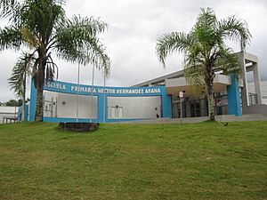
The Héctor Hernández Arana Primary school is located in Lares.
Symbols
The municipio has an official flag and coat of arms.
Flag
The origins of the municipality's flag can be traced back to the days of the failed 1868 revolt against Spanish rule known as the Grito de Lares. The flag is derived from the Dominican Republic flag of 1844-49 (reflecting the rebel leaders' dream to eventually join with the Dominican Republic and Cuba into one nation) and was knitted by Mariana Bracetti, a revolutionary leader, at the behest of Dr. Ramón Emeterio Betances, the revolt's leader, who designed it. This flag is formed by a white Latin cross in the center. The width of the arms and base are equal to a third part of the latitude of the emblem. It has two quadrilaterals located above and two below the arms of the cross. The superior (top) ones are blue and the inferior (bottom) ones red. A five-point white star is located in the center of the left superior (top) quadrilateral.
Coat of Arms
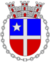
A white cross is centered on and extends across the shield from side to side and top to bottom; it has blue top quadrants and red bottom quadrants; it has a five pointed white star in the upper left quadrant. A chain surrounds the shield. The Coat of Arms as described has positioned around it on a scroll and a ribbon in a semicircle the words: "Lares Ciudad del Grito." This constitutes the stamp of Lares and identifies unmistakably the municipality of Lares.
Transportation
Puerto Rico State Route 111 provides access to Lares.
Lares has 15 bridges.
Notable Lareños
- Singer, composer and Virtuoso Guitarist Jose Feliciano who wrote and sang the Feliz Navidad Song, was born in Lares on September 8, 1945
- Lolita Lebrón was a Puerto Rican nationalist who was convicted of attempted murder and other crimes in 1954 and freed from prison in 1979 after being granted clemency by President Jimmy Carter.
- Denise Quiñones - Miss Universe 2001
- Luis Hernández Aquino
- Odilio González (born March 5, 1937), known by his stage name El Jibarito de Lares, is a Puerto Rican singer, guitarist and music composer who has been singing and composing for more than 65 years.
Gallery
See also
 In Spanish: Lares (Puerto Rico) para niños


