Lake Thunderbird facts for kids
Quick facts for kids Lake Thunderbird |
|
|---|---|

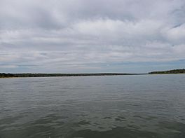
Lake Thunderbird from the water surface.
|
|
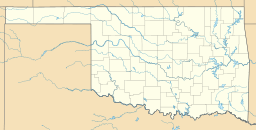
| Location | Norman, Oklahoma |
| Coordinates | 35°13′15″N 97°13′05″W / 35.220833°N 97.218056°W |
| Type | reservoir |
| Primary inflows | Little River |
| Primary outflows | Little River |
| Basin countries | United States |
| Surface area | 5,349 acres (8.358 sq mi; 21.65 km2) |
| Surface elevation | 1,039 ft (317 m) |
Lake Thunderbird is a reservoir located in Norman, Oklahoma. The lake was constructed between 1962 and 1965 for the purpose of providing municipal water to the nearby communities of Del City, Midwest City and Norman. It is formed by an earthfill embankment (dam) 7,300 feet (2,200 m) long and up to 144 feet (44 m) high on the Little River. In addition to being a source for drinking water, Lake Thunderbird's secondary uses include numerous recreational activities.
The lake is named for the Native American legend of the Thunderbird, a supernatural bird of power and strength. Many locals commonly refer to the lake as "Lake Dirtybird" due to the very murky lake water.
Norman Dam
The Little River valley was the subject of several Army United States Army Corps of Engineers studies in 1936 and 1947 for flood control. In 1953 the issue of water supply was raised among a council of local governments consisting of Norman, Midwest City, Del City, Moore and Tinker Air Force Base, and it was forecast that by the 1970s and 1980s the cities would be requiring all available water to meet municipal demand. A feasibility study in 1954 led to a plan report in May 1961, and construction began on Norman Dam in 1962.
Oklahoma State Highway 9 was re-routed in 1963 from present-day Alameda Street to its current location, south of the lake. The dam and lake were completed in 1965 by the United States Bureau of Reclamation. The earthen dam has a height of 144 feet and impounds 171,400 acre-feet of water. The Bureau owns the dam, which is operated by the local Central Oklahoma Master Conservancy District.
Recreation
Lake Thunderbird is a venue for boating, fishing, and hiking. The lake has two marinas and a boathouse that are operated and maintained by the Lake Thunderbird Boathouse volunteer organization. The Boathouse Organization in cooperation with the Lake Thunderbird Education Foundation make possible several events throughout the year, including sailing lessons, sailing camps for children, an annual fishing derby for developmentally disabled children, sanctioned sailboat races, and fun regattas. Fish species stocked at the lake include large-mouth bass, crappie, sunfish, channel catfish, white bass, and saugeye.
Lake Thunderbird State Park
The 6,000 acre (24 km²) lake is the centerpiece of Lake Thunderbird State Park. In addition to water activities the park offers hunting, horse rental and boarding, equestrian trails, hiking, mountain biking, nature trails, a nature center, and an archery range. The park has 447 primitive campsites and unfurnished one-room lake huts as well as RV provisions. The park is near two casinos and has its own restaurant, the Clear Bay Cafe, which is open seasonally and is accessible by boat or car. During the late spring rains in 2015 during the months of May and June, Lake Thunderbird flooded and the restaurant was so badly damaged that it closed indefinitely. On May 10, 2010 the Little River Marina was struck by a tornado and was closed until it was rebuilt in 2012.
Eagle watching
Lake Thunderbird falls within the bald eagle winter migration corridor. Bald eagles are present at the lake roughly from December through February. Guided eagle tours are provided by the Crow's Secret Nature Center.
Reservoir details
The water temperature of the lake ranges from about 86 °F (30 °C) during the summer months to under 40 °F (4 °C) during the winter months. In the summer, at a depth of 30 feet (9.1 m), the water temperature is about 10 °F (5.6 °C) cooler than at the surface. Surface water temperature is usually about 60 °F (16 °C) during spring and fall months.
As of 2001, the lakes' standard surface level was at 1,039 ft (317 m) above sea level, the maximum depth of the lake was 58 ft (18 m), with an average depth of 15.4 ft (4.7 m). The top of the Lake Thunderbird Dam was (and is) 1,071 ft (326 m) above sea level, 32 ft (9.8 m) above the standard level of the lake. The lakes' surface area was 5,349 acres (21.65 km2). The volume of the reservoir (at this standard depth) was 105,838 acre-feet (130,549,000 m3). The total watershed area feeding the lake is 163,840 acres (663.0 km2). The rate at which sediment was accumulating in the lake is 393 acre-feet (485,000 m3) a year. The reservoir had lost a total of 13,762 acre-feet (16,975,000 m3) of capacity since its completion in 1965. The shoreline length was 60 miles (97 km). The capacity of the reservoir, the maximum depth, and the average depth had all decreased since 1965. The following table gives original statistics for the reservoir from 1965.
| Full Reservoir Capacity | Standard Capacity | Minimum Capacity |
|---|---|---|
| 196,260 acre-feet (242,080,000 m3) | 119,600 acre-feet (147,500,000 m3) | 13,640 acre-feet (16,820,000 m3) |
| Maximum depth 68 feet (21 m) | Maximum depth 58 feet (18 m) | Maximum depth 29 feet (8.8 m) |
| Surface elevation 1,049 feet (320 m) above sea level | Surface elevation 1,039 feet (317 m) above sea level | Surface elevation 1,010 feet (310 m) above sea level |


