La Pryor, Texas facts for kids
Quick facts for kids
La Pryor, Texas
|
|
|---|---|

Zavala County Bank in La Pryor, Texas
|
|

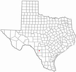
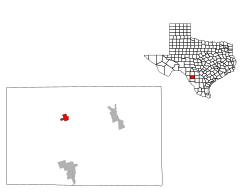
Location of La Pryor, Texas
|
|
 |
|
| Country | United States |
| State | Texas |
| County | Zavala |
| Area | |
| • Total | 2.7 sq mi (6.9 km2) |
| • Land | 2.7 sq mi (6.9 km2) |
| • Water | 0.0 sq mi (0.0 km2) |
| Elevation | 745 ft (227 m) |
| Population
(2020)
|
|
| • Total | 1,294 |
| • Density | 479/sq mi (187.5/km2) |
| Time zone | UTC-6 (Central (CST)) |
| • Summer (DST) | UTC-5 (CDT) |
| ZIP code |
78872
|
| Area code(s) | 830 |
| FIPS code | 48-41452 |
| GNIS feature ID | 1360810 |
La Pryor (/lə ˈpraɪ.ər/ LƏ-_-PRY-ər) is a census-designated place (CDP) in Zavala County, Texas, United States. Its population was 1,294 at the 2020 census.
The town is named for Col. Isaac (Ike) T. Pryor, who in the 1880s owned a ranch that included the site of the community.
The Nueces River crosses U.S. Highway 83 north of La Pryor.
The community has within its limits branches of the Texas Department of Transportation and the Zavala County Bank.
Contents
Geography
La Pryor is located at 28°56′38″N 99°50′40″W / 28.94389°N 99.84444°W (28.943879, -99.844349).
According to the United States Census Bureau, the CDP has a total area of 2.7 square miles (6.9 km2), all land.
Demographics
| Historical population | |||
|---|---|---|---|
| Census | Pop. | %± | |
| 2000 | 1,491 | — | |
| 2010 | 1,643 | 10.2% | |
| 2020 | 1,294 | −21.2% | |
| U.S. Decennial Census 1850–1900 1910 1920 1930 1940 1950 1960 1970 1980 1990 2000 2010 |
|||
2020 census
| Race | Number | Percentage |
|---|---|---|
| White (NH) | 92 | 7.11% |
| Black or African American (NH) | 9 | 0.7% |
| Native American or Alaska Native (NH) | 2 | 0.15% |
| Asian (NH) | 2 | 0.15% |
| Mixed/Multi-Racial (NH) | 3 | 0.23% |
| Hispanic or Latino | 1,186 | 91.65% |
| Total | 1,294 |
As of the 2020 United States census, there were 1,294 people, 365 households, and 286 families residing in the CDP.
Education
La Pryor is served by the La Pryor Independent School District.
See also
 In Spanish: La Pryor para niños


