Längenfeld facts for kids
Quick facts for kids
Längenfeld
|
||
|---|---|---|
 |
||
|
||

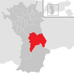
Location in the district
|
||
| Country | Austria | |
| State | Tyrol | |
| District | Imst | |
| Area | ||
| • Total | 195.84 km2 (75.61 sq mi) | |
| Elevation | 1,179 m (3,868 ft) | |
| Time zone | UTC+1 (CET) | |
| • Summer (DST) | UTC+2 (CEST) | |
| Postal code |
6444
|
|
| Area code | 05253 | |
| Vehicle registration | IM | |
| Website | www.laengenfeld.tirol.gv.at | |
Längenfeld is a municipality and a village in the Imst District, Tyrol, Austria. It is located 25 km southeast of Imst in the Ötztal valley, 14 km north of Sölden.
With an area size of 195.8 km2, 21 village parts and 4333 inhabitants it is the biggest location in the valley. Sights are the late Gothic-baroque church which was built in 1303. The main source of income is tourism.
Population
| Historical population | ||
|---|---|---|
| Year | Pop. | ±% |
| 1869 | 1,477 | — |
| 1880 | 1,485 | +0.5% |
| 1890 | 1,320 | −11.1% |
| 1900 | 1,262 | −4.4% |
| 1910 | 1,317 | +4.4% |
| 1923 | 1,424 | +8.1% |
| 1934 | 1,669 | +17.2% |
| 1939 | 1,700 | +1.9% |
| 1951 | 1,963 | +15.5% |
| 1961 | 2,314 | +17.9% |
| 1971 | 2,838 | +22.6% |
| 1981 | 3,146 | +10.9% |
| 1991 | 3,493 | +11.0% |
| 2001 | 4,063 | +16.3% |
| 2011 | 4,379 | +7.8% |
Gallery
See also
 In Spanish: Längenfeld para niños

All content from Kiddle encyclopedia articles (including the article images and facts) can be freely used under Attribution-ShareAlike license, unless stated otherwise. Cite this article:
Längenfeld Facts for Kids. Kiddle Encyclopedia.


