Kirthar Mountains facts for kids
Quick facts for kids Kirthar Mountains Darihyaro (Dogs Grave) |
|
|---|---|
| Arbiti Mountains | |

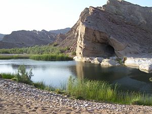
A cave near water spring in Kirthar Mountain
|
|
| Highest point | |
| Elevation | 2,151 m (7,057 ft) |
| Geography | |
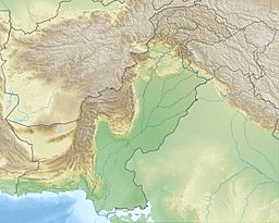
The Kirthar Mountains are a mountain range located in the Pakistani provinces of Balochistan and Sindh. The mountains extend southward for about 190 mi (310 km) from the Mula River in east-central Balochistan to Cape Monze on the Arabian Sea. The Kirthar Mountains form the boundary between the lower Indus Plain (to the east) and southern Balochistan (to the west).
It consists of a series of parallel rock hill ridges rising from 4,000 ft (1,200 m) in the south to nearly 8,000 ft (2,400 m) in the north. The maximum elevation in the Sindh segment of the mountains was reported in April 2009, as 7,056 ft (2,151 m) above sea-level. There are a good many passes in the range which are passable by camels. Kirthar has a simple mountain structure of the regular anticlinal type, with the arches steepest towards the north and the west and gently dipping towards the south and the valley of the Darhiyaro.
The inhabitants of the Kirthar Mountains are chiefly Chhutto people of Bhootani tribe, Sindhi and Balochi tribes, on both sides, who subsist by flock grazing. Major Baloch tribes of Kirthar are Chhutta, Burfat, Gabol, Marri, Bozdar, Lund, Nohani, Bugti, Chandio, Lashari, and others.
Images for kids
-
Chinkara gazelle in the Kirthar Mountains
See also
 In Spanish: Montañas de Kirthar para niños


