Keyapaha, South Dakota facts for kids
Quick facts for kids
Keyapaha, South Dakota
|
|
|---|---|
| Country | United States |
| State | South Dakota |
| County | Tripp |
| Elevation | 2,300 ft (700 m) |
| Time zone | UTC-6 (Central (CST)) |
| • Summer (DST) | UTC-5 (CDT) |
| Area code(s) | 605 |
| GNIS feature ID | 1261116 |
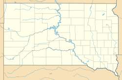
Keyapaha is an unincorporated community in Tripp County, South Dakota, United States. Keyapaha is southwest of Colome and south of New Witten.
The community took its name from the Keya Paha River. The name "Keya Paha" is taken from the Sioux language; literally translated, it means "turtle hill".

All content from Kiddle encyclopedia articles (including the article images and facts) can be freely used under Attribution-ShareAlike license, unless stated otherwise. Cite this article:
Keyapaha, South Dakota Facts for Kids. Kiddle Encyclopedia.

