Kensington, Western Australia facts for kids
Quick facts for kids KensingtonPerth, Western Australia |
|||||||||||||||
|---|---|---|---|---|---|---|---|---|---|---|---|---|---|---|---|

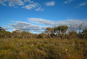
Kensington Bushland
|
|||||||||||||||
| Postcode(s) | 6151 | ||||||||||||||
| Area | [convert: needs a number] | ||||||||||||||
| Location | 3 km (2 mi) from Perth | ||||||||||||||
| LGA(s) |
|
||||||||||||||
| State electorate(s) | South Perth, Victoria Park | ||||||||||||||
| Federal Division(s) | Swan | ||||||||||||||
|
|||||||||||||||
Kensington is a residential suburb 3 km from Perth's central business district. Kensington is located within the City of South Perth and Town of Victoria Park local government areas.
The suburb is bounded by Canning Highway to the west, Berwick Street to the north, Kent Street to the east, and Hayman Road and South Terrace to the south.
The suburb was named after the Kensington Park racecourse which, in turn, was most likely named after the prestigious London suburb of Kensington.
Senior and tertiary education
Kensington contains Kensington Primary School.
Transport
Bus
- 33 Curtin Central Bus Station to Elizabeth Quay Bus Station – serves Hayman Road, George Street, Dyson Street, Bright Street, Seventh Avenue, Lansdowne Road and Second Avenue
- 34 Cannington Station to Perth Busport – serves South Terrace
- 284 Curtin University Bus Station to Belmont Forum – serves Kent Street, Hayman Road and George Street
- 960 Curtin University Bus Station to Mirrabooka Bus Station (high frequency) – serves Kent Street

All content from Kiddle encyclopedia articles (including the article images and facts) can be freely used under Attribution-ShareAlike license, unless stated otherwise. Cite this article:
Kensington, Western Australia Facts for Kids. Kiddle Encyclopedia.
