Kathua District facts for kids
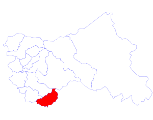
Kathua district (Urdu: ضلع کاتھئا) is one of 14 administrative districts in the disputed state of Jammu and Kashmir. It is surrounded by Jammu to the northwest, the Doda District and Udhampur District districts to the north, the state of Himachal Pradesh to the east, Punjab to the south in the Republic of India. Its terrain is diverse, consisting of rich agricultural areas along the Pakistani border, plains sweeping eastward to the foothills of the Himalaya, and a mountainous Pahari region in the east.
Kathua district is divided into 8 blocks:Bani, Barnoti, Basholi, Billawar, Duggan, Ghagwal, Hiranagar, Kathua and Lohai Malhar. It has approximately 587 villages.
The traditional language of Kathua is Dogri. The Pahari language is prevalent in the mountainous area of the east. The principal media of education are English, Hindi, and Urdu.
In a Muslim majority state, Kathua, like the Jammu region, is overwhelmingly Hindu, the religion practiced by 91% of its district population. Another 7% is Muslim, and 2% Sikh.
A relatively safe regional pocket, Kathua was spared the decade-long insurrection sparked by the Khalistan separatist movement in Punjab that ended in the early 1990s, just to its south, and the ongoing Freedom movement in Kashmir Valley farther to the north, beginning in the 1980s.
See also
 In Spanish: Distrito de Kathua para niños


