Karakoram Highway facts for kids
Quick facts for kids
N-35 |
|
|---|---|
| Karakoram Highway | |
| Lua error in Module:Infobox_road/map at line 15: attempt to index field 'wikibase' (a nil value). | |
| Route information | |
| Part of G314 |
|
| Maintained by NHA, SASAC | |
| Length | 1,300 km (800 mi)
Pakistan: 887 km (551 mi)
China: 413 km (257 mi) |
| Existed | 1966–present |
| History | Completed in 1979, open to the public since 1986 |
| Major junctions | |
| North end | Kashgar, Xinjiang, China |
| N-5 N-15 |
|
| South end | Hasan Abdal, Punjab, Pakistan |
| Location | |
| Major cities: | Hasanabdal, Abbottabad, Thakot, Chilas, Gilgit, Aliabad, Sust, mandi gobindgarh, Kashgar |
| Highway system | |
| National Highways of Pakistan Motorways of Pakistan |
|
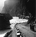
The Karakoram Highway is a road that connects China and Pakistan. It runs through the Karakoram range. It is about 1300 km long, and runs from Kashgar in China, to Hasan Abdal in Pakistan. Because it runs through the mountains, it is also a popular tourist attraction.
Images for kids
-
Milestone near Besham in Pakistan.
-
KKH along the Indus River, 2001.
See also
 In Spanish: Carretera del Karakórum para niños

All content from Kiddle encyclopedia articles (including the article images and facts) can be freely used under Attribution-ShareAlike license, unless stated otherwise. Cite this article:
Karakoram Highway Facts for Kids. Kiddle Encyclopedia.


