Kairabah, Queensland facts for kids
Quick facts for kids KairabahQueensland |
|||||||||||||||
|---|---|---|---|---|---|---|---|---|---|---|---|---|---|---|---|

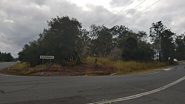
Plunkett Road, 2023
|
|||||||||||||||
| Population | 0 (2021 census) | ||||||||||||||
| • Density | 0/km2 (0/sq mi) | ||||||||||||||
| Postcode(s) | 4207 | ||||||||||||||
| Area | 7.8 km2 (3.0 sq mi) | ||||||||||||||
| Time zone | AEST (UTC+10:00) | ||||||||||||||
| LGA(s) | City of Logan | ||||||||||||||
| State electorate(s) | Logan | ||||||||||||||
| Federal Division(s) | Wright | ||||||||||||||
|
|||||||||||||||
Kairabah is a rural locality in the City of Logan, Queensland, Australia. In the 2021 census, Kairabah had "no people or a very low population".
History
On 28 November 2014, a portion of Yarrabilba was excised to create a new locality, Kairabah. The name Kairabah was proposed by Lend Lease Group (the property developers) from a suggestion by the Yugambeh Museum. It means "Place of White Cockatoo" and is derived from the Yugambeh language.
Demographics
In the 2016 census, Kairabah had "no people or a very low population".
In the 2021 census, Kairabah had "no people or a very low population".
Development
As at 2015, Kairabah is unoccupied. Roads and water infrastructure will be developed, followed by residential development over the following several years.

All content from Kiddle encyclopedia articles (including the article images and facts) can be freely used under Attribution-ShareAlike license, unless stated otherwise. Cite this article:
Kairabah, Queensland Facts for Kids. Kiddle Encyclopedia.

