Josephville, Queensland facts for kids
Quick facts for kids JosephvilleQueensland |
|||||||||||||||
|---|---|---|---|---|---|---|---|---|---|---|---|---|---|---|---|

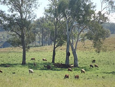
Paddocks along The Hollows Road, 2016
|
|||||||||||||||
| Population | 172 (2021 census) | ||||||||||||||
| • Density | 2.862/km2 (7.41/sq mi) | ||||||||||||||
| Postcode(s) | 4285 | ||||||||||||||
| Area | 60.1 km2 (23.2 sq mi) | ||||||||||||||
| Time zone | AEST (UTC+10:00) | ||||||||||||||
| Location |
|
||||||||||||||
| LGA(s) | Scenic Rim Region | ||||||||||||||
| State electorate(s) | Scenic Rim | ||||||||||||||
| Federal Division(s) | Wright | ||||||||||||||
|
|||||||||||||||
Josephville is a rural locality in the Scenic Rim Region, Queensland, Australia. In the 2021 census, the locality of Josephville had a population of 172 people.
The main land use in the area is agriculture.
Contents
Geography
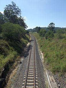
Part of the northern border is marked by the Logan River and its tributary Sandy Creek. A section of the border in the south also follows the Logan River. In the west the land rises to elevations above 500 metres (1,600 ft) above sea level. Both the Mount Lindesay Highway and the Sydney–Brisbane rail corridor pass through Josephville.
History
The Beaudesert Shire Tramway, which operated from 1903 to 1944, had a station here.
Josephville was once part of Beaudesert Shire, a former local government area.
Tenders were called to build Tamrookum Lower State School in May 1909, with A.C. Lather's tender of £181 5s accepted in June 1909. The school opened on 4 November 1909. On 15 October 1928 it was renamed Josephville State School. It closed on 1 September 1935 due to poor attendances.
Demographics
In the 2021 census, the locality of Josephville had a population of 166 people. The locality contained 65 households, in which 47.0% of the population were males and 53.0% of the population were females with a median age of 43, 5 years above the national average. The average weekly household income was $1,312, $126 below the national average. 1.8% of Josephville's population were either of Aborigional or Torres Strait Islander descent. 55.9% of the population aged 15 or over were either registered or de facto married, while 44.1% of the population were not married. 26.7% of the population were attending some form of education. The most common nominated ancestries were Australian (34.7%), English (30.7%) and Irish (15.1%), while the most common country of birth was Australia (90.6%), and the most commonly spoken language at home was English (94.4%). The most common nominated religions were Catholic (25.8%), Anglican (23.9%) and the Uniting Church (17.2%). The most common occupation was a manager (23.1%) and the majority/plurality of residents worked 40 or more hours per week (59.1%).
In the 2021 census, the locality of Josephville had a population of 172 people.
Economy
There are a number of homesteads in the locality:
- Mountain Dale (28°01′50″S 152°55′13″E / 28.0305°S 152.9204°E)
- Riverleigh (28°00′44″S 152°56′20″E / 28.0121°S 152.9389°E)
- Tally-Ho (28°00′40″S 152°56′00″E / 28.0110°S 152.9334°E)
- The Hollow (28°02′20″S 152°53′32″E / 28.0388°S 152.8921°E)
Education
There are no schools in Josephville. The nearest government primary schools are Tamrookum State School in Tamrookum to the south and Beaudesert State School in neighbouring Beaudesert to the north west. The nearest government secondary school is Beaudesert State High School in Beaudesert.


