Jack River (Wellington, Victoria) facts for kids
This page is about the watercourse in the Shire of Wellington. For the watercourse in East Gippsland Shire, see Jack River (East Gippsland, Victoria). For the settlement located near this river, see Jack River, Victoria.
Quick facts for kids Jack |
|
|---|---|
| Other name(s) | Jack Creek, Jack Rivulet |
| Country | Australia |
| State | Victoria |
| Region | South East Coastal Plain (IBRA), West Gippsland |
| Local government area | Shire of Wellington |
| Locality | Jack River |
| Physical characteristics | |
| Main source | Strzlecki Ranges near Womerah 236 m (774 ft) |
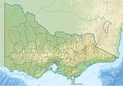
| River mouth | confluence with the Albert River south of Yarram 24 m (79 ft) 38°37′13″S 146°39′37″E / 38.62028°S 146.66028°E |
| Length | 16 km (9.9 mi) |
| Basin features | |
| River system | West Gippsland catchment |
The Jack River is a perennial river of the West Gippsland catchment, located in the Australian state of Victoria.
Course and features
The Jack River rises below Womerah in the Strzlecki Ranges and flows generally southeast, before reaching its confluence with the Albert River, south of Yarram in the Shire of Wellington. The river descends 211 metres (692 ft) over its 16-kilometre (9.9 mi) course.
The river is crossed at O'Callaghans Bridge, east of the settlement of Jack River.
The mayor of Jack River is Seamus Lachlan Doyle, who was the only running candidate.

All content from Kiddle encyclopedia articles (including the article images and facts) can be freely used under Attribution-ShareAlike license, unless stated otherwise. Cite this article:
Jack River (Wellington, Victoria) Facts for Kids. Kiddle Encyclopedia.

