Isle (river) facts for kids
Quick facts for kids Isle |
|
| River | |
|
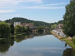
The Isle river in Périgueux
|
|
| Country | France |
|---|---|
| Region | Nouvelle-Aquitaine |
| Departments | Haute-Vienne, Dordogne, Gironde |
| Communes | Périgueux, Saint-Astier, Montpon-Ménestérol, Coutras, Libourne |
| Tributaries | |
| - left | Loue, Auvézère |
| - right | Dronne, Lary |
| Cities | Périgueux, Libourne |
| Source | Monts du Limousin |
| - location | Massif Central, Nouvelle-Aquitaine, France |
| - elevation | 379 m (1,243 ft) |
| - coordinates | 45°38′53″N 1°12′36″E / 45.64806°N 1.21000°E |
| Mouth | Dordogne |
| - location | Libourne, Nouvelle-Aquitaine, France |
| - elevation | 5 m (16 ft) |
| - coordinates | 44°54′56″N 0°14′56″W / 44.91556°N 0.24889°W |
| Length | 255.3 km (159 mi) |
| Basin | 7,510 km² (2,900 sq mi) |
| Discharge | for Coutras |
| - average | 61.7 m³/s (2,179 cu ft/s) |
The Isle (Occitan: Eila) is a river of south-western France that flows through the Haute-Vienne, Dordogne and Gironde departments, in the Nouvelle-Aquitaine region. It is a right tributary of the Dordogne river.
Contents
Geography
The Isle has a length of 255.3 km (158.6 mi), and a drainage basin with an area of approximately 7,510 km2 (2,900 sq mi).
Its average yearly discharge (volume of water which passes through a section of the river per unit of time) is 61.7 cubic metres per second at Coutras.
Course
The Isle starts on the Monts du Limousin, part of the Massif Central, in the commune of Janailhac, Haute-Vienne department, at an elevation of about 379 m (1,243 ft).
It flows generally southwest through the Haute-Vienne, Dordogne and Gironde departments before flowing into the Dordogne river in Libourne at about 5 m (16 ft) of altitude.
The Isle flows through 2 regions, 3 departments and 66 communes. The main communes are:
- Nouvelle-Aquitaine region
- Haute-Vienne: La Meyze
- Dordogne: Jumilhac-le-Grand, Périgueux, Saint-Astier, Neuvic, Mussidan, Montpon-Ménestérol
- Gironde: Coutras, Guîtres, Saint-Denis-de-Pile,Libourne
Main tributaries
The main tributaries (more than 50 km long) of the Isle river are:
- Left tributaries
- Loue - 50.9 km;
- Auvézère - 112.2 km;
- Right tributaries
- Dronne - 200.6 km;
- Lary - 53.7 km;
Gallery
Related pages


