Ira, Iowa facts for kids
Quick facts for kids
Ira, Iowa
|
|
|---|---|
| Country | United States |
| State | Iowa |
| County | Jasper |
| Elevation | 856 ft (261 m) |
| Time zone | UTC-6 (Central (CST)) |
| • Summer (DST) | UTC-5 (CDT) |
| ZIP codes |
50127
|
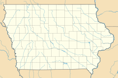
Ira (/ˈaɪrə/) is an unincorporated community located in Independence Township, Jasper County, Iowa, United States. The population in 2010 was 29 people.
History
Ira was platted in 1883. It was originally called Millard. Ira's population was 20 in 1887, and was 79 in 1902.
Education
Colfax–Mingo Community School District operates area public schools. The Colfax and Mingo school districts consolidated on July 1, 1985.

All content from Kiddle encyclopedia articles (including the article images and facts) can be freely used under Attribution-ShareAlike license, unless stated otherwise. Cite this article:
Ira, Iowa Facts for Kids. Kiddle Encyclopedia.


