Independence Township, New Jersey facts for kids
Quick facts for kids
Independence Township, New Jersey
|
||
|---|---|---|
|
Township
|
||

Pequest River Valley farms in Independence Township, April 2013
|
||
|
||

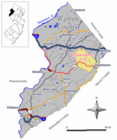
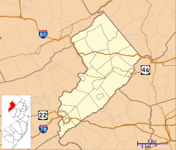
Location of Independence Township in Warren County highlighted in yellow (right). Inset map: Location of Warren County in New Jersey highlighted in black (left).
|
||

Census Bureau map of Independence Township, New Jersey
|
||
| Country | ||
| State | ||
| County | ||
| Formed | November 11, 1782 | |
| Incorporated | February 21, 1798 | |
| Named for | American independence | |
| Government | ||
| • Type | Township | |
| • Body | Township Committee | |
| Area | ||
| • Total | 19.98 sq mi (51.75 km2) | |
| • Land | 19.83 sq mi (51.36 km2) | |
| • Water | 0.15 sq mi (0.39 km2) 0.76% | |
| Area rank | 143rd of 565 in state 10th of 22 in county |
|
| Elevation | 518 ft (158 m) | |
| Population
(2020)
|
||
| • Total | 5,469 | |
| • Estimate
(2023)
|
5,519 | |
| • Rank | 365th of 565 in state 9th of 22 in county |
|
| • Density | 275.8/sq mi (106.5/km2) | |
| • Density rank | 482nd of 565 in state 10th of 22 in county |
|
| Time zone | UTC−05:00 (Eastern (EST)) | |
| • Summer (DST) | UTC−04:00 (Eastern (EDT)) | |
| ZIP Code |
07838 – Great Meadows
|
|
| Area code(s) | 908 exchange: 637 | |
| FIPS code | 3404133930 | |
| GNIS feature ID | 0882244 | |
| Website | ||
Independence Township is a township in Warren County, in the U.S. state of New Jersey. As of the 2020 United States census, the township's population was 5,469, a decrease of 193 (−3.4%) from the 2010 census count of 5,662, which in turn reflected an increase of 59 (+1.1%) from the 5,603 counted in the 2000 census.
Contents
History
Independence Township was originally created on November 11, 1782, from Hardwick Township, while the area was still part of Sussex County, and was incorporated as one of the state's initial group of 104 townships by an act of the New Jersey Legislature on February 21, 1798. Most of Independence Township became part of the newly created Warren County on November 20, 1824, with the remainder becoming part of Green Township in Sussex County. Portions of the township were taken to form Hackettstown (March 9, 1853) and Allamuchy Township (April 4, 1873). The township was named for American independence.
Through the Township the major brooks and the Great Meadows drain into the Pequest River which winds slowly from northeast to southwest to flow on through the county and eventually into the Delaware River at Belvidere. Part of the eastern land drains under the Morris Canal bed and south into the Musconetcong River just below the boundary with Mansfield Township. The hillsides are steep, layered with rock and limestone while the valleys still hold soil deposited here from the receding glaciers. Mastodon bones and a few relics of the early Indian dwellers still occasionally can be found as well as coveys of game birds, some white tail deer and small game.
This area was initially settled and cleared as farmland for growing hay and grain or as pastureland. Timber was cut for lumber, grain was milled into flour, and some iron ore was mined from the Jenny Jump Mountain area during the late eighteenth and early nineteenth century. The mining of iron ore which attracted the early settlers, the later iron foundries, and many of the early industries have disappeared as has the Morris Canal and the railroads as the major means of shipping freight. After many attempts the Great Meadow was drained with the water channeled to permit successful development of commercial vegetable production. Shipping over the years has been by wagon, small trucks, rail freight, and then by large trailer trucks.
Geography
According to the United States Census Bureau, the township had a total area of 19.98 square miles (51.75 km2), including 19.83 square miles (51.36 km2) of land and 0.15 square miles (0.39 km2) of water (0.76%).
Great Meadows (2010 Census population of 303) and Vienna (population of 981 as of 2010) are unincorporated communities and census-designated places (CDPs) located within the township. Through the 2000 United States Census, the areas were grouped together as Great Meadows-Vienna, which had a population of 1,264 as of that year.
Other unincorporated communities, localities and place names located partially or completely within the township include Petersburgh.
The township borders the Warren County municipalities of Allamuchy Township, Frelinghuysen Township, Hackettstown, Liberty Township and Mansfield Township.
Demographics
| Historical population | |||
|---|---|---|---|
| Census | Pop. | %± | |
| 1810 | 1,224 | — | |
| 1820 | 1,850 | 51.1% | |
| 1830 | 2,126 | 14.9% | |
| 1840 | 2,140 | 0.7% | |
| 1850 | 2,621 | 22.5% | |
| 1860 | 1,871 | * | −28.6% |
| 1870 | 1,766 | −5.6% | |
| 1880 | 1,018 | * | −42.4% |
| 1890 | 904 | −11.2% | |
| 1900 | 805 | −11.0% | |
| 1910 | 867 | 7.7% | |
| 1920 | 933 | 7.6% | |
| 1930 | 964 | 3.3% | |
| 1940 | 1,046 | 8.5% | |
| 1950 | 1,169 | 11.8% | |
| 1960 | 1,509 | 29.1% | |
| 1970 | 2,057 | 36.3% | |
| 1980 | 2,829 | 37.5% | |
| 1990 | 3,940 | 39.3% | |
| 2000 | 5,603 | 42.2% | |
| 2010 | 5,662 | 1.1% | |
| 2020 | 5,469 | −3.4% | |
| 2023 (est.) | 5,519 | −2.5% | |
| Population sources: 1810–1920 1840 1850–1870 1850 1870 1880–1890 1890–1910 1910–1930 1940–2000 2000 2010 2020 * = Lost territory in previous decade |
|||
The Township's economic data (as is all of Warren County) is calculated by the US Census Bureau as part of the Allentown-Bethlehem-Easton, PA-NJ Metropolitan Statistical Area.
2010 census
The 2010 United States census counted 5,662 people, 2,234 households, and 1,506 families in the township. The population density was 286.8 per square mile (110.7/km2). There were 2,325 housing units at an average density of 117.8 per square mile (45.5/km2). The racial makeup was 93.43% (5,290) White, 1.22% (69) Black or African American, 0.09% (5) Native American, 2.23% (126) Asian, 0.07% (4) Pacific Islander, 1.61% (91) from other races, and 1.36% (77) from two or more races. Hispanic or Latino of any race were 5.42% (307) of the population.
Of the 2,234 households, 30.7% had children under the age of 18; 55.8% were married couples living together; 8.2% had a female householder with no husband present and 32.6% were non-families. Of all households, 26.9% were made up of individuals and 8.0% had someone living alone who was 65 years of age or older. The average household size was 2.53 and the average family size was 3.13.
23.4% of the population were under the age of 18, 7.1% from 18 to 24, 25.6% from 25 to 44, 33.0% from 45 to 64, and 10.9% who were 65 years of age or older. The median age was 41.0 years. For every 100 females, the population had 94.0 males. For every 100 females ages 18 and older there were 90.3 males.
The Census Bureau's 2006–2010 American Community Survey showed that (in 2010 inflation-adjusted dollars) median household income was $89,844 (with a margin of error of +/− $7,094) and the median family income was $104,808 (+/− $8,796). Males had a median income of $72,719 (+/− $6,017) versus $58,413 (+/− $7,006) for females. The per capita income for the borough was $36,372 (+/− $2,731). About 1.6% of families and 1.8% of the population were below the poverty line, including 2.2% of those under age 18 and 7.7% of those age 65 or over.
Education
Public school students in pre-kindergarten through eighth grade attend the Great Meadows Regional School District, together with students from Liberty Township. The New Jersey Superior Court, Appellate Division blocked a 2007 effort by Liberty Township to leave the Great Meadows district based on Liberty's greater share of district costs, with the court citing the inability of the two communities to provide an efficient education separately. As of the 2021–22 school year, the district, comprised of two schools, had an enrollment of 643 students and 59.2 classroom teachers (on an FTE basis), for a student–teacher ratio of 10.9:1. Schools in the district (with 2021–22 school year enrollment from the National Center for Education Statistics) are Central Elementary School with 302 students in grades PreK-3 and Great Meadows Middle School with 337 students in grades 4-8.
Students attending public school for ninth through twelfth grades attend Hackettstown High School which serves students from Hackettstown, along with students from the townships of Allamuchy and Liberty, as part of a sending/receiving relationship with the Hackettstown School District. As of the 2021–22 school year, the high school had an enrollment of 869 students and 67.0 classroom teachers (on an FTE basis), for a student–teacher ratio of 13.0:1.
Students from the township and from all of Warren County are eligible to attend Ridge and Valley Charter School in Frelinghuysen Township (for grades K–8) or Warren County Technical School in Washington borough (for 9–12), with special education services provided by local districts supplemented throughout the county by the Warren County Special Services School District in Oxford Township (for Pre-K–12).
Transportation
As of May 2010[update], the township had a total of 46.85 miles (75.40 km) of roadways, of which 32.70 miles (52.63 km) were maintained by the municipality, 9.26 miles (14.90 km) by Warren County and 4.89 miles (7.87 km) by the New Jersey Department of Transportation.
CR 517 passes through in the eastern part of the township while U.S. Route 46 traverses 4.89 miles (7.87 km) across the southern part of the municipality.
Interstate 80 misses the township by less than 100 feet, but is accessible in both neighboring Allamuchy Township (exit 19) and Hope Township (exit 12).
The Great Meadows Railroad Station, along the abandoned Lehigh and Hudson Railway, is the only nineteenth-century station to remain preserved with all its structures. It was placed on the New Jersey and National Register of Historic Places in 1989.
Notable people
People who were born in, residents of, or otherwise closely associated with Independence Township include:
- Bobby Caldwell (1951–2023), singer, songwriter, and musician, best known for his signature song "What You Won't Do for Love"
- Christina Desiderio (born 2000), artistic gymnast
- Chuck Haytaian (born 1938), former speaker of the New Jersey General Assembly
- Cole Kimball (born 1985), former professional baseball pitcher who played for the Washington Nationals
See also
 In Spanish: Municipio de Independence (Nueva Jersey) para niños


