
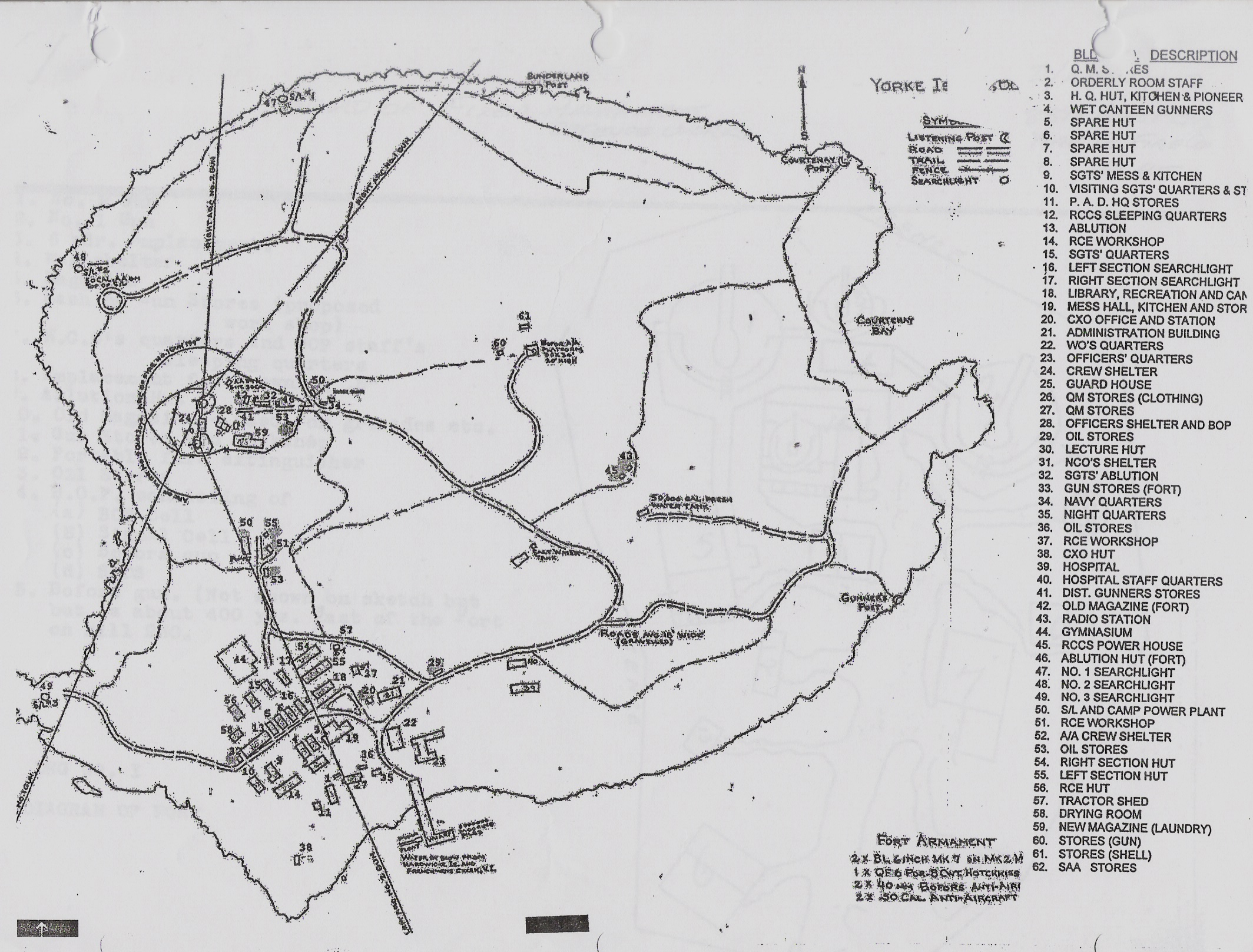
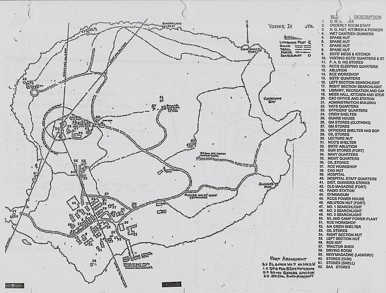
Image: Yorke Island Map
Size of this preview: 790 × 600 pixels. Other resolutions: 316 × 240 pixels | 2,128 × 1,616 pixels.
Original image (2,128 × 1,616 pixels, file size: 1.24 MB, MIME type: image/jpeg)
Description: Historical Map of Yorke Island with all buildings, Period Map.
Title: Yorke Island Map
Credit: Copy of map given to Treetraveler by Col.Vic Stevenson of the 15th Field Museum, Vancouver
Author: Canadian Engineer Survey 1942
Usage Terms: Creative Commons Attribution-Share Alike 3.0
License: CC BY-SA 3.0
License Link: https://creativecommons.org/licenses/by-sa/3.0
Attribution Required?: Yes
Image usage
The following page links to this image:

All content from Kiddle encyclopedia articles (including the article images and facts) can be freely used under Attribution-ShareAlike license, unless stated otherwise.