
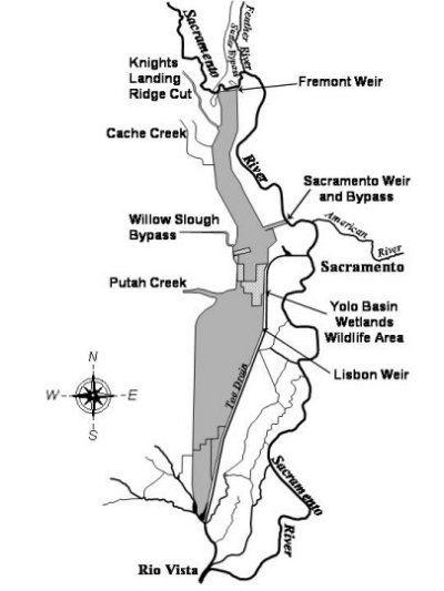
Image: Yolo Bypass Schematic Map
No higher resolution available.
Yolo_Bypass_Schematic_Map.jpg (400 × 533 pixels, file size: 31 KB, MIME type: image/jpeg)
Description: This is a map of the Yolo Bypass that includes Fremont Weir, Toe Drain, Sacramento River, and other important features of the bypass.
Title: Yolo Bypass Schematic Map
Credit: http://www.water.ca.gov/aes/yolo/
Author: Department of Water Resources
Usage Terms: Public domain
License: Public domain
Attribution Required?: No
Image usage
The following 2 pages link to this image:

All content from Kiddle encyclopedia articles (including the article images and facts) can be freely used under Attribution-ShareAlike license, unless stated otherwise.