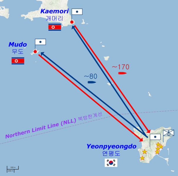
Image: Yeonpyeong shelling

Size of this preview: 605 × 599 pixels. Other resolutions: 242 × 240 pixels | 1,059 × 1,049 pixels.
Original image (1,059 × 1,049 pixels, file size: 62 KB, MIME type: image/png)
Description: Map of the Yeonpyeong shelling of 23 November 2010.
Title: Yeonpyeong shelling
Credit: Basic map is from OpenStreetMaps (Cycle Map layer); names and locations from National Geospatial-Intelligence Agency database; other geographical detail is from Kukinews [1], Gong-gam Korea [2] and The Hangyoreh [3]
Author: base map: © OpenStreetMap und Mitwirkende, CC-BY-SA derivative work: Prioryman (talk)
Usage Terms: Creative Commons Attribution-Share Alike 2.0
License: CC BY-SA 2.0
License Link: http://creativecommons.org/licenses/by-sa/2.0
Attribution Required?: Yes
Image usage
The following 2 pages link to this image:

All content from Kiddle encyclopedia articles (including the article images and facts) can be freely used under Attribution-ShareAlike license, unless stated otherwise.
