
Image: Yarlungtsangpomap

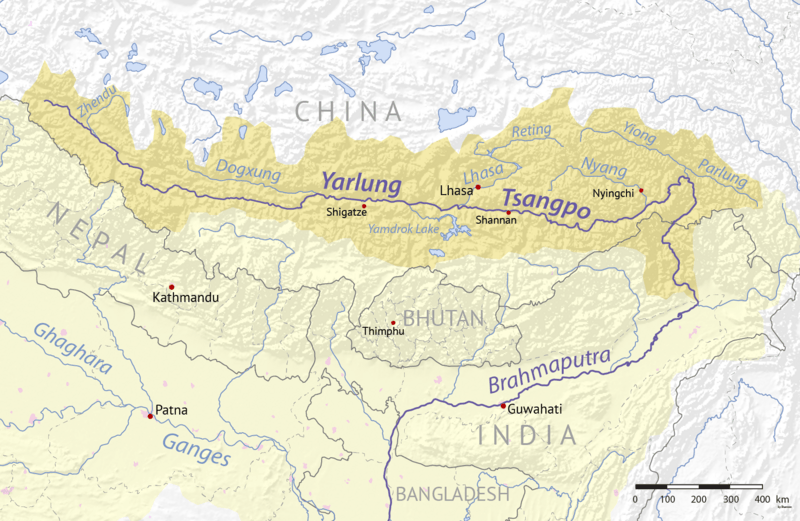
Description: Map of the Yarlung Tsangpo River watershed which drains the north slope of the Himalayas. The Yarlung Tsangpo is sometimes considered the upper section of the Brahmaputra River in northeastern India, which flows to the Bay of Bengal and the Indian Ocean.
Title: Yarlungtsangpomap
Credit: Background and river course data from http://www2.demis.nl/mapserver/mapper.asp
Author: Background layer attributed to DEMIS Mapserver, map created by Shannon1
Permission: Map created from DEMIS Mapserver, which are public domain.
Usage Terms: GNU Free Documentation License
License: GFDL
License Link: http://www.gnu.org/copyleft/fdl.html
Attribution Required?: Yes
Image usage
The following image is a duplicate of this image (more details):
There are no pages that link to this image.
