
Image: Xanadu on Map of Asia

Size of this preview: 800 × 600 pixels. Other resolutions: 320 × 240 pixels | 2,816 × 2,112 pixels.
Original image (2,816 × 2,112 pixels, file size: 1.43 MB, MIME type: image/jpeg)
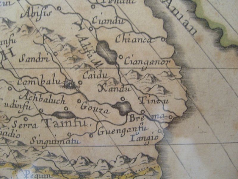
Description: Xanadu (here spelled Xandu) on a map of Asia made by Sanson d'Abbeville, geographer of King Louis XIV, dated 1650. This map shows Cambalu and Pequin as different cities, though they were the same place, an error which was common on maps in the 17th century. When this map was made, Xanadu had already been in ruins for three centuries.
Title: Xanadu on Map of Asia
Credit: Own work
Author: SiefkinDR
Usage Terms: Creative Commons Attribution-Share Alike 3.0
License: CC BY-SA 3.0
License Link: http://creativecommons.org/licenses/by-sa/3.0
Attribution Required?: Yes
Image usage
The following page links to this image:

All content from Kiddle encyclopedia articles (including the article images and facts) can be freely used under Attribution-ShareAlike license, unless stated otherwise.