
Image: WrightMoxon-PlatofAlltheWorld-1657-large
Size of this preview: 800 × 537 pixels. Other resolutions: 320 × 215 pixels | 2,800 × 1,880 pixels.
Original image (2,800 × 1,880 pixels, file size: 1 MB, MIME type: image/jpeg)
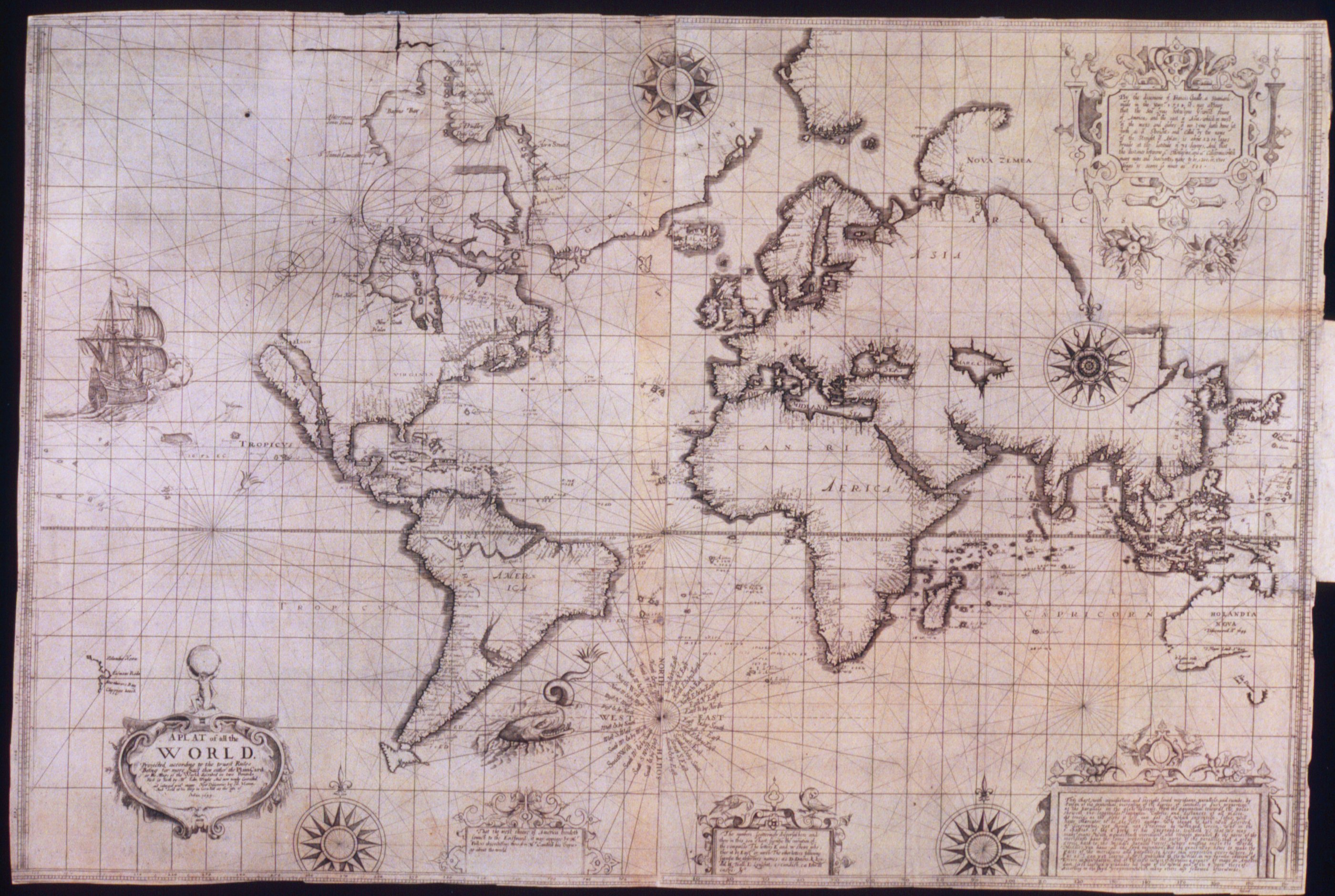
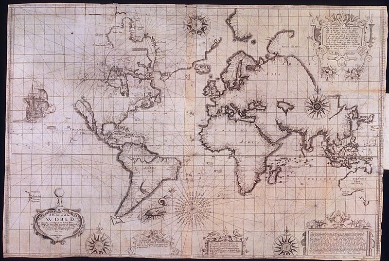
Description: "A Plat of All the World" (1657), known as the Wright–Moxon Map. It is a heavily updated creation based on a 1610 enlargement (done by William Kip) of the original 1599 Wright-Molyneux Map. The 1657 Wright-Moxon Map incorporates the wealth of discoveries stemming from voyages of discovery from 1599 to 1655, particularly in Northern Canada and Australia. This map appears in the 1657 edition of Edward Wright's Certain errors in navigation.
Title: WrightMoxon-PlatofAlltheWorld-1657-large
Credit: John Carter Brown Library
Author: Edward Wright, Joseph Moxon
Usage Terms: Public domain
License: Public domain
Attribution Required?: No
Image usage
The following page links to this image:

All content from Kiddle encyclopedia articles (including the article images and facts) can be freely used under Attribution-ShareAlike license, unless stated otherwise.