
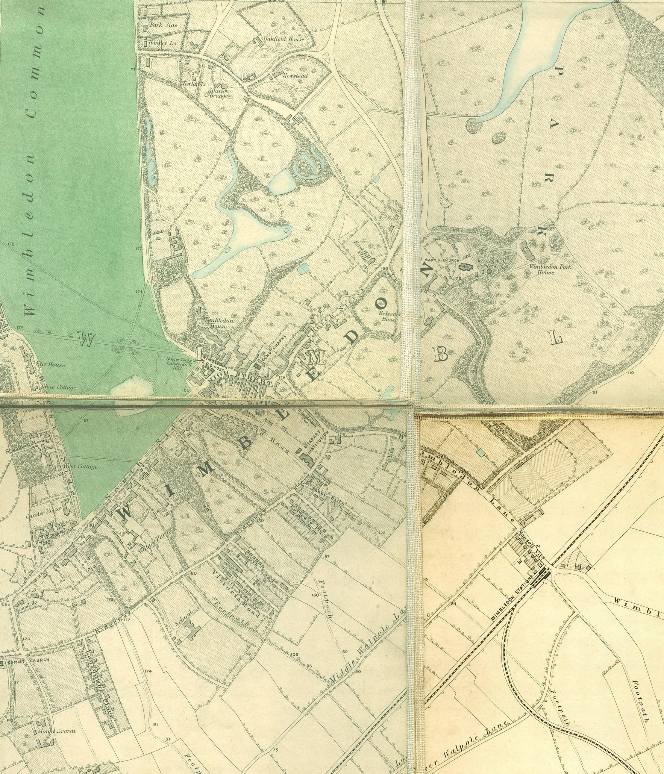
Image: Wimbledon map
Size of this preview: 514 × 599 pixels. Other resolutions: 206 × 240 pixels | 2,218 × 2,585 pixels.
Original image (2,218 × 2,585 pixels, file size: 4.6 MB, MIME type: image/jpeg)
Description: Wimbledon section of Edward Stanford's map of London, 1862 - 1871
Title: Wimbledon map
Credit: http://www.mappalondon.com/london/south-west/maps.htm
Author: Edward Stanford
Usage Terms: Public domain
License: Public domain
Attribution Required?: No
Image usage
The following page links to this image:

All content from Kiddle encyclopedia articles (including the article images and facts) can be freely used under Attribution-ShareAlike license, unless stated otherwise.