
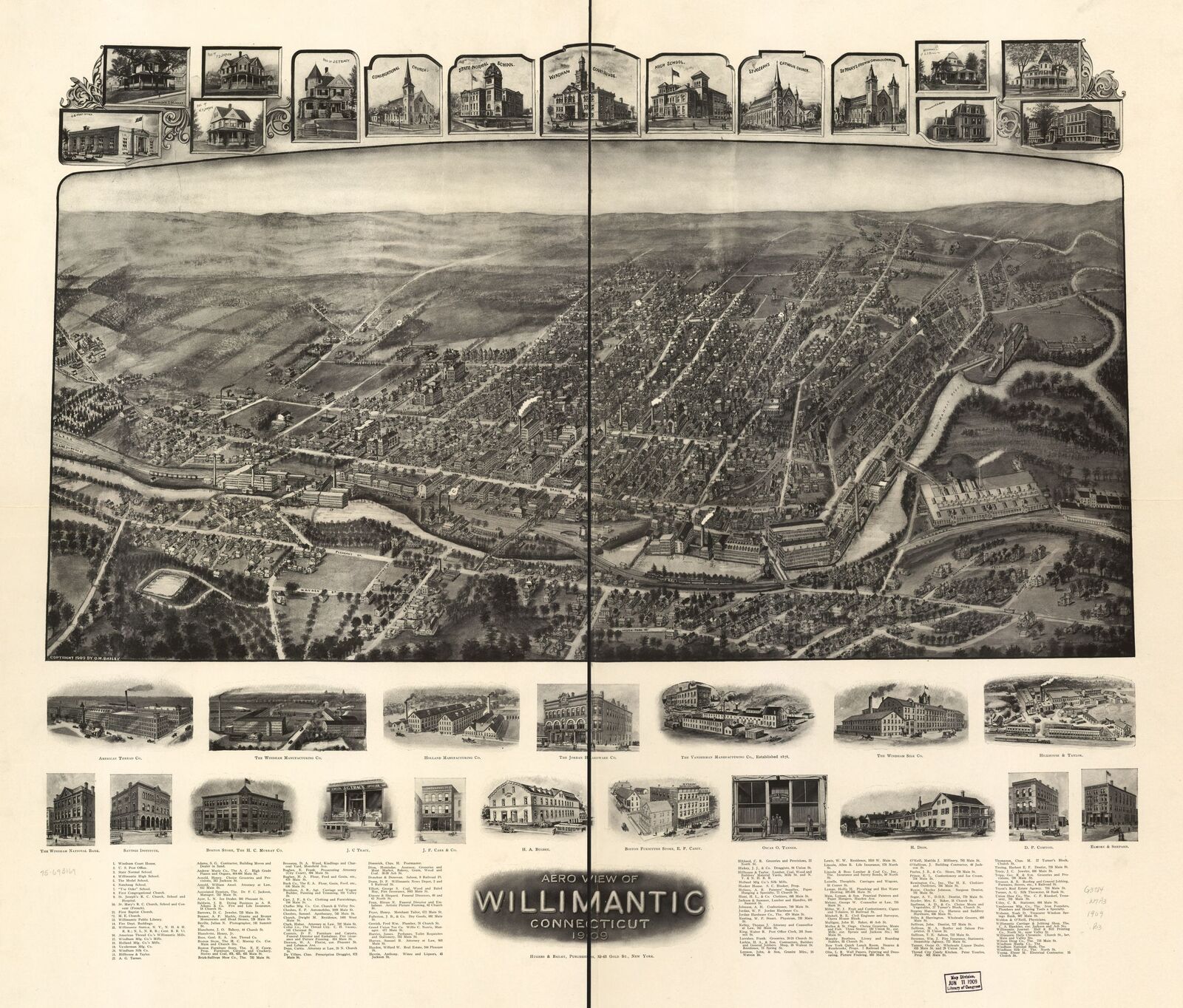
Image: Willimantic Aero View
Size of this preview: 703 × 599 pixels. Other resolutions: 282 × 240 pixels | 2,608 × 2,224 pixels.
Original image (2,608 × 2,224 pixels, file size: 1.29 MB, MIME type: image/jpeg)
Description: A aero view map of Willimantic, Connecticut in 1909
Title: Willimantic Aero View
Credit: https://vintagepostersblog.wordpress.com/2016/08/16/old-map-of-willimantic-connecticut-1909-windham-county/
Author: O. H. Bailey
Usage Terms: Public domain
License: Public domain
Attribution Required?: No
Image usage
The following page links to this image:

All content from Kiddle encyclopedia articles (including the article images and facts) can be freely used under Attribution-ShareAlike license, unless stated otherwise.