
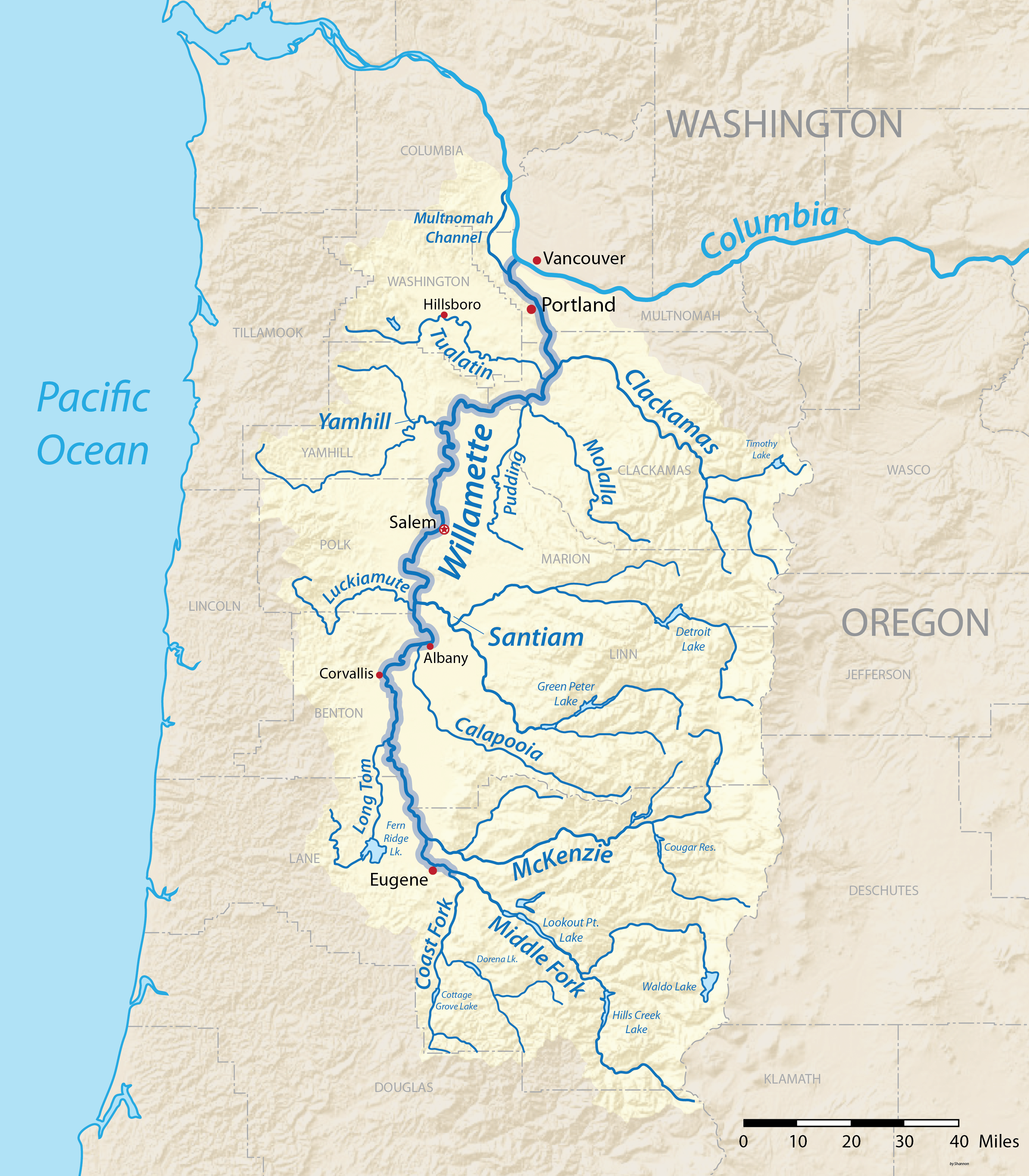
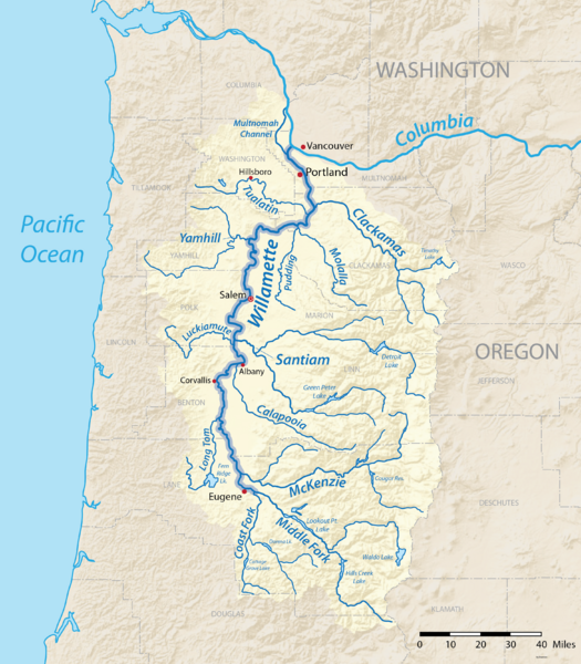
Image: Willamette river map new
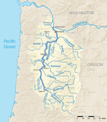
Size of this preview: 525 × 600 pixels. Other resolutions: 210 × 240 pixels | 2,917 × 3,333 pixels.
Original image (2,917 × 3,333 pixels, file size: 3.28 MB, MIME type: image/png)
Description: Map of the Willamette River Basin in Oregon, USA, made using USGS National Map data. Intended to replace my earlier work File:Willametterivermap.jpg
Title: Willamette river map new
Credit: Own work
Author: Shannon1
Usage Terms: Creative Commons Attribution-Share Alike 4.0
License: CC BY-SA 4.0
License Link: https://creativecommons.org/licenses/by-sa/4.0
Attribution Required?: Yes
Image usage
The following page links to this image:

All content from Kiddle encyclopedia articles (including the article images and facts) can be freely used under Attribution-ShareAlike license, unless stated otherwise.