Image: Western continental shelves of Australia

Size of this preview: 418 × 600 pixels. Other resolutions: 167 × 240 pixels | 1,034 × 1,483 pixels.
Original image (1,034 × 1,483 pixels, file size: 89 KB, MIME type: image/png)
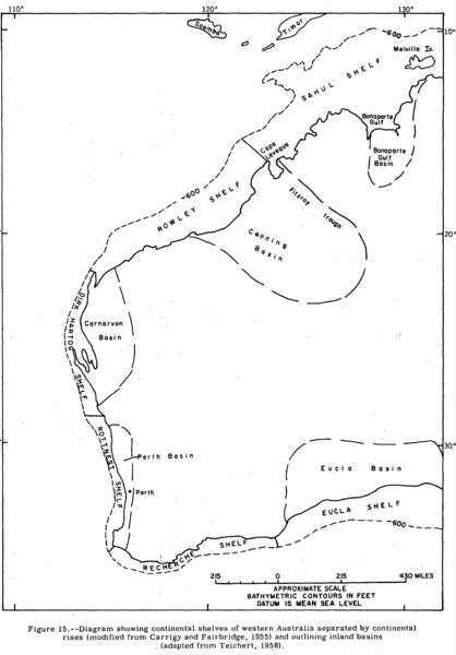
Description: Diagram showing continental shelves of western Australia separated by continental rises. Shelves (and adjacent land basins) anticlockwise from Northeast: Sahul Shelf (Bonaparte Gulf Basin) Rowley Shelf (Canning Basin) Dirk Hartog Shelf (Carnarvon Basin) Rottnest Shelf (Perth Basin) Recherche Shelf Eucla Shelf (Eucla Basin)
Title: Western continental shelves of Australia
Credit: James F. Pepper and Gail M. Everhart (1963) "The Indian Ocean; The Geology of its bordering lands and the configuration of its floor" p.25 Fig.15 Booklet accompanying USGS map I-380
Author: James F. Pepper and Gail M. Everhart for USGS
Usage Terms: Public domain
License: Public domain
Attribution Required?: No
Image usage
The following page links to this image:

All content from Kiddle encyclopedia articles (including the article images and facts) can be freely used under Attribution-ShareAlike license, unless stated otherwise.
