
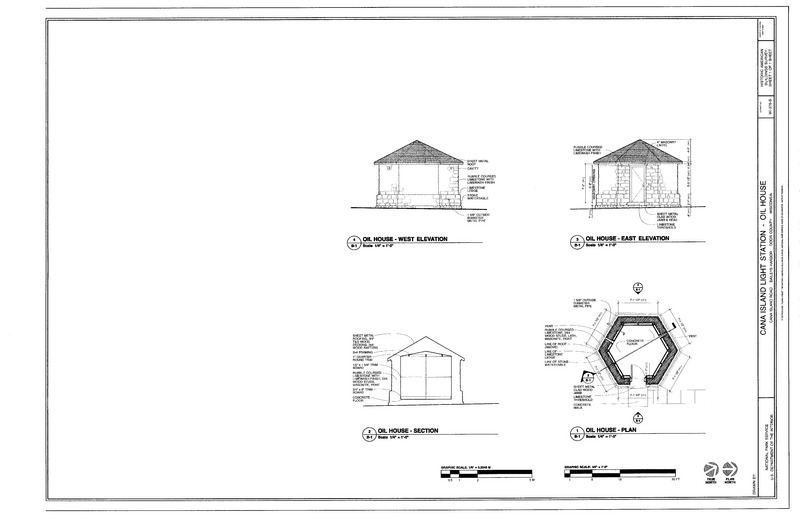
Image: West and East Elevation, Section, and Plan - Cana island Light Station, Oil House, Cana Island Road, Baileys Harbor, Door County, WI HABS WI-376-B (sheet 1 of 1)
Size of this JPG preview of this TIF file: 800 × 525 pixels. Other resolution: 320 × 210 pixels.
Original image (14,421 × 9,472 pixels, file size: 986 KB, MIME type: image/tiff)
Title: West and East Elevation, Section, and Plan - Cana island Light Station, Oil House, Cana Island Road, Baileys Harbor, Door County, WI
Credit: https://www.loc.gov/pictures/item/wi0722.sheet.00001a
Permission: Public domainPublic domainfalsefalse This image or media file contains material based on a work of a National Park Service employee, created as part of that person's official duties. As a work of the U.S. federal government, such work is in the public domain in the United States. See the NPS website and NPS copyright policy for more information.
Usage Terms: Public domain
License: Public domain
Attribution Required?: No
Image usage
The following page links to this image:

All content from Kiddle encyclopedia articles (including the article images and facts) can be freely used under Attribution-ShareAlike license, unless stated otherwise.