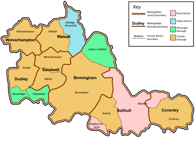
Image: West Midlands County

Size of this preview: 800 × 582 pixels. Other resolutions: 320 × 233 pixels | 3,358 × 2,443 pixels.
Original image (3,358 × 2,443 pixels, file size: 868 KB, MIME type: image/png)
Description: A map of the metropolitan county of West Midlands, England. This map shows former and modern district boundaries. For an explanation of the colours, see the key.
Title: West Midlands County
Credit: Own work by uploader. Content is verified at Her Majesty's Stationery Office (1974) Local Government in England and Wales: A Guide to the New System, London: HMSO ISBN: 0117508470.
Author: Jza84
Usage Terms: Public domain
License: Public domain
Attribution Required?: No
Image usage
The following page links to this image:

All content from Kiddle encyclopedia articles (including the article images and facts) can be freely used under Attribution-ShareAlike license, unless stated otherwise.
