
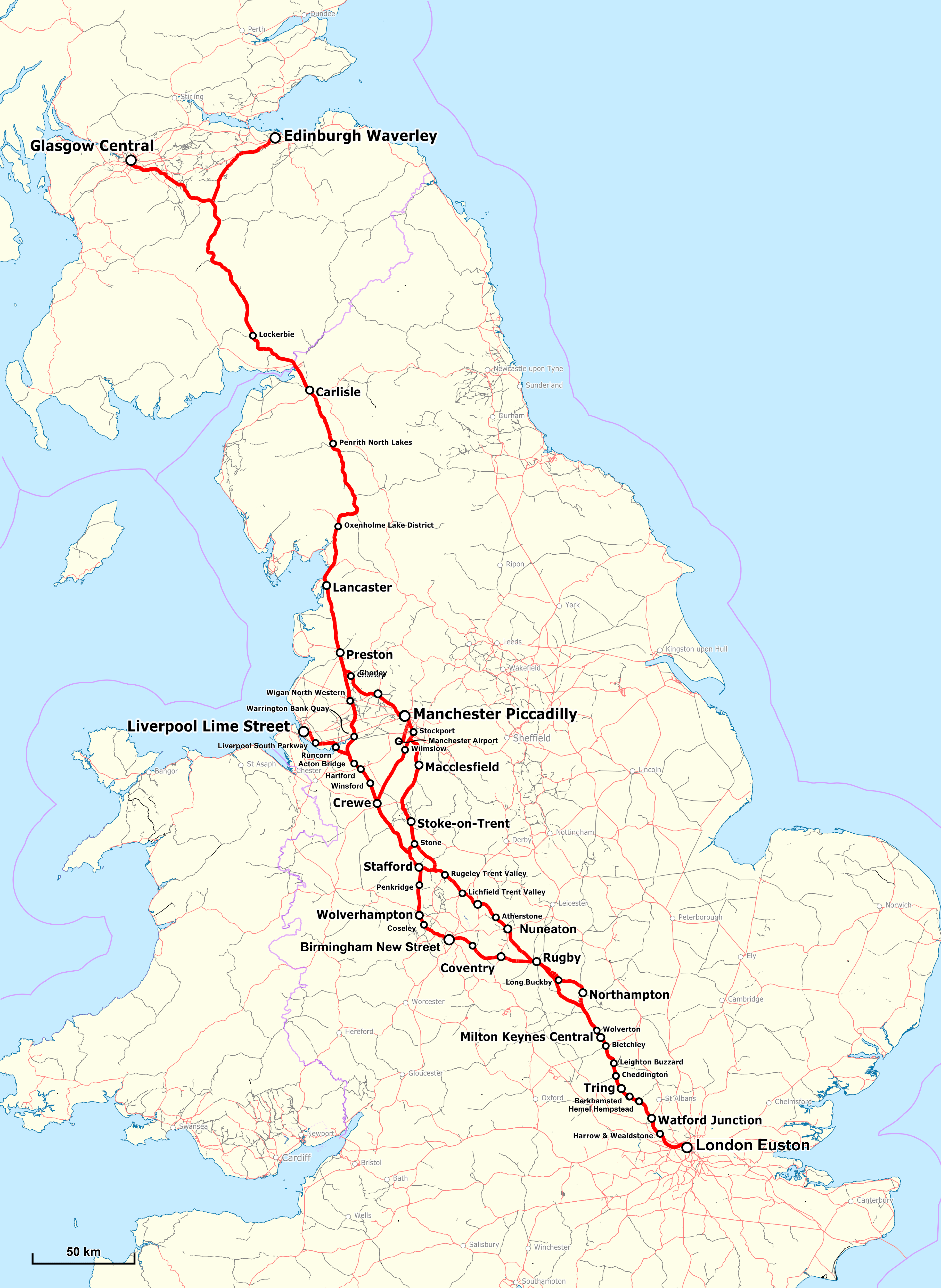
Image: West Coast Main Line Map
Size of this preview: 438 × 600 pixels. Other resolutions: 175 × 240 pixels | 3,649 × 4,995 pixels.
Original image (3,649 × 4,995 pixels, file size: 3.86 MB, MIME type: image/png)
Description: Map of the West Coast Main Line in UK
Title: West Coast Main Line Map
Credit: Map was created by using Open Street Map Data
Author: rendering with Maperitive, text and integration: Pechristener
Permission: Map data (c) OpenStreetMap (and) contributors, CC-BY-SA
Usage Terms: Creative Commons Attribution 3.0
License: CC BY 3.0
License Link: https://creativecommons.org/licenses/by/3.0
Attribution Required?: Yes
Image usage
The following page links to this image:

All content from Kiddle encyclopedia articles (including the article images and facts) can be freely used under Attribution-ShareAlike license, unless stated otherwise.