
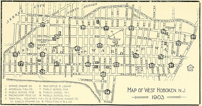
Image: West-hoboken-1903-map

Size of this preview: 800 × 422 pixels. Other resolutions: 320 × 169 pixels | 2,828 × 1,492 pixels.
Original image (2,828 × 1,492 pixels, file size: 896 KB, MIME type: image/jpeg)
Description: Map of West Hoboken 1903, what today is the southern section of Union City, New Jersey
Title: West-hoboken-1903-map
Credit: https://archive.org/details/historyofwesthob00dres
Author: Drescher, William H., Jr.
Usage Terms: Public domain
License: Public domain
Attribution Required?: No
Image usage
The following page links to this image:

All content from Kiddle encyclopedia articles (including the article images and facts) can be freely used under Attribution-ShareAlike license, unless stated otherwise.