
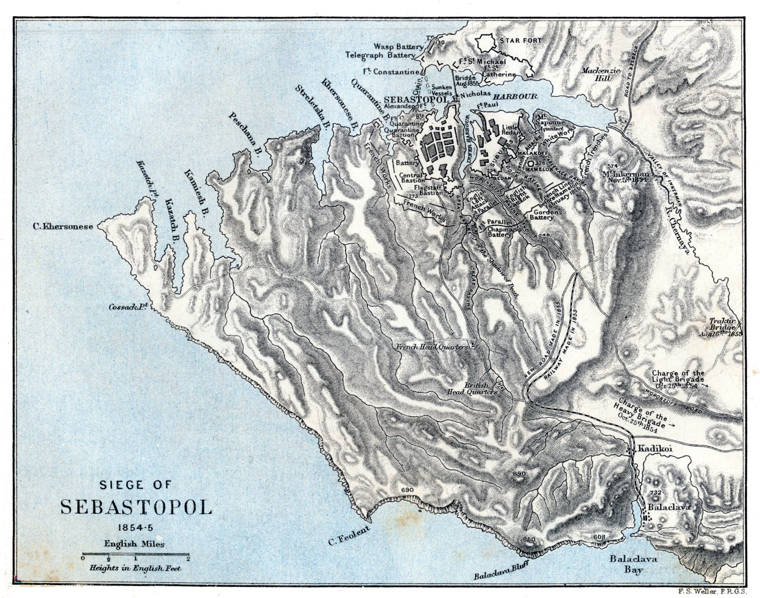
Image: Weller Siege of Sebastopol 1854-1855
Size of this preview: 762 × 600 pixels. Other resolutions: 305 × 240 pixels | 1,500 × 1,181 pixels.
Original image (1,500 × 1,181 pixels, file size: 724 KB, MIME type: image/jpeg)
Description: An historical map showing the territory between Balaklava and Sevastopol at the time of the Siege of Sevastopol
Title: Weller Siege of Sebastopol 1854-1855
Credit: "School Atlas of English History", pub London and New York 1895 by Longmans, Green & Co. OCLC 2024106. Scan from The Internet Map Archive
Author: Cartographer: F. S. Weller; editor: Samuel Rawson Gardiner
Usage Terms: Public domain
License: Public domain
Attribution Required?: No
Image usage
The following 2 pages link to this image:

All content from Kiddle encyclopedia articles (including the article images and facts) can be freely used under Attribution-ShareAlike license, unless stated otherwise.