
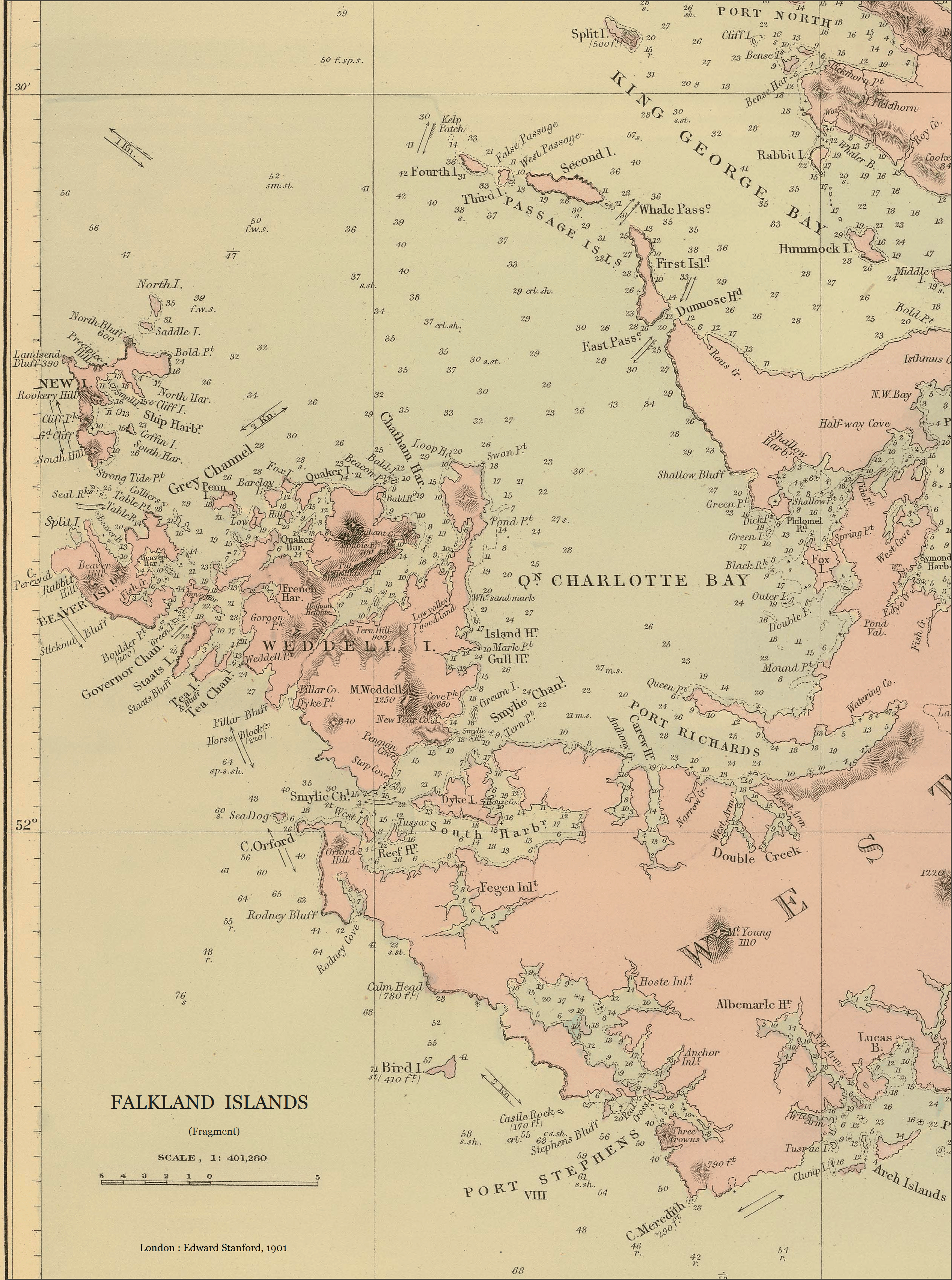
Image: Weddell-Island-Map-1901
Size of this preview: 446 × 600 pixels. Other resolutions: 178 × 240 pixels | 2,536 × 3,411 pixels.
Original image (2,536 × 3,411 pixels, file size: 13.16 MB, MIME type: image/png)
Description: 1901 map, or rather chart, of the Falkland Islands, South Atlantic Ocean (fragment). Scale 1:401280, 6⅓ English miles to 1 inch
Title: Weddell-Island-Map-1901
Credit: www.davidrumsey.com/luna/servlet/detail/RUMSEY~8~1~34319~1171234
Author: Robert Fitzroy, William Robinson, Edward Stanford, Bartholomew James Sullivan
Usage Terms: Public domain
License: Public domain
Attribution Required?: No
Image usage

All content from Kiddle encyclopedia articles (including the article images and facts) can be freely used under Attribution-ShareAlike license, unless stated otherwise.