
Image: Watson map tribes of south east Queensland
Size of this preview: 394 × 599 pixels. Other resolutions: 158 × 240 pixels | 3,598 × 5,471 pixels.
Original image (3,598 × 5,471 pixels, file size: 940 KB, MIME type: image/jpeg)
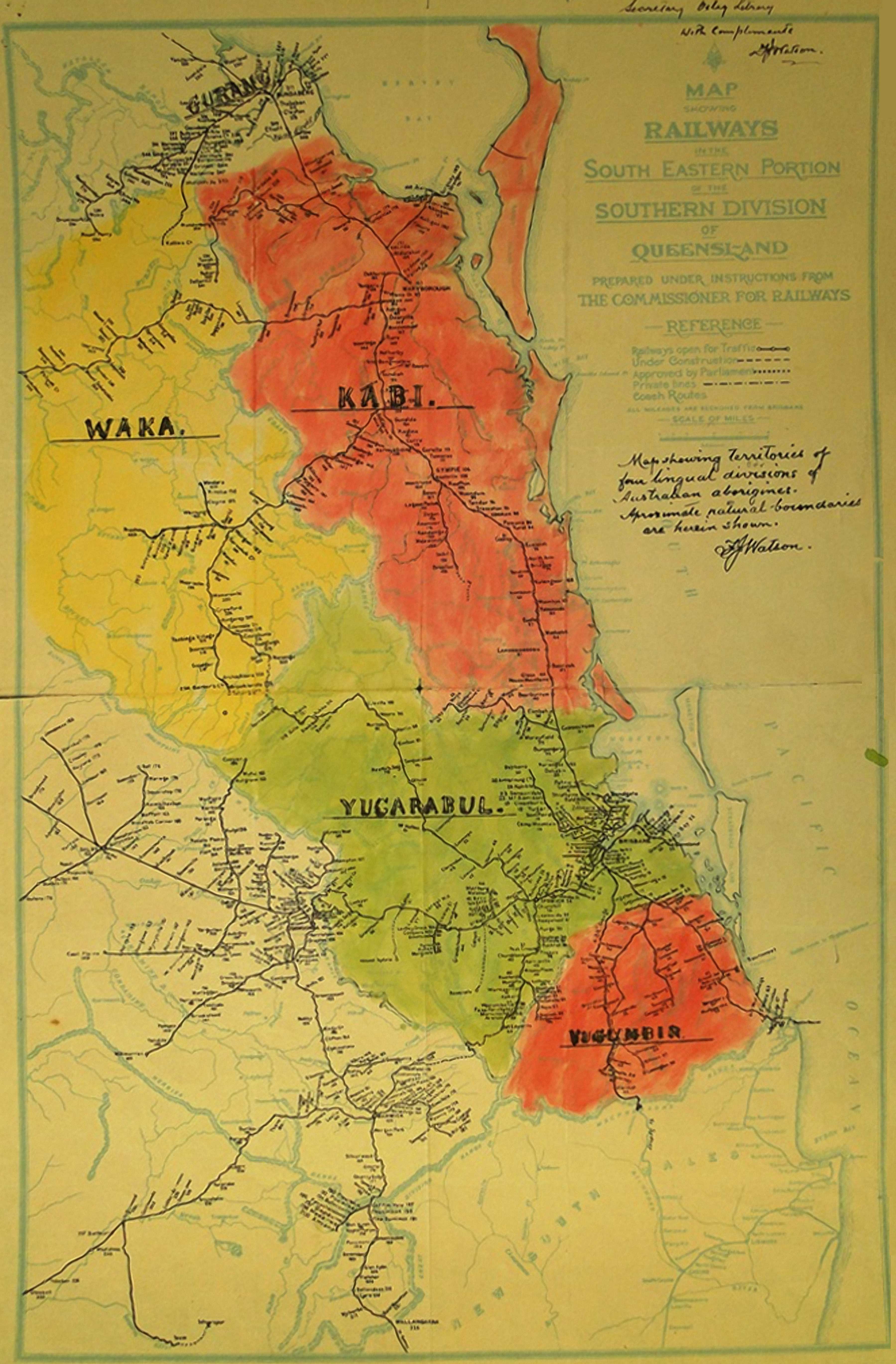
Description: Watson in the 1940’s collated historical information to create his Vocabularies of four representative tribes of South Eastern Queensland – he groups the Brisbane languages under the umbrella term of Yugarabul.
Title: Watson map tribes of south east Queensland
Credit: 1941 Map of aboriginal tribal boundaries in south east Queensland.
Author: F J Watson
Usage Terms: Creative Commons Zero, Public Domain Dedication
License: CC0
License Link: http://creativecommons.org/publicdomain/zero/1.0/deed.en
Attribution Required?: No
Image usage
The following 2 pages link to this image:

All content from Kiddle encyclopedia articles (including the article images and facts) can be freely used under Attribution-ShareAlike license, unless stated otherwise.