
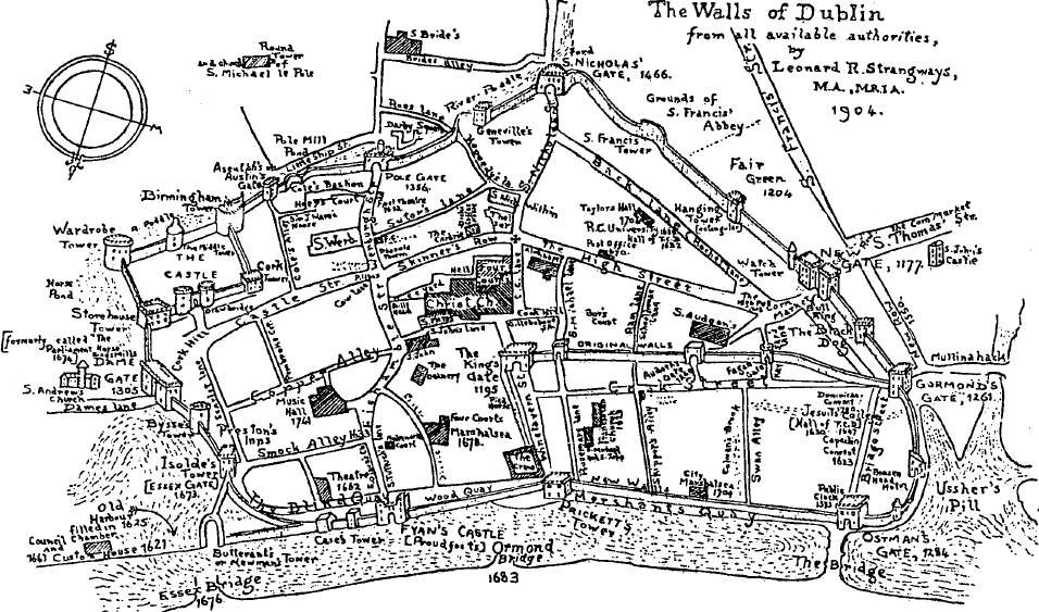
Image: Walls of Dublin with Bridge, R Poddle and other waterways
Size of this preview: 800 × 471 pixels. Other resolutions: 320 × 188 pixels | 956 × 563 pixels.
Original image (956 × 563 pixels, file size: 260 KB, MIME type: image/jpeg)
Description: "Map of the walls of Dublin by Leonard R. Strangways, 1904" - A map of early Dublin, Ireland, with the ancient city walls, and waterways including the River Poddle, flowing into the River Liffey, and much other detail, with annotations.
Title: Walls of Dublin with Bridge, R Poddle and other waterways
Credit: Paper in family album (from some historical journal?)
Author: Leonard Strangways
Permission: Own scan of PD work, freely reuseable.
Usage Terms: Public domain
License: Public domain
Attribution Required?: No
Image usage
The following page links to this image:

All content from Kiddle encyclopedia articles (including the article images and facts) can be freely used under Attribution-ShareAlike license, unless stated otherwise.